Marker Logo HMdb.org THE HISTORICAL
MARKER DATABASE
“Bite-Size Bits of Local, National, and Global History”
Near Lumpkin in Stewart County, Georgia — The American South (South Atlantic)
 

Providence United Methodist Church


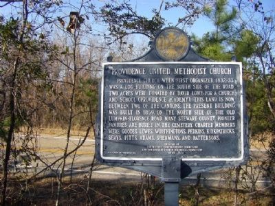
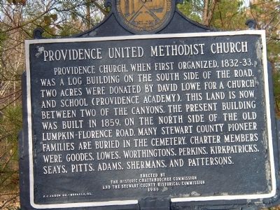
Providence United Methodist Church Marker image. Click for full size.
Photographed By William Walsh, December 29, 2006
1. Providence United Methodist Church Marker
Inscription. Providence Church, when first organized, 1832-33, was a log building on the south side of the road. Two acres were donated by David Lowe for a church and school (Providence Academy). This land is now between two of the canyons. The present building was built in 1859, on the north side of the old Lumpkin-Florence road. Many Stewart County pioneer families are buried in the cemetery. Charter members were Goodes, Lowes, Worthingtons, Perkins, Kirkpatricks, Seays, Pitts, Adams, Shermans and Pattersons.
 
Erected 1980 by the Historic Chatahoochie Commission and the Stewart County Historical Commission.
 
Topics. This historical marker is listed in these topic lists: Cemeteries & Burial SitesChurches & Religion. A significant historical year for this entry is 1859.
 
Location. 32° 4.278′ N, 84° 54.66′ W. Marker is near Lumpkin, Georgia, in Stewart County. Marker is on Canyon Road (State Highway 39), on the right when traveling east. Touch for map. Marker is in this post office area: Lumpkin GA 31815, United States of America. Touch for directions.
 
Other nearby markers. At least 8 other markers are within 7 miles of this marker, measured as the crow flies. Rev. David Walker Lowe (approx. half a mile away); Green Grove Missionary Baptist Church / Green Grove Schoolhouse (approx. 5.3 miles away); Indian Trail (approx. 5.8 miles away); Masonic Female College
Paid Advertisement
Click on the ad for more information.
Please report objectionable advertising to the Editor.
Click or scan to see
this page online
(approx. 6.7 miles away); Providence Canyons (approx. 6.7 miles away); John Wellborn Root Birthplace Site (approx. 6.9 miles away); Bedingfield Inn (approx. 6.9 miles away); Our Soldiers (approx. 7 miles away). Touch for a list and map of all markers in Lumpkin.
 
Providence United Methodist Church Marker image. Click for full size.
Photographed By Brian Brown, January 30, 2009
2. Providence United Methodist Church Marker
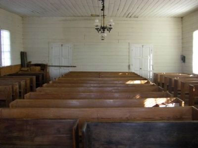
Providence United Methodist Church (Interior View) image. Click for full size.
Photographed By Brian Brown, January 30, 2009
3. Providence United Methodist Church (Interior View)
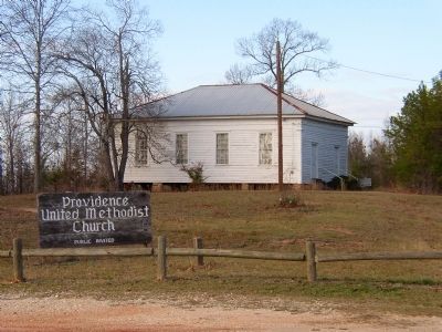
Providence United Methodist Church and Marker image. Click for full size.
Photographed By William Walsh, December 29, 2006
4. Providence United Methodist Church and Marker
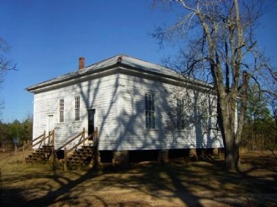
Providence United Methodist Church, Stewart County GA image. Click for full size.
Photographed By Brian Brown, January 30, 2009
5. Providence United Methodist Church, Stewart County GA
 
 
Credits. This page was last revised on November 15, 2021. It was originally submitted on October 6, 2008, by Kevin W. of Stafford, Virginia. This page has been viewed 1,256 times since then and 30 times this year. Photos:   1. submitted on October 6, 2008, by Kevin W. of Stafford, Virginia.   2, 3. submitted on January 31, 2009, by Brian Brown of Fitzgerald, Georgia.   4. submitted on October 6, 2008, by Kevin W. of Stafford, Virginia.   5. submitted on January 31, 2009, by Brian Brown of Fitzgerald, Georgia.
Share this page.  
Share on Tumblr
m=12146

CeraNet Cloud Computing sponsors the Historical Marker Database.
This website earns income from purchases you make after using our links to Amazon.com. We appreciate your support.
Paid Advertisement
Apr. 23, 2024