Leesburg in Loudoun County, Virginia — The American South (Mid-Atlantic)
Mile Hill
Cavalry Clash
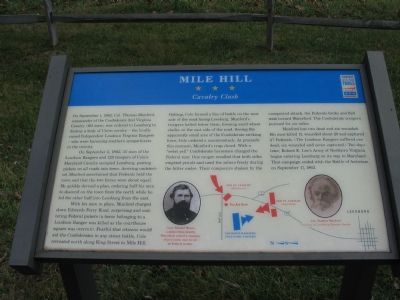
On September 1, 1862, Col. Thomas Munford, commander of the Confederate 2nd Virginia Cavalry (163 men), was ordered to Leesburg to destroy a body of Union Cavalry—the locally raised Independent Loudoun Virginia Rangers—who were harassing southern sympathizers in the vicinity.
On September 2, 1862, 35 men of the Loudoun Rangers and 125 troopers of Cole’s Maryland Cavalry occupied Leesburg, posting pickets on all roads into town. Arriving undetected, Munford ascertained that the Federals held the town and that the two forces were about equal. He quickly devised a plan, ordering half his men to descend on the town from the north while he led the other half into Leesburg from the east.
With his men in place, Munford charged down Edwards Ferry Road, surprising and scattering Federal pickets (a horse belonging to a Loudoun Ranger was killed as the courthouse was overrun). Fearful that citizens would aid the Confederates in any street battle, Cole retreated north along King Street to Mile Hill. Halting, Cole formed a line of battle on the west side of the road facing Leesburg. Munford’s troopers halted below them, forming amid wheat stacks on the east side of the road. Seeing the apparently small size of the Confederate striking force, Cole ordered a counterattack. At precisely this moment, Munford’s trap closed. With a “rebel yell” Confederate horsemen charged the Federal rear. One ranger recalled that both sides emptied pistols and used the sabers freely during the bitter melee. Their composure shaken by the unexpected attack, the Federals broke and fled west toward Waterford. The Confederate troopers pursued for six miles.
Munford lost two dead and six wounded. His men killed 11, wounded about 20 and captured 47 Federals. (The Loudoun Rangers suffered one dead, six wounded, and seven captured.) Two days later, Robert E. Lee’s Army of Northern Virginia began entering Leesburg on its way to Maryland. That campaign ended with the Battle of Antietam on September 17, 1862.
Erected by Civil War Trails.
Topics and series. This historical marker is listed in this topic list: War, US Civil. In addition, it is included in the Virginia Civil War Trails series list. A significant historical month for this entry is September 1788.
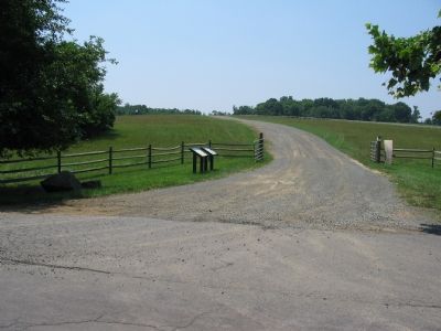
Location. 39° 8.595′ N, 77° 33.009′ W. Marker is in Leesburg, Virginia, in Loudoun County. Marker is on Tutt Lane (Virginia Route 740) west of Victory Lane, on the left when traveling west. Tutt Lane extends west of James Monroe Highway (US 15) North of Leesburg, just north of the intersection of Business 15 and Bypass 15. Touch for map. Marker is at or near this postal address: 41948 Tutt Ln, Leesburg VA 20176, United States of America. Touch for directions.
Other nearby markers. At least 8
other markers are within 2 miles of this marker, measured as the crow flies. 1862 Antietam Campaign (here, next to this marker); Goose Creek Chapel (approx. ¼ mile away); Morven Park (approx. ¼ mile away); Sharpsburg (Antietam) Campaign (approx. 0.8 miles away); A Serious Business (approx. 1.1 miles away); The Farmhand House (approx. 1.1 miles away); The Garden (approx. 1.1 miles away); Battle of Ball's Bluff (approx. 1.2 miles away). Touch for a list and map of all markers in Leesburg.
More about this marker. The marker is located on the grounds of Morven Park. The marker has a picture of Capt. Samuel Means, “a miller from nearby Waterford, raised a company of pro-union men to act as Federal scouts.” A picture of Col. Thomas Munford, courtesy of Lynchburg Museum System is also displayed. A map depicts the action that occurred in the fields north of town.
Also see . . . Battle of Mile Hille (Wickipedia). (Submitted on June 21, 2007, by Craig Swain of Leesburg, Virginia.)
Credits. This page was last revised on May 1, 2022. It was originally submitted on June 21, 2007, by Craig Swain of Leesburg, Virginia. This page has been viewed 3,124 times since then and 143 times this year. Photos: 1, 2. submitted on June 21, 2007, by Craig Swain of Leesburg, Virginia. • J. J. Prats was the editor who published this page.

