San Patricio in San Patricio County, Texas — The American South (West South Central)
Old Cemetery on the Hill
Photographed by Larry D. Moore, August 11, 2018
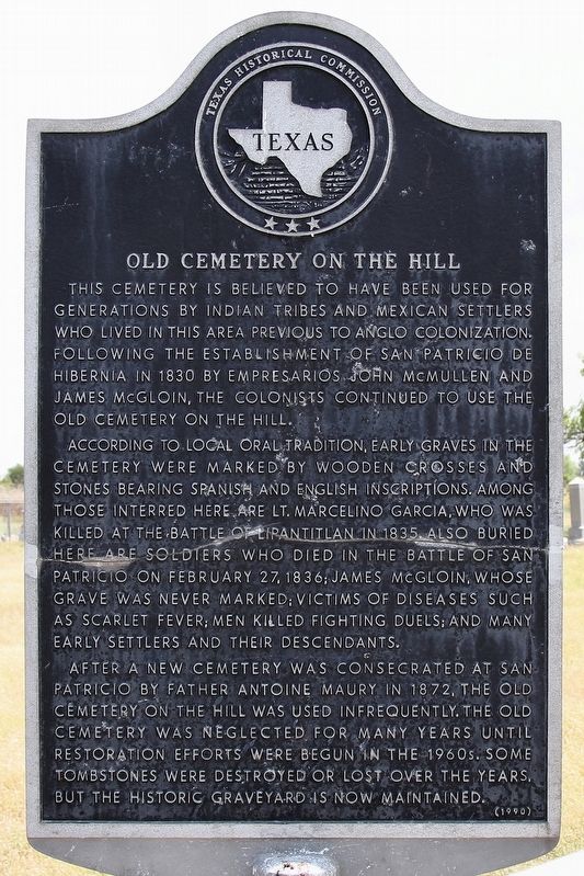
1. Old Cemetery on the Hill Marker
According to local oral tradition, early graves in the cemetery were marked by wooden crosses and stones bearing Spanish and English inscriptions. Among those interred here are Lt. Marcelino Garcia, who was killed at the battle of Lipantitlan in 1835. Also buried here are soldiers who died in the battle of San Patricio on February 27, 1836; James McGloin, whose grave was never marked; victims of diseases such as scarlet fever; men killed fighting duels; and many early settlers and their descendants.
After a new cemetery was consecrated at San Patricio by father Antoine Maury in 1872, the old cemetery on the hill was used infrequently. The old cemetery was neglected for many years until restoration efforts were begun in the 1960s. Some tombstones were destroyed or lost over the years, but the historic graveyard is now maintained.
Erected 1990 by Texas Historical Commission. (Marker Number 23439.)
Topics. This historical marker is listed in this topic list: Cemeteries & Burial Sites. A significant historical date for this entry is February 27, 1836.
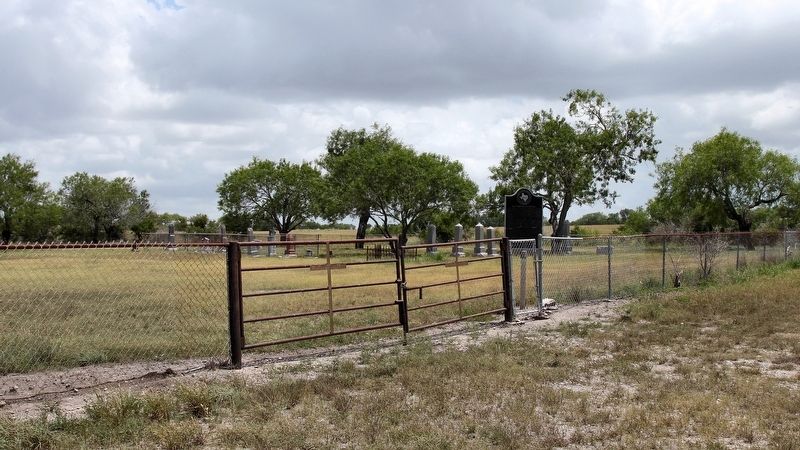
Location. 27° 57.56′ N, 97° 45.74′ W. Marker is in San Patricio, Texas, in San Patricio County. It can be reached from CR 1441. Marker is in a cemetery .1 mile north of E. Fitzgerald St (County Rd 21) via a dirt driveway. Touch for map. Marker is in this post office area: Mathis TX 78368, United States of America. Touch for directions.

Regionally, this marker is in the American South and on the Gulf Coast. Globally, it is in North America, a
this page online
Other nearby markers. At least 8 other markers are within walking distance of this marker: Education in San Patricio (approx. 0.6 miles away); Old Dougherty House (approx. 0.6 miles away); Saint Patrick's Catholic Church (approx. 0.7 miles away); a different marker also named Old Cemetery on the Hill (approx. 0.8 miles away); Battle of San Patricio (approx. 0.8 miles away); San Patricio County (approx. 0.8 miles away); Josepha Rodriguez (approx. 0.8 miles away); Courthouses of San Patricio County (approx. 0.8 miles away). Touch for a list and map of all markers in San Patricio.
More about this marker. There is a duplicate of the marker in front of San Patricio City Hall, corner of Main St (FM 666) and McGloin St.
Photographed by Larry D. Moore, August 11, 2018
2. Old Cemetery on the Hill Marker Area
Credits. This page was last revised on November 26, 2024. It was originally submitted on August 17, 2018, by Larry D. Moore of Del Valle, Texas. This page has been viewed 1,192 times since then and 83 times this year. Photos: 1, 2. submitted on August 17, 2018, by Larry D. Moore of Del Valle, Texas. • Andrew Ruppenstein was the editor who published this page.
