West Los Angeles in Los Angeles County, California — The American West (Pacific Coastal)
Tongva Springs
Serra Springs
| — | Wounded Deer Springs | — |
Photographed by Craig Baker, August 4, 2018
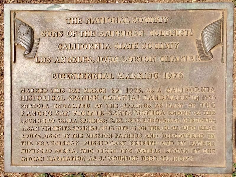
1. Tongva Springs Marker
Marked this day March 20 1976, as a California Historical Spanish Colonial Landmark “In 1776 Portola encamped at the springs, part of the Rancho San Vicente - Santa Monica, known as the: 1. Junipero Serra Springs; 2. El Berrendo; 3. San Gregorio; 4. San Vincente Springs. This site is on the El Camino Real route, used by the Mission Fathers and discovered by the Franciscan Missionary Priests and by Father Junipero Serra, who liked its waters, known by the Indian habitation as: 5. Wounded Deer Springs".
Erected 1976 by Sons of the American Colonists. (Marker Number 522.)
Topics and series. This historical marker is listed in these topic lists: Exploration • Indigenous Peoples and Communities • Paleontology. In addition, it is included in the California Historical Landmarks, the El Camino Real, “The King's Highway” (California), the Portolá Expedition, and the Sons of the American Colonists series lists.
Location. 34° 2.702′ N, 118° 27.465′ W. Marker is in Los Angeles, California, in Los Angeles County. It is in West Los Angeles. It can be reached
this page online

Regionally, this marker is in the Transverse Ranges. It is also on the American Pacific Coast. Globally, it is in North America, on the Ring of Fire, on the Pacific Rim, in the Western Hemisphere, in the Western World, and in the Anglosphere. Historically, it finds itself in what was once New Spain and also Mexico’s Alta California.
Other nearby markers. At least 8 other markers are within 2 miles of this marker, measured as the crow flies: Jones & Emmons Building (approx. 0.6 miles away); Coral Trees (approx. 0.7 miles away); U.S.S. Maine Memorial (approx. 0.7 miles away); Veterans Administration Center (approx. 0.7 miles away); Aidin's Place Playground (approx. 0.8 miles away); Chris Carr (approx. 1.1 miles away); Siple House (approx. 1.1 miles away); Durham House
Photographed by Craig Baker, August 4, 2018
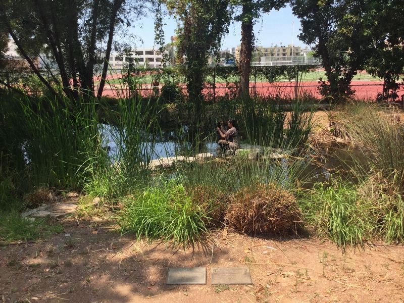
2. Tongva Springs Marker
Marker is at the bottom of this photo, on the right. To the left is a marker placed by the high school in 1979, “Wounded Deer Springs”.
Regarding Tongva Springs. Also called Kuruvungna Springs by the Tongva themselves.
This is California Historical Landmark No. 522 - “Serra Springs”.
The foundation holds an annual "Life Before Columbus" festival each October.
Also see . . . Gabrielino/Tongva Springs Foundation. Alliance for California Traditional Arts website entry (Submitted on May 13, 2026, by Larry Gertner of New York, New York.)
Photographed by Craig Baker, August 4, 2018
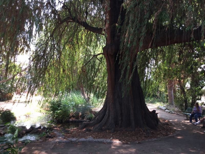
3. Sacred Tree, planted by the Tongva people.
Photographed by Larry A. Taylor, October 2, 2011
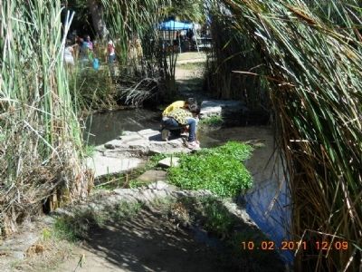
4. Stream from Tongva Sacred Springs
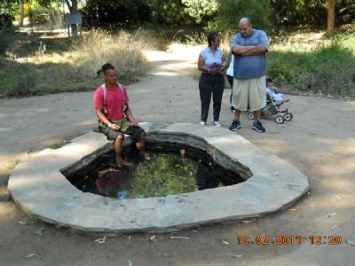
Photographed by Larry A. Taylor, October 2, 2011
5. Tongva Sacred Springs Pool
One of the springs on the site.
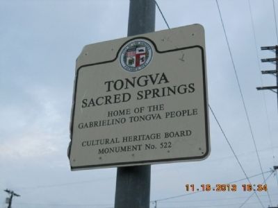
Photographed by Larry A. Taylor, November 13, 2013
6. Street Sign
State Landmark 522 - not a City Monument.
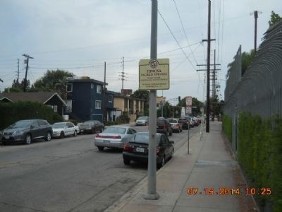
Photographed by Larry A. Taylor, July 19, 2014
7. Tongva Sacred Springs area
This is Barrington Boulevard. To the right is the Tongva site and the campus of University High.
Credits. This page was last revised on May 13, 2026. It was originally submitted on May 25, 2014, by Larry A. Taylor of Los Angeles, California. This page has been viewed 1,441 times since then and 63 times this year. Last updated on August 20, 2018, by Craig Baker of Sylmar, California. Photos: 1, 2, 3. submitted on August 20, 2018, by Craig Baker of Sylmar, California. 4, 5, 6. submitted on May 25, 2014, by Larry A. Taylor of Los Angeles, California. 7. submitted on October 14, 2014, by Larry A. Taylor of Los Angeles, California. • Andrew Ruppenstein was the editor who published this page.
