East Donegal Township near Mount Joy in Lancaster County, Pennsylvania — The American Northeast (Mid-Atlantic)
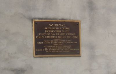
Donegal Presbyterian Church
American Presbyterian and Reformed Historical Site
by settlers from the north of Ireland
First Church built of logs
Present building erected in 1740
patent granted by John Thomas and Richard Penn
June 4, 1740.
Presbytery of Donegal organized
in this church October 11, 1732
Members of this congregation have figured prominently
in all wars of this country.
Topics and series. This historical marker is listed in these topic lists: Churches & Religion • Colonial Era. In addition, it is included in the American Presbyterian and Reformed Historic Sites series list. A significant historical month for this entry is June 1864.
Location. 40° 6.062′ N, 76° 33.964′ W. Marker is near Mount Joy, Pennsylvania, in Lancaster County. It is in East Donegal Township. Marker is on Donegal Springs Road. Touch for map. Marker is at or near this postal address: 1891 Donegal Springs Rd, Mount Joy PA 17552, United States of America. Touch for directions.
Other nearby markers. At least 8 other markers are within 2 miles of this marker, measured as the crow flies. The Witness Tree Monument (here, next to this marker); The Witness Tree (a few steps from this marker); a different marker also named Donegal Presbyterian Church (within shouting distance of this marker); Early Telegraph (approx. 1.9 miles away); In honor of those who served our country in Korea & Vietnam (approx. 2 miles away); Honor Roll (approx. 2 miles away); In honor of those who served in the World War (approx. 2 miles away); Simon Cameron (approx. 2 miles away). Touch for a list and map of all markers in Mount Joy.
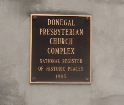
Regarding Donegal Presbyterian Church. Donegal Presbyterian Church was listed in the National Register of Historic Places in 1985. This church is also one of 445 American Presbyterian and Reformed Historical Sites registered between 1973 and 2003 by the Presbyterian Historical Society (PHS), headquartered in Philadelphia. Approved sites received a metal plaque featuring John Calvin’s seal and the site’s registry number (PHS marker location unknown).
The following text is taken from the Presbyterian Historical Society website:
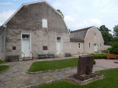
The second Presbyterian congregation in the county, Donegal Church applied to New Castle Presbytery for "a supply of preaching" as early as 1721. James Anderson was installed in 1727 as the first pastor, and the Donegal Presbytery was organized here in 1732. The present building dates from 1730-40, although it was renovated in 1772 and 1850 with pulpit, pews, doors, and windows rearranged. Next to the church
is the Witness Tree, where the members and the reluctant Scottish pastor, urged on by the Associate Presbytery, pledged allegiance to the new nation in 1777. Attached to the sanctuary is a 1958 educational wing, and nearby stands the Kerr Study House, completed in 1811, used as the pastor's study, church office, and museum.
Also see . . . Donegal Presbyterian Church History. (Submitted on June 17, 2015, by Bill Pfingsten of Bel Air, Maryland.)
Credits. This page was last revised on February 7, 2023. It was originally submitted on June 16, 2015, by Don Morfe of Baltimore, Maryland. This page has been viewed 502 times since then and 36 times this year. Last updated on August 24, 2018, by Douglass Halvorsen of Klamath Falls, Oregon. Photos: 1, 2, 3. submitted on June 16, 2015, by Don Morfe of Baltimore, Maryland. • Bill Pfingsten was the editor who published this page.


