Wick in Highland, Scotland, United Kingdom — Northwestern Europe (the British Isles)
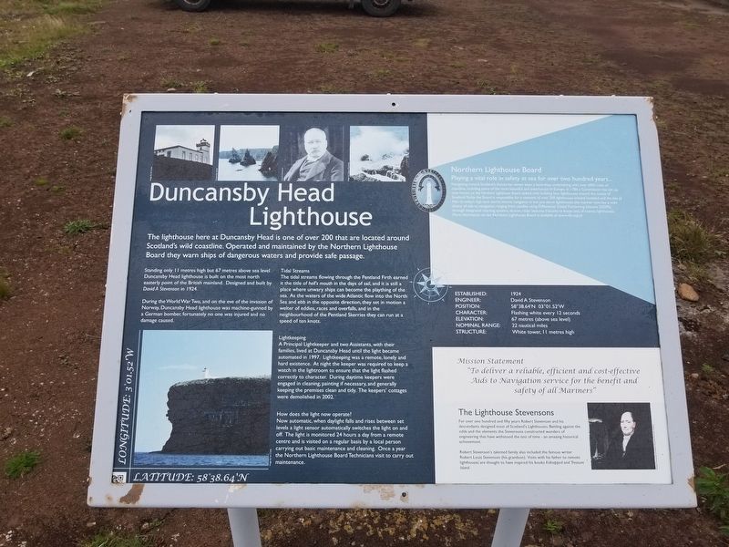
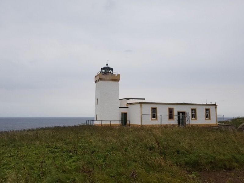
Duncansby Head Lighthouse
The lighthouse here at Duncansby Head is one of over 200 that are located around Scotland’s wild coastline. Operated and maintained by the Northern Lighthouse Board they warn ships of dangerous waters and provide safe passage.
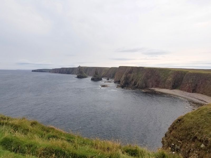
Standing only 11 metres high but 67 metres above sea level Duncansby Head is built on the most north easterly point of the British mainland. Designed and built by David A Stevenson in 1924.
During World War Two, and on the eve of the invasion of Norway, Duncansby Head Lighthouse was machine-gunned by a German bomber. Fortunately no one was injured and no damage caused.
Tidal Streams
The tidal streams flowing through the Pentland Firth earned it the title of hell’s mouth in the days of sail, and it is still a place where unwary ships can become a plaything of the sea. As the waters of the wide Atlantic flow into the North Sea and ebb in the opposite direction, they set in motion a welter of eddies, races and overfalls, and in the neighbourhood of the Pentland Skerries they can run at a speed of ten knots.
Lightkeeping
A Principal Lightkeeper and two Assistants, with their families, lived at Duncansby Head until the light became automated in 1997. Lightkeeping was a remote, lonely and hard existence. At night the keeper was required to keep a watch in the lightroom to ensure that the light flashed correctly to character. During daytime keepers were engaged in cleaning, painting if necessary, and generally keeping the premises clean and tidy. The keepers' cottages were demolished in 2002.
How does the light now operate?
Now automatic, when daylight falls and rises between set levels a light sensor automatically switches the light on and off. The light is monitored 24 hours a day from a remote centre and is visited on a regular basis by a local person carrying out basic maintenance and cleaning. Once a year the Northern Lighthouse Board Technicians visit to carry out maintenance.
Established: 1924
Engineer: David A Stevenson
Position: 58° 38.64’N 03° 01.52W
Character: Flashing white every 12 seconds
Elevation: 67 Metres (above seal level)
Nominal Range: 22 nautical miles
Structure: White tower, 11 metres high
Mission Statement
“To deliver a reliable, efficient and cost-effective Aids to Navigation service for the benefit and safety of all Mariners”
The Lighthouse Stevensons
For over one hundred and fifty years Robert Stevenson and his descendants designed most of Scotland's Lighthouses. Battling against the odds and the elements the Stevensons constructed wonders of engineering that have withstood the test of time - an amazing historical achievement.
Robert Stevenson's talented family also included the famous writer Robert Louis Stevenson (his grandson). Visits with his father to remote lighthouses are thought to have inspired his books Kidnapped and Treasure Island.
Topics and series. This historical marker is listed in these topic lists: Industry & Commerce • Waterways & Vessels. In addition, it is included in the Lighthouses series list.
Location. 58° 38.639′ N, 3° 1.557′ W. Marker is in Wick, Scotland, in Highland. Marker is on unnamed road, 2.9 kilometers east of Scotland Route A99, on the left when traveling east. Touch for map. Marker is in this post office area: Wick, Scotland KW1 4YS, United Kingdom. Touch for directions.
Other nearby markers. At least 6 other markers are within 24 kilometers of this marker, measured as the crow flies. Warth Hill Viewpoint (approx. 4.5 kilometers away); Nybster Broch (approx. 10.8 kilometers away); The Castle & Gardens of Mey (approx. 11.5 kilometers away); Royal Visit - Castle of Mey (approx. 11.6 kilometers away); Keiss Quoad Sacra Parish War Memorial (approx. 13.1 kilometers away); Wick War Memorial (approx. 22.9 kilometers away).
Also see . . . Duncansby Head on Wikipedia. (Submitted on September 3, 2018, by Michael Herrick of Southbury, Connecticut.)
Credits. This page was last revised on January 27, 2022. It was originally submitted on September 3, 2018, by Michael Herrick of Southbury, Connecticut. This page has been viewed 158 times since then and 7 times this year. Photos: 1, 2, 3. submitted on September 3, 2018, by Michael Herrick of Southbury, Connecticut.


