Columbia Way in Vancouver in Clark County, Washington — The American West (Northwest)
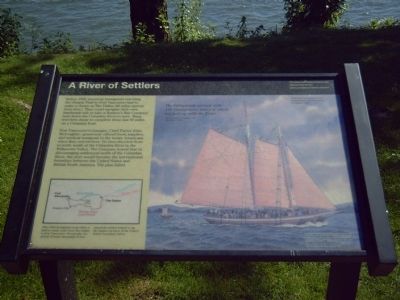
A River of Settlers
Fort Vancouver's manager, Chief Factor John McLoughlin, generously offered food, supplies, and medical treatment to the weary Americans when they arrived here. He then directed them to settle south of the Columbia River in the Willamette Valley. The Company hoped that by discouraging settlement north of the Columbia River, the river would become the international boundary between the United States and British North America. The plan failed.
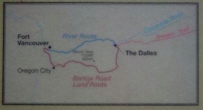
[Map of the two route options available to Oregon Trail travelers from The Dalles is included with the following caption]:
After 1846 immigrants took either a land or water route from The Dalles to Fort Vancouver. Eventually, the arrival of many thousands of new American settlers helped to tip the balance in favor of the United States' boundary claims.
Topics and series. This historical marker is listed in these topic lists: Industry & Commerce • Settlements & Settlers • Waterways & Vessels. In addition, it is included in the Oregon Trail series list. A significant historical year for this entry is 1846.
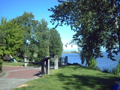
Location. 45° 37.194′ N, 122° 40.089′ W. Marker is in Vancouver, Washington, in Clark County. It is in Columbia Way. Marker can be reached from SE Columbia Way. Marker is in Old Apple Tree Park. Touch for map. Marker is at or near this postal address: 112 Columbia Way, Vancouver WA 98661, United States of America. Touch for directions.
Other nearby markers. At least 8 other markers are within walking distance of this marker. Heart of a Trading Empire (about 300 feet away, measured in a direct line); A Busy Place Is This (about 500 feet away); United States Army Arrives (about 600 feet away); Captain George Vancouver Monument Plaza (approx. 0.3 miles away); Captain George Vancouver Monument (approx. 0.3 miles away); The Vancouver Farm (approx. 0.4 miles away); An English Garden in the Wilderness (approx. 0.4 miles away); St. James Mission (approx. 0.4 miles away). Touch for a list and map of all markers in Vancouver.
More about this marker. The main painting identifies that "American immigrants were transported in Hudson's Bay Company boats. There is also included a November 1, 1845 quote from Thomas Lowe, a Hudson's Bay Company clerk:
"The Callepooiah
arrived with 140 Immigrants, many of whom are laid up with the Fever."
The Vancouver National Historic Reserve is a partnership of the National Park service, the City of Vancouver, the U. S. Army, and the State of Washington and is dedicated to the preservation, education and public use of these historic properties. This exhibit is funded by the National Park Service's Fee Demonstration Program.
Credits. This page was last revised on February 7, 2023. It was originally submitted on October 9, 2008, by Kevin W. of Stafford, Virginia. This page has been viewed 1,449 times since then and 14 times this year. Photos: 1, 2, 3. submitted on October 9, 2008, by Kevin W. of Stafford, Virginia.


