Mammoth in Mammoth Hot Springs in Park County, Wyoming — The American West (Mountains)
Road Builders
Photographed by Rich Pfingsten, March 23, 2009
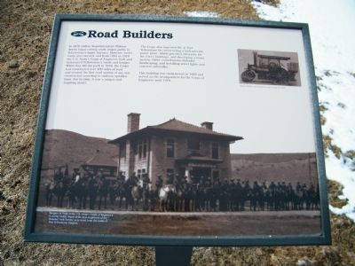
1. Road Builders Marker
The Corps also improved life at Fort Yellowstone by constructing a hydroelectric power plant, which provided electricity for the Fort's buildings, and developing a water system. Other contributions included landscaping, and installing street lights and concrete sidewalks.
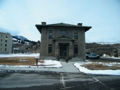
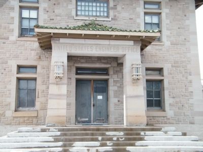
This building was constructed in 1903 and served as the headquarters for the Corps of Engineers until 1918.
Inset photo captions: 1) Steam Roller purchased by the Corps in 1916, 2) Rangers in front of the U.S. Army Corps of Engineer's building (1929). Many of the first employees of the National Park Service were hired from the ranks of Fort Yellowstone troopers.
Erected by National
this page online
Topics. This historical marker is listed in these topic lists: Military • Roads & Vehicles. A significant historical year for this entry is 1878.
Location. This marker has been replaced by another marker nearby. It was located near 44° 58.613′ N, 110° 42.025′ W. Marker was in Mammoth Hot Springs, Wyoming, in Park County. It was in Mammoth. It was on North Entrance Road 0 miles east of Grand Loop Road, on the right when traveling west. Touch for map. Marker was in this post office area: Yellowstone National Park WY 82190, United States of America. Touch for directions.

Regionally, this marker was in the Bighorn Basin and in Greater Yellowstone. It was also in the American Mountain West and in the Lewis & Clark Corridor. Globally, it was in North America, the Rocky Mountains, the Western Hemisphere, the Western World, and the Anglosphere.
Other nearby markers. At least 8 other markers are within walking distance of this location: A different marker also named Road Builders (here, next to this marker); Elk Rut (within shouting distance of this marker); The Parade Ground (within shouting distance of this
Photographed by Rich Pfingsten, March 23, 2009
2. Road Builders Marker with Engineer's Office Building in the background
Other markers no longer nearby. Welcome to Historic Fort Yellowstone (was about 300 feet away, measured in a direct line but has been permanently removed); From Soldier to Ranger (was about 400 feet away but has been permanently removed); The Drill Field (was about 500 feet away but has been permanently removed); A Good Duty Station (was about 600 feet away but has been permanently removed).
More about this marker. This marker has been removed and replaced with a new marker nearby called Road Builders.
Photographed by Rich Pfingsten, March 23, 2009
3. United States Engineer Office
Credits. This page was last revised on November 5, 2024. It was originally submitted on February 28, 2011, by Rich Pfingsten of Forest Hill, Maryland. This page has been viewed 1,126 times since then and 29 times this year. Last updated on September 11, 2018, by Craig Baker of Sylmar, California. Photos: 1, 2, 3. submitted on February 28, 2011, by Rich Pfingsten of Forest Hill, Maryland. • Bill Pfingsten was the editor who published this page.
