Mammoth in Yellowstone National Park in Park County, Wyoming — The American West (Mountains)
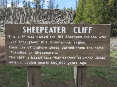
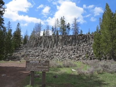
Sheepeater Cliff
Their use of bighorn sheep earned them the name "Tukadika" or "Sheepeaters".
The cliff is basalt lava that formed "columnar joints" when it cooled nearly 500,000 years ago.
Topics. This historical marker is listed in this topic list: Native Americans.
Location. 44° 53.481′ N, 110° 43.776′ W. Marker is in Yellowstone National Park, Wyoming, in Park County. It is in Mammoth. Marker is on Sheepeater Cliff Road, 0.3 miles east of U.S. 89, on the left when traveling east. Marker is about 6.5 miles south of Mammoth Hot Springs, at the end of a narrow access road. Touch for map. Marker is in this post office area: Yellowstone National Park WY 82190, United States of America. Touch for directions.
Other nearby markers. At least 8 other markers are within 6 miles of this marker, measured as the crow flies. The Golden Gate (approx. 3 miles away); Obsidian Cliff (approx. 4.7 miles away); Orange Spring Mound (approx. 5.2 miles away); A Changing Landscape (approx. 5.4 miles away); Fort Yellowstone (approx. 5˝ miles away); Yellowstone National Park Chapel (approx. 5.8 miles away); A Sense of Community (approx. 5.8 miles away); Guard Duty (approx. 5.9 miles away). Touch for a list and map of all markers in Yellowstone National Park.
Also see . . . National Park Service video. Sheepeater Cliff was named by Yellowstone Superintendent Philetus Norris after a visit to the area in 1879. Learn more about the cliff and about Sheepeater Indians in this short video. Duration: 2 minute 30 seconds (Submitted on May 25, 2015, by Richard Denney of Austin, Texas.)
Additional keywords. geology
Credits. This page was last revised on February 16, 2023. It was originally submitted on May 25, 2015, by Richard Denney of Austin, Texas. This page has been viewed 478 times since then and 20 times this year. Last updated on September 16, 2018, by Craig Baker of Sylmar, California. Photos: 1, 2, 3. submitted on May 25, 2015, by Richard Denney of Austin, Texas. • Bill Pfingsten was the editor who published this page.


