Darien in McIntosh County, Georgia — The American South (South Atlantic)
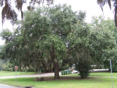
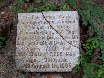
The Oglethorpe Oak
Gen. Oglethorpe Camped
Height, 75 feet
Circumference: 360 feet
Trunk 15 ft 6 in Longest Limb 61 ft.
Average Length of Limbs 50 ft.
Covers 7,600 feet
Will Shelter 5,065 Men
Age Unknown
Measured in 1895
Topics. This historical marker is listed in these topic lists: Colonial Era • Horticulture & Forestry • Landmarks. A significant historical year for this entry is 1895.
Location. 31° 22.214′ N, 81° 26.049′ W. Marker is in Darien, Georgia, in McIntosh County. Marker can be reached from GA-99 (Adams Street) near US 17, on the right when traveling east. Touch for map. Marker is in this post office area: Darien GA 31305, United States of America. Touch for directions.
Other nearby markers. At least 8 other markers are within walking distance of this marker. New Inverness (a few steps from this marker); a different marker also named Oglethorpe Oak (within shouting distance of this marker); McIntosh County (within shouting distance of this marker); The Burning of Darien (about 400 feet away, measured in a direct line); Methodists at Darien (about 500 feet away); Columbus Square (about 700 feet away); Darien's Railroad and Depot (about 700 feet away); Fort King George (about 700 feet away). Touch for a list and map of all markers in Darien.
Regarding The Oglethorpe Oak. see nearby Marker for Oglethorpe Oak
The old oak, which shaded units of Oglethorpe's men, survived hurricanes, fires, and other calamities until it finally expired in the 1960s, leaving just a stump.

Photographed By Mike Stroud, August 17, 2008
2. The Oglethorpe Oak Marker, seen in stump, at left
“Traditional site of Oglethorpe’s shelter in 1736 upon occasion of his visit to Darien, a town founded that year by Scotchmen under his direction."... Atlantic Coastal Highway Commission , Marker seen at right
Credits. This page was last revised on June 16, 2016. It was originally submitted on October 11, 2008, by Mike Stroud of Bluffton, South Carolina. This page has been viewed 1,534 times since then and 22 times this year. Last updated on October 12, 2008, by Mike Stroud of Bluffton, South Carolina. Photos: 1, 2. submitted on October 11, 2008, by Mike Stroud of Bluffton, South Carolina. • Bill Pfingsten was the editor who published this page.
