Hayes in Stanley County, South Dakota — The American Midwest (Upper Plains)
Deadwood Trail Went S.W.
Photographed by Cosmos Mariner, August 18, 2016
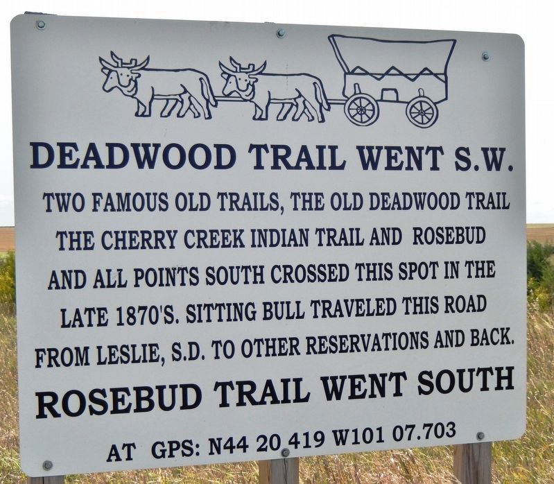
1. Deadwood Trail Went S.W. Marker (newer, metal version; facing north)
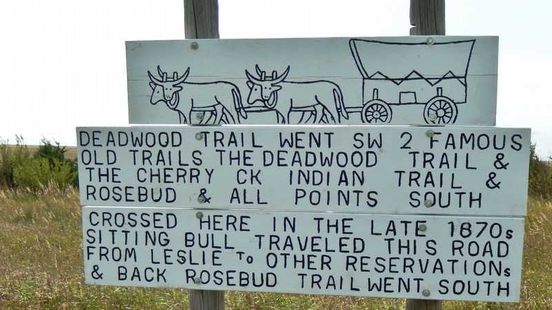
Two famous old trails, the Old Deadwood Trail and the Cherry Creek Indian Trail and Rosebud and all points south crossed this spot in the late 1870’s. Sitting Bull traveled this road from Leslie, S.D. to other reservations and back.
Rosebud Trail went south
Topics. This historical marker is listed in these topic lists: Indigenous Peoples and Communities • Roads & Vehicles.
Location. 44° 20.418′ N, 101° 7.704′ W. Marker is in Hayes, South Dakota, in Stanley County. It is on South Dakota Highway 63 (U.S. 14) 2.1 miles south of 34, on the right when traveling south. Marker is located on the west side of the highway. Touch for map. Marker is at or near this postal address: 21039 US Highway 14, Hayes SD 57537, United States of America. Touch for directions.

Regionally, this marker is in East River. It is also in the American Lewis & Clark Corridor, on the prairies, and on the Northern Plains. Globally, it is in North America, the Western Hemisphere, the Western World, and the Anglosphere. Historically, it finds itself in what was once Rupert’s Land and also
this page online
Other nearby markers. At least 6 other markers are within 8 miles of this marker, measured as the crow flies: Plum Creek Station (about 300 feet away, measured in a direct line); Plum Creek Waterhole (about 300 feet away); Old Indian Trail (approx. 2.4 miles away); Little Brown Church On The Prairie (approx. 3½ miles away); Old Deadwood Trail (approx. 3½ miles away); Early Western Highway (approx. 7.8 miles away).
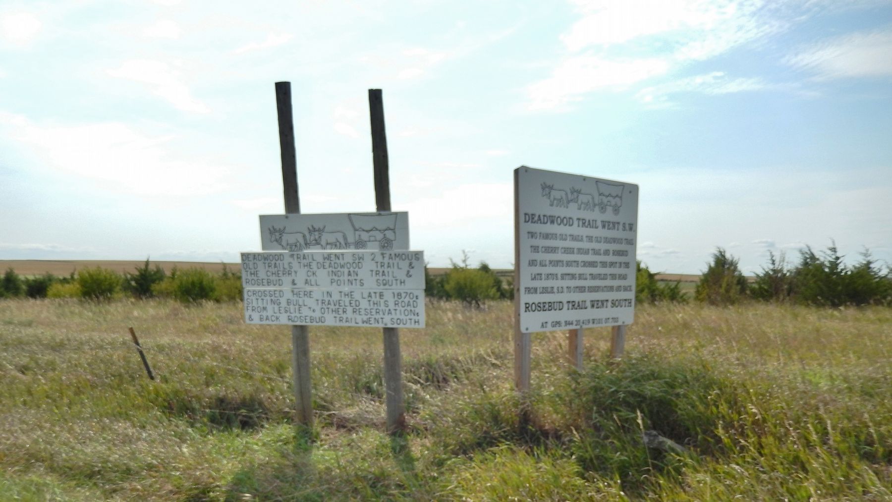
More about this marker. There are two duplicate markers at this location; an older, wooden one facing east, and a newer, metal one facing north.
Also see . . .
1. The Old Deadwood Trail. One of the famous trails is the Fort Pierre to Deadwood Trail which begins at the end of Hustan Ave in Fort Pierre near the southwest end of the present Colonel Waldron Missouri River Bridge. Following the discovery of gold in Deadwood in 1875, hordes of prospectors, gamblers and storekeepers headed for the Black Hills which was in the heart of the Great Sioux Reservation. The fact that they were trespassing on Indian land didn’t stop them and they kept coming from all directions. (Submitted on October 3, 2018, by Cosmos Mariner of Cape Canaveral, Florida.)
2. Cherry Creek Indian Trail.
Photographed by Cosmos Mariner, August 18, 2016
2. Deadwood Trail Went S.W. Marker (older, wooden version; facing east)
3. Rosebud Sioux Tribe. Located in south-central South Dakota, the Rosebud Indian Reservation borders the Pine Ridge Reservation on its northwestern corner and the state of Nebraska to its south. The Rosebud Sioux Tribe, more properly known as Sicangu Lakota Oyate, or Burnt Thigh People, are descendants of the Sicangu Oyate of the Tetonwan Division of the Oceti Sakowin or Seven Council Fires. Historically, they were warriors and hunters and expert horsemen. (Submitted on October 3, 2018, by Cosmos Mariner of Cape Canaveral, Florida.)
Photographed by Cosmos Mariner, August 18, 2016
3. Deadwood Trail Went S.W. Markers (wide view)
Credits. This page was last revised on October 5, 2018. It was originally submitted on October 1, 2018, by Cosmos Mariner of Cape Canaveral, Florida. This page has been viewed 610 times since then and 41 times this year. Photos: 1, 2, 3. submitted on October 3, 2018, by Cosmos Mariner of Cape Canaveral, Florida. • Bill Pfingsten was the editor who published this page.
