
Tintagel in Cornwall, England, United Kingdom — Northwestern Europe (the British Isles)
Excavations and discoveries
Photographed by Michael Herrick, August 5, 2018
1. Excavations and discoveries Marker
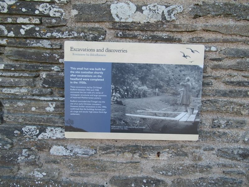
Excavations and discoveries
Kowansow ha diskudhansow
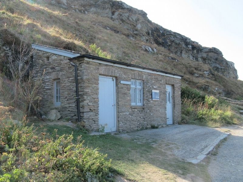
This small hut was built for the site custodian shortly after excavations on the headland were completed in the 1930s.
These excavations, led by CA Ralegh Radford between 1933 and 1938, uncovered the low walls of a series of rectangular structures and large quantities of imported Mediterranean pottery.
Radford concluded that Tintagel was the site of an early Christian monastery. However, further excavations in the 1990s confirmed that the buildings formed part of a large and secular high-status Dark Age settlement.
( photo caption )
Radford talking to visitors from the Royal Institution of Cornwall in the 1930s.
Topics. This historical marker is listed in these topic lists: Exploration • Forts and Castles.
Location. 50° 40.105′ N, 4° 45.6′ W. Marker is in Tintagel, England, in Cornwall. It can be reached from Castle Road 0.6 kilometers west of Atlantic Road, on the right when traveling west. Located at Tintagel Castle. Touch for map. Marker is in this post office area: Tintagel, England PL34 0HE,
this page online

Regionally, this marker is in South West England. Globally, it is on the Atlantic Ocean, in the North Atlantic Region, on the Atlantic Arc, in Europe, on the Celtic Fringe, in Atlantic Europe, on one of the British Isles, in the Western World, and in the Anglosphere. Historically, it finds itself in what was once the Roman Empire.
Other nearby markers. At least 8 other markers are within walking distance of this marker: The Trader’s tale (a few steps from this marker); A complicated ruin (a few steps from this marker); Prince Dafydd’s tale (within shouting distance of this marker); Florence’s shelter (within shouting distance of this marker); The Priest’s tale (within shouting distance of this marker); Tintagel village (about 90 meters away, measured in a direct line); A changing coastline (about 90 meters away); Where history meets legend (about 90 meters away). Touch for a list and map of all markers in Tintagel.
Also see . . .
1. English Heritage - Tintagel Castle. (Submitted on October 2, 2018, by Michael Herrick of Southbury, Connecticut.)
2. Tintagel Castle on Wikipedia.
Photographed by Michael Herrick, August 5, 2018
2. Excavations and discoveries Marker
Credits. This page was last revised on January 27, 2022. It was originally submitted on October 2, 2018, by Michael Herrick of Southbury, Connecticut. This page has been viewed 233 times since then and 11 times this year. Photos: 1, 2. submitted on October 2, 2018, by Michael Herrick of Southbury, Connecticut.
