Pasadena in Los Angeles County, California — The American West (Pacific Coastal)
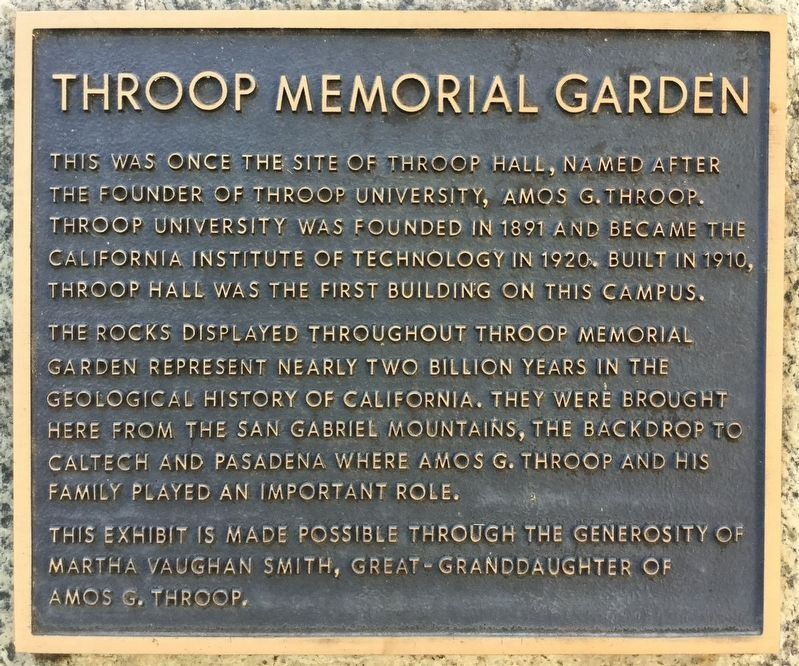
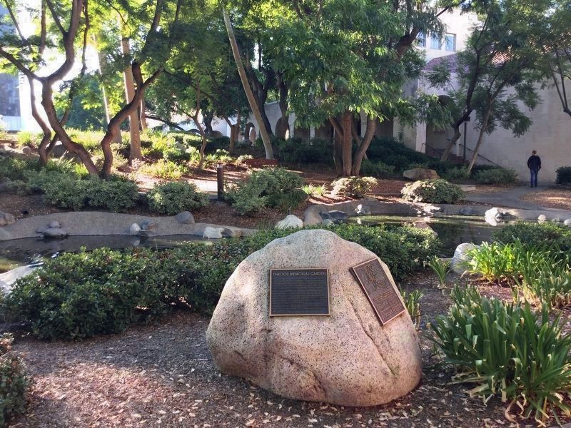
Throop Memorial Garden
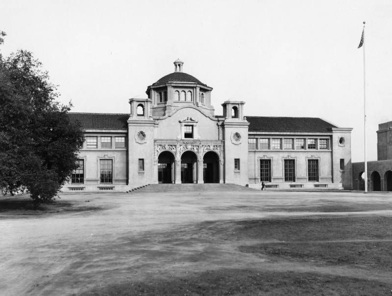
This was once the site of Throop Hall, named after the founder of Throop University, Amos G. Throop. Throop University was founded in 1891 and became the California Institute of Technology in 1920. Built in 1910, Throop Hall was the first building on this campus.
The rocks displayed throughout Throop Memorial Garden represent nearly two billion years in the geological history of California. They were brought here from the San Gabriel Mountains, the backdrop to CalTech and Pasadena where Amos G. Throop and his family played an important role.
This exhibit is made possible through the generosity of Martha Vaughan Smith, great-granddaughter of Amos G. Throop.
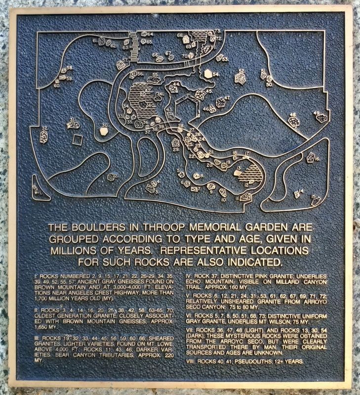
The boulders in Throop Memorial Garden are grouped according to type and age, given in millions of years. Representative locations for such rocks are also indicated.
I: Rocks numbered 2, 9, 15, 17, 21, 22, 26-29, 34, 35, 39, 49, 52, 55, 57; ancient gray gneisses found on Brown Mountain and at 3,000-4,000 ft. elevations near Angeles Crest Highway; more than 1,700 million years old (MY).
II: Rocks 3, 4, 14, 16, 20, 25, 38, 42, 58, 63-65, 70; oldest generation granite, closely associated with Brown Mountain gneisses; approx. 1,650 MY.
III: Rocks 19, 32, 33, 44, 45, 56, 59, 60, 66; sheared granites, lighter varieties, found on Mt. Lowe, above 4,000 ft; rocks 11, 43, 46; darker varieties, Bear Canyon tributaries; approx. 220 MY.
IV: Rock 37; distinctive pink granite, underlies Echo Mountain, visible on Millard Canyon trail; approx. 160 MY.
V: Rocks 6, 12, 21, 24, 31, 53, 61, 62, 67, 69, 71, 72; relatively unsheared granite from Arroyo Seco canyon; 75 to 80 MY.
VI: Rocks 5, 7, 8, 50, 51, 68, 73; distinctive uniform gray granite, underlies Mt. Wilson; 75 MY.
VII: Rocks 36, 47, 48 (light), and rocks 13, 30, 54 (dark); these mysterious rocks were obtained from the Arroyo Seco, but were clearly transported there by Man. Their original sources and ages are unknown.
VIII: Rocks 40, 41; pseudoliths; 12+ years.
Topics. This historical marker is listed in these topic lists: Education • Science & Medicine.
Location. 34° 8.218′ N, 118° 7.499′ W. Marker is in Pasadena, California, in Los Angeles County. Marker can be reached from California Boulevard east of Wilson Avenue. Located on the Cal Tech campus, near Millikan Pond. Touch for map. Marker is at or near this postal address: 274 Olive Walk, Pasadena CA 91125, United States of America. Touch for directions.
Other nearby markers. At least 8 other markers are within walking distance of this marker. Karman Laboratory of Fluid Dynamics and Jet Propulsion (within shouting distance of this marker); The First Known Antiparticle (about 300 feet away, measured in a direct line); Hameetman Center (about 400 feet away); Iris Garden (about 500 feet away); William Morris Davis, 1850-1930 (about 600 feet away); Beckman pH Meter (approx. 0.2 miles away); Tournament Park (approx. 0.3 miles away); Hale Solar Laboratory (approx. 0.3 miles away). Touch for a list and map of all markers in Pasadena.
Credits. This page was last revised on September 28, 2023. It was originally submitted on October 2, 2018, by Craig Baker of Sylmar, California. This page has been viewed 463 times since then and 45 times this year. Photos: 1, 2. submitted on October 2, 2018, by Craig Baker of Sylmar, California. 3. submitted on October 3, 2018, by Craig Baker of Sylmar, California. 4. submitted on October 6, 2018, by Andrew Ruppenstein of Lamorinda, California. • Andrew Ruppenstein was the editor who published this page.


