
Sioux Falls in Minnehaha County, South Dakota — The American Midwest (Upper Plains)
Hive of the Queen City
Photographed by Cosmos Mariner, August 21, 2016
1. Hive of the Queen City Marker
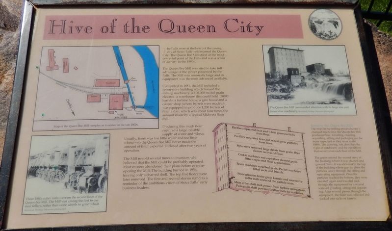
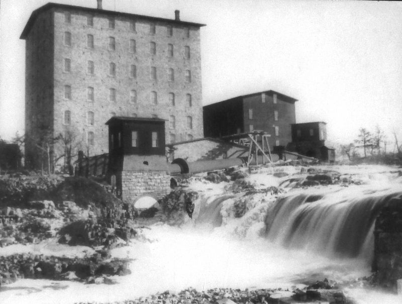
The Queen Bee Mill was sited to take full advantage of the power possessed by the Falls. The Mill was unusually large and its equipment was the most advanced available.
Completed in 1881, the Mill included a seven-story building which housed the milling machinery, a 100,000 bushel grain elevator, a warehouse that could hold 10,000 barrels, a turbine house, a gate house and a cooper shop (where barrels were made). It was equipped to produce 1,200 barrels of flour a day, which was about four times the amount made by a typical Midwest flour mill.
Producing this much flour required a large, reliable supply of water and wheat. Usually, there was too little water and too little wheat — so the Queen Bee Mill never made the amount of flour expected. It closed after two years of operation.
The Mill re-sold several times to investors who believed that the Mill could be profitably operated. Most owners abandoned their
this page online
Running the Queen Bee Mill
The steps in the milling process haven't changed much since the Queen Bee Mill produced flour. Grinding, cleaning, separating, sifting and packaging are the main steps, just as they were in the 1880s. The drawing, left, describes the types of machinery and the operations that occurred on each floor of the Mill.
The grain entered the second story of the building, where it was cleaned and ground. Next, it was elevated to the top of the building where gravity drew the particles down through the sifting and separating equipment. Once the particles reached the bottom, they were elevated again sifting and separating. After several passes through the equipment, the flour was collected and packed into sacks or barrels.
Topics. This historical marker is listed in these topic lists: Industry & Commerce • Man-Made Features. A significant historical year for this entry is 1881.
Location. 43° 33.376′ N,
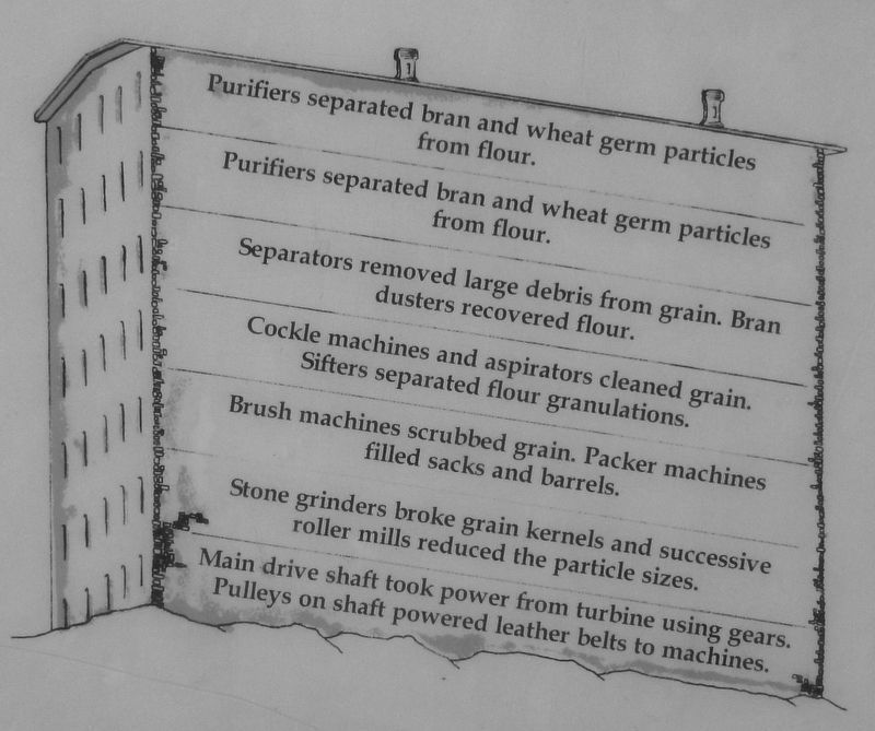
2. Marker detail: Steps in the milling process
- Purifiers separated bran and wheat germ particles from flour.
- Separators removed large debris from grain. Bran dusters recovered flour.
- Cockle machines and aspirators cleaned grain. Sifters separated flour granulations.
- Brush machines scrubbed grain. Packer machines filled sacks and barrels.
- Stone grinders broke grain kernels and successive roller mills reduced the particle sizes.
- Main drive shaft took power from turbine using gears. Pulleys on shaft powered leather belts to machines.
- Separators removed large debris from grain. Bran dusters recovered flour.
- Cockle machines and aspirators cleaned grain. Sifters separated flour granulations.
- Brush machines scrubbed grain. Packer machines filled sacks and barrels.
- Stone grinders broke grain kernels and successive roller mills reduced the particle sizes.
- Main drive shaft took power from turbine using gears. Pulleys on shaft powered leather belts to machines.

Regionally, this marker is in East River. It is also in the American Midwest, in the Lewis & Clark Corridor, in the Corn Belt, on the prairies, and on the Northern Plains. Globally, it is in North America, the Western Hemisphere, the Western World, and the Anglosphere. Historically, it finds itself in what was once Rupert’s Land and also the Louisiana Purchase.
Other nearby markers. At least 8 other markers are within walking distance of this marker: Philander Prescott (within shouting distance of this marker); The Queen Bee Mill (within shouting distance of this marker); Inland Seas (within shouting distance of this marker); Harnessing the River (about 300 feet away,
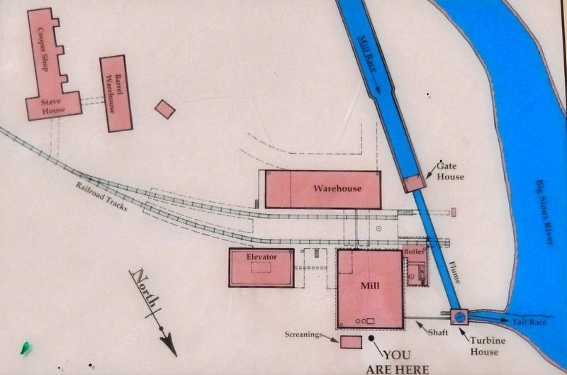
3. Marker detail: Map of the Queen Bee Mill complex as it existed in the late 1800s
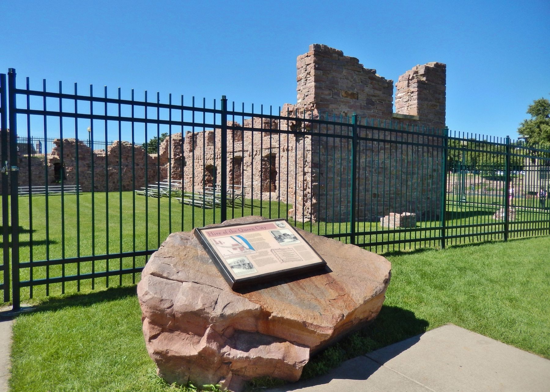
More about this marker. Marker is a large, framed plaque, mounted horizontally, waist-high, on a large boulder on the north side of the Queen Bee Mill ruins.
Related markers. Click here for a list of markers that are related to this marker. The Queen Bee Mill
Photographed by Siouxland Heritage Museum photograph
4. Marker detail: The Queen Bee Mill commanded attention with its large size and innovative machinery
The Queen Bee Mill commanded attention with its large size and innovative machinery.
Photographed by Siouxland Heritage Museum photograph
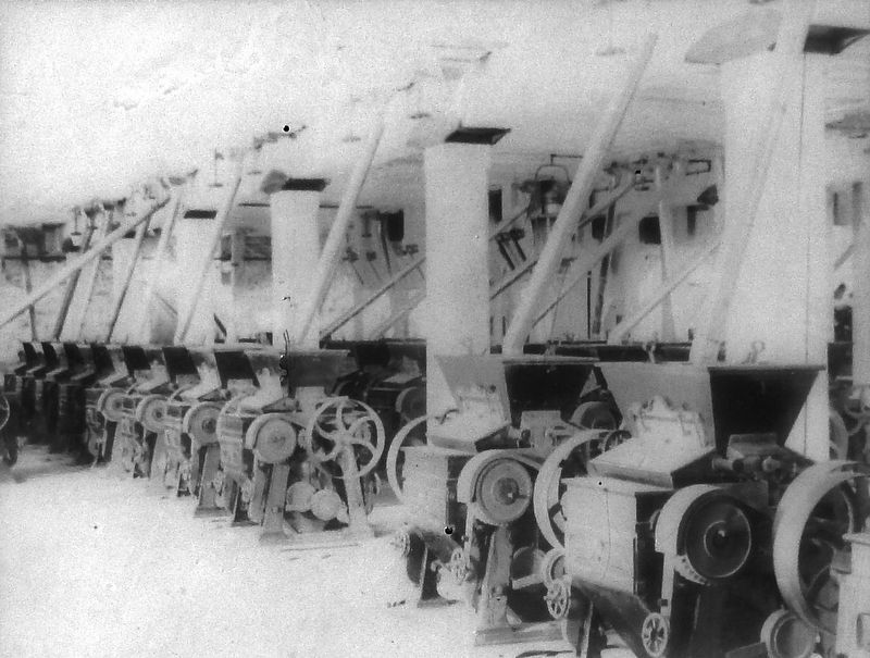
5. Marker detail: Steel roller mills
These 1880s roller mills were on the second floor of the Queen Bee Mill. The Mill was among the first to use steel rollers, rather than stone wheels to grind wheat.
Photographed by Cosmos Mariner, August 21, 2016
6. Hive of the Queen City Marker (wide view; Queen Bee Mill ruins in background)
Credits. This page was last revised on October 8, 2018. It was originally submitted on October 3, 2018, by Cosmos Mariner of Cape Canaveral, Florida. This page has been viewed 1,623 times since then and 190 times this year. Photos: 1, 2, 3, 4, 5, 6. submitted on October 4, 2018, by Cosmos Mariner of Cape Canaveral, Florida. • Bill Pfingsten was the editor who published this page.
