Sioux Falls in Minnehaha County, South Dakota — The American Midwest (Upper Plains)
Harnessing the River
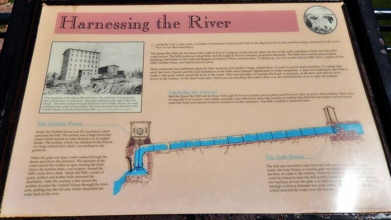
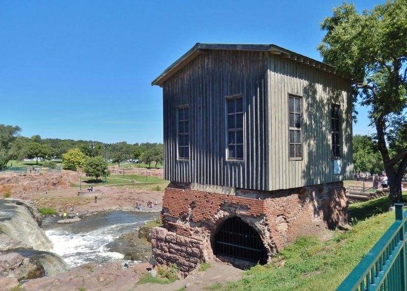
The Queen Bee Mill and the Sioux Falls Light & Power Company hydro-electric plant are two of the early industries which used the Falls water power. The Mill produced wheat flour and the Light & Power Company generated electricity. The Mill ruins and the power plant building, both listed on the National Register of Historic Places, remain today. Looking up, you can see the historic Mill ruins, a replica of the Mill's turbine house, and historic power plant.
These companies had ambitious plans for their factories and needed a large, reliable flow of water to power their machines. To satisfy this need, the river channel and the rock formations of the Falls were changed significantly by both companies. A dam was built above the Falls to create a mill pond which raised the level of the water. This was necessary to increase the head, or pressure, of the flow and deliver more power to the turbine. At the dam's east end, where you are standing, the water's flow was diverted from the river to spin the turbine.
Capturing the Current
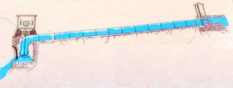
Both the Queen Bee Mill and the Sioux Falls Light & Power Company power plant used the river's flow to power their turbines. Their ways of using the river's power were similar, but there were differences due to the number of turbines (the Mill had one turbine and the power plant had three) and amount of power needed to run the machinery. The Mill's method is illustrated here.
The Turbine House
Inside the Turbine House was the machinery which powered the Mill. The turbine was a large horizontal wheel which turned as water flowed over its angled blades. The turbine, which was attached to the bottom of a long vertical drive shaft, was enclosed in the penstock.
When the gate was open, water rushed through the flume and down the penstock. The pressure of the water forced the turbine to spin, turning the shaft. Above the turbine shaft, a set of gears turned the Mill's main drive shaft. Inside the Mill, a series of gears, pulleys and leather belts powered the machinery. After the rushing water turned the turbine, it exited the Turbine House through the brick arch, spilling into the tail race which channeled the water back to the river.
The Gate House
The mill race funneled water from the mill pond to the Gate House. Inside the Gate House, a wooden gate was raised or lowered to control the flow of water to the turbine. When the Mill was not in use, the gate could be closed to raise the mill pond's water level. When it was time for the machines
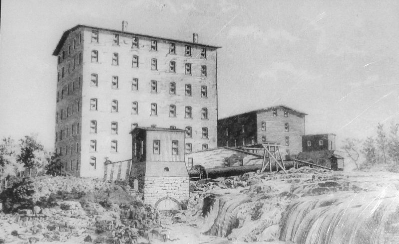
2. Marker detail: the Queen Bee Mill
This engraving of the Queen Bee Mill shows the buildings and equipment that used the power of the river. The small building on the right is the Gate House. The water rushed through the flume to the Turbine House, the small building in the center of this picture. The drive shaft ran from the back of the Turbine House to the first floor of the Mill.
Topics. This historical marker is listed in these topic lists: Industry & Commerce • Man-Made Features.
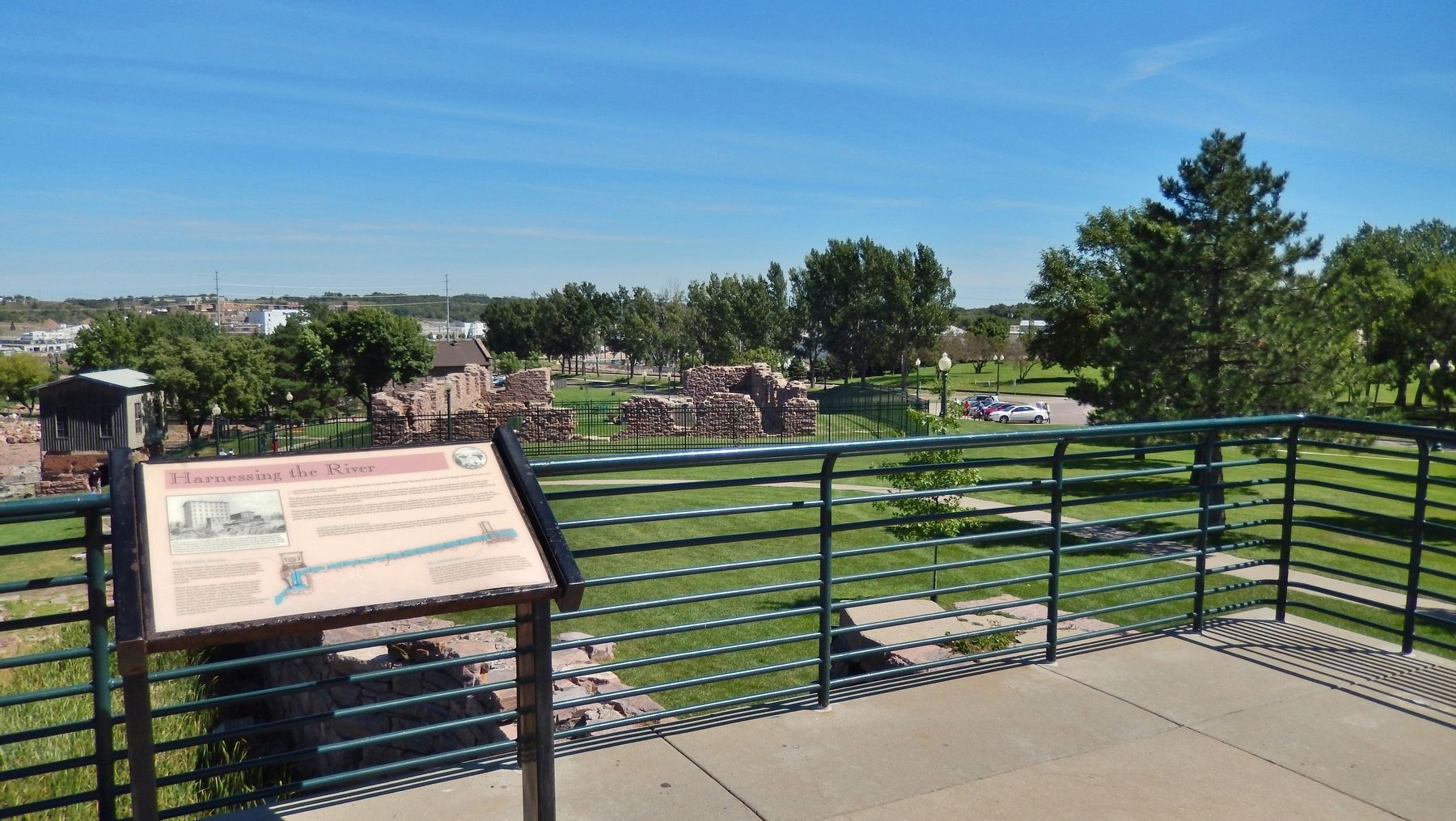
Location. 43° 33.335′ N, 96° 43.366′ W. Marker is in Sioux Falls, South Dakota, in Minnehaha County. Marker can be reached from East Falls Park Drive, on the right when traveling south. Marker is located in Falls Park, along the walkway on the north side of the Queen Bee Mill Ruins, overlooking the mill race ruins. Touch for map. Marker is in this post office area: Sioux Falls SD 57104, United States of America. Touch for directions.
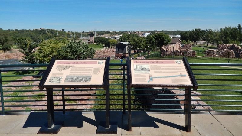
Other nearby markers. At least 8 other markers are within walking distance of this marker. Namesake of the City (here, next to this marker); Foundation of the City (a few steps from this marker); Beginning of Great Changes (a few steps from this marker); Inland Seas (within shouting distance of this marker); The Queen Bee Mill (about 300 feet away, measured in a direct line); Philander Prescott (about 300 feet away); Hive of the Queen City (about 300 feet away); The Lure of the Falls (about 400 feet away). Touch for a list and map of all markers in Sioux Falls.
More about this marker. Marker is a large, framed plaque, mounted horizontally, on waist-high metal posts.
Credits. This page was last revised on October 8, 2018. It was originally submitted on October 3, 2018, by Cosmos Mariner of Cape Canaveral, Florida. This page has been viewed 220 times since then and 11 times this year. Photos: 1, 2, 3, 4, 5, 6. submitted on October 4, 2018, by Cosmos Mariner of Cape Canaveral, Florida. • Bill Pfingsten was the editor who published this page.
