Fort Pierre in Stanley County, South Dakota — The American Midwest (Upper Plains)
Fur Trade on the Upper Missouri River

Photographed by Barry Swackhamer, July 20, 2025
1. Fur Trade on the Upper Missouri River Marker
A slightly altered marker has replaced an earlier one, but the text remains essentially the same.
Larger fur trading forts operated year-round, serving as regional centers for a network of smaller, seasonal "posts" near American Indian encampments. Forts provided food and other supplies to the outlying posts and held their furs for shipment. Forts not only served as trading posts, but also as the place to come for news and fellowship.
Images courtesy of the South Dakota Historical Society and the National Archives.
Erected by The South Dakota State Historical Society, a Preserve America grant and the Dakota, Minnesota and Eastern Railroad Corporation.
Topics. This historical marker is listed in these topic lists: Forts and Castles • Indigenous Peoples and Communities •
this page online
Location. 44° 23.393′ N, 100° 23.331′ W. Marker is in Fort Pierre, South Dakota, in Stanley County. It can be reached from Fort Chouteau Road 0.3 miles east of State Highway 1806. Marker is located on the grounds of the Fort Pierre Chouteau National Historic Landmark, on the south side of the walking trail from Fort Chouteau Road. Touch for map. Marker is at or near this postal address: 350 Fort Chouteau Road, Fort Pierre SD 57532, United States of America. Touch for directions.

Regionally, this marker is in the Crow Creek Sioux Tribe and in East River. It is also in the American Lewis & Clark Corridor, on the prairies, and on the Northern Plains. Globally, it is in North America, the Western Hemisphere, the Western World, and the Anglosphere. Historically, it finds itself in what was once Rupert’s Land and also the Louisiana Purchase.
Other nearby markers. At least 8 other markers are within walking distance of this marker: Scotty Philip and his Buffalo Ranch (within shouting distance of this marker); Rivers and Trails (within shouting distance of this

Photographed by Cosmos Mariner, August 19, 2016
2. Fur Trade on the Upper Missouri River Marker
More about this marker. Marker is a large composite plaque, mounted horizontally on waist-high metal posts.
Related markers. Click here for a list of markers that are related to this marker. Fort Pierre Chouteau National Historic Landmark
Also see . . . The Upper Missouri River Basin in the Nineteenth Century: Fur Trade. Fur trade companies were large and profitable enterprises in turn of the 19th century North America. The British Hudson’s Bay Company and North West Company dominated the North American fur trade in the second half of the eighteenth century, but after the US’ independence, American fur traders began to seriously compete.
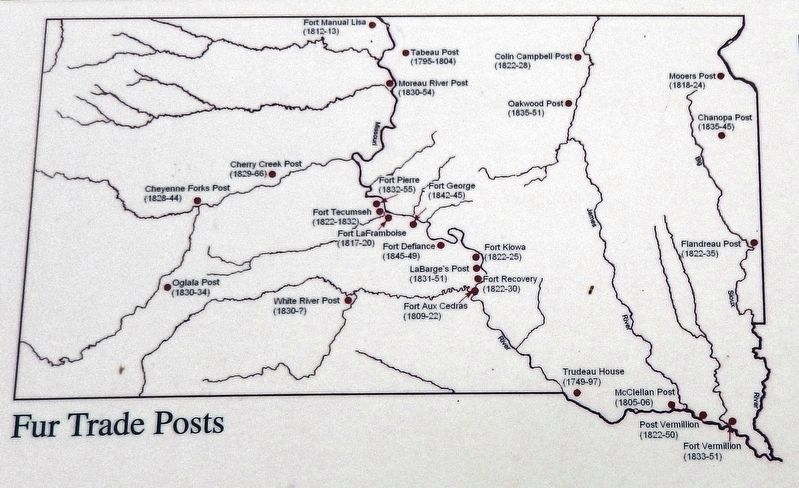
3. Marker detail: Fur Trade Posts on the Upper Missouri River
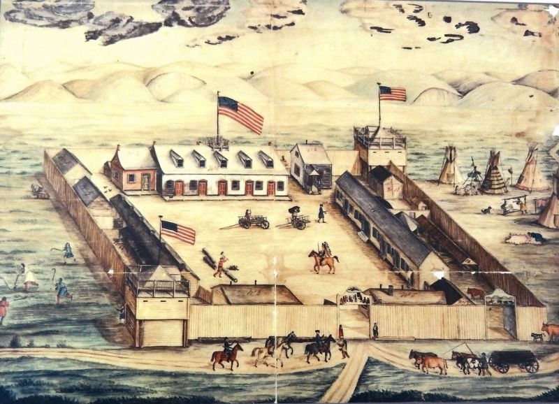
National Archives
4. Marker detail: Fort Pierre Chouteau watercolor by Frederick Behman, 1854
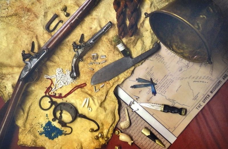
5. Marker detail: Buffalo robes or other furs made a fair trade for manufactured goods
From top (left to right): strike-a-light, thimbles, flintlock rifle, flintlock pistol, tinklers (small metal items), metal knife, bottle of peppermint, tobacco twists, brass trade pot. From lower left: glass trade beads, a hide scale, hair pipes (long white tubes), hawk bells, white ball clay pipes, sgian dubh (knife and sheath pronounced skin doo), and metal points.
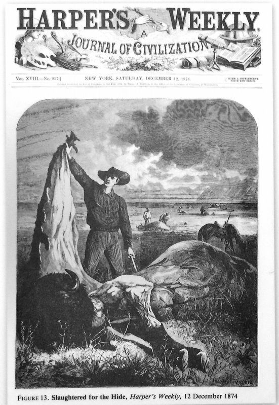
Photographed by Harpers Weekly (Dec. 12, 1874)
6. Marker detail: "Slaughtered for the Hide," by Paul Frenzeny & Jules Tavernier, Harper's Weekly 1874
Government policy, railroads, and overhunting decimated the great buffalo herds by the mid to late 1800s.
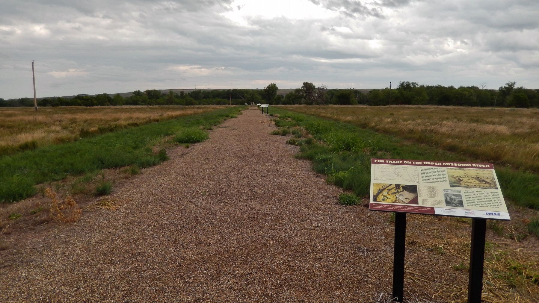
Photographed by Cosmos Mariner, August 19, 2016
7. Fur Trade Upper Missouri River Marker (wide view; Fort Pierre Chouteau Site in background)
Credits. This page was last revised on November 9, 2025. It was originally submitted on October 6, 2018, by Cosmos Mariner of Cape Canaveral, Florida. This page has been viewed 1,451 times since then and 138 times this year. Photos: 1. submitted on November 9, 2025, by Barry Swackhamer of Brentwood, California. 2, 3, 4. submitted on October 9, 2018, by Cosmos Mariner of Cape Canaveral, Florida. 5, 6. submitted on October 10, 2018, by Cosmos Mariner of Cape Canaveral, Florida. 7. submitted on October 9, 2018, by Cosmos Mariner of Cape Canaveral, Florida. • Andrew Ruppenstein was the editor who published this page.
