Near Soda Springs in Caribou County, Idaho — The American West (Mountains)
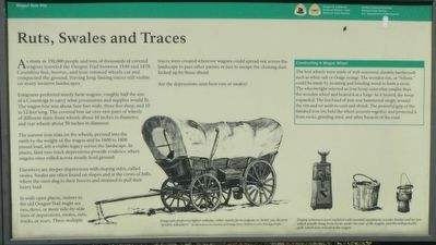
Ruts, Swales and Traces

Photographed By Barry Swackhamer, May 13, 2018
1. Ruts, Swales and Traces Marker
Captions: (bottom center} Emigrants preferred lighter vehicles, either sturdy farm wagons or , better yet, the new "prairie schooners."; (bottom right) Prairie schooners were outfitted with essential equipment; a water bucket and tar pot, which usually hung from hooks under the rear of the wagon, and the indispensable jack, which was stowed in the wagon.
Emigrants preferred sturdy farm wagons, roughly half the size of a Conestoga to carry what possessions and supplies would fit. The wagon box was about four feet wide, three feet deep, and 10 to 12 feet long. The covered box sat over two pairs of wheels of different sizes: front wheels about 44 inches in diameter, and rear wheels about 50 inches in diameter.
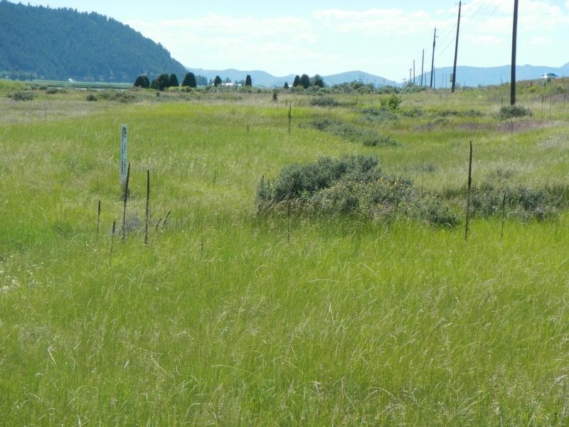
The narrow iron rims on the wheels, pressed into the earth by the weight of the wagon and its 1600 to 1800 pound load, left a visible legacy across the landscape. In places, faint two-track depressions provide evidence where wagons once rolled across mostly level ground.
Elsewhere are deeper depressions with sloping sides, called swales. Swales are often found on slopes and at the crest of hills, where the oxen dug in their hooves and strained to pull their heavy load.
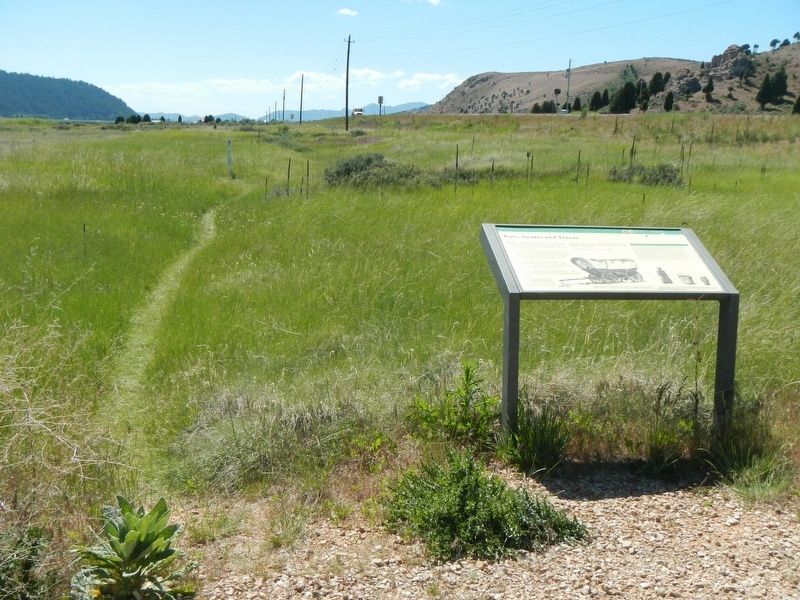
In wide open places, visitors to the old Oregon Trail might see two, three or more side-by-side lines of depressions, swales, ruts, tracks, or scars. These multiple traces created wherever wagons could spread out across the landscape to pass other parties or just to escape the choking dust kicked up by those ahead.
Are the depressions seen here ruts or swales.?
(side-bar at upper right:)
Constructing a Wagon Wheel
The best wheels were made of well-seasoned, durable hardwoods such as white oak or Osage orange. The wooden rim, or "felloes," could be made by steaming or bending wood to form a circle. The wheelwright selected an iron hoop somewhat smaller that the wooden wheel and heated it in a large forge. As it heated, the hoop expanded. The hot band of iron was hammered snugly around the rim and set aside to cool and shrink. The powerful grip of the finished iron tire held the wheel securely together and protected it from rocks, grinding sand, and other hazards of the road.
Erected by Oregon & California National Historic Trails,, National Park Service and Caribou Historical Society.
Topics. This historical marker is listed in this topic list: Roads & Vehicles.
Location. 42° 39.48′ N, 111° 39.228′ W. Marker is near Soda Springs, Idaho, in Caribou County. Marker can be reached from U.S. 30 near Valley View Drive, on the left when traveling west. Touch for map. Marker is at or near this postal address: 2463 US Highway 30, Soda Springs ID 83276, United States of America. Touch for directions.
Other nearby markers. At least 8 other markers are within 3 miles
of this marker, measured as the crow flies. Soda Springs (approx. 1.4 miles away); Camp Connor (approx. 1.4 miles away); First In Soda Springs (approx. 2 miles away); Clash Of Cultures (approx. 2 miles away); Law & Order On The Frontier (approx. 2 miles away); A New Beginning... (approx. 2 miles away); Not A Walk In The Park... (approx. 2.4 miles away); Wagon Box Grave of 1861 (approx. 2.4 miles away). Touch for a list and map of all markers in Soda Springs.
More about this marker. This marker is located on a short un-named road leading to the Alexander Reservoir boat launch.
Credits. This page was last revised on October 11, 2018. It was originally submitted on October 11, 2018, by Barry Swackhamer of Brentwood, California. This page has been viewed 523 times since then and 58 times this year. Photos: 1, 2, 3. submitted on October 11, 2018, by Barry Swackhamer of Brentwood, California.

