Edgefield in Edgefield County, South Carolina — The American South (South Atlantic)
Sheppard's Crossroads
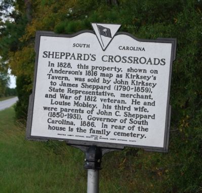
Photographed by Brian Scott, October 10, 2008
1. Sheppard's Crossroads Marker
Erected 1972 by Edgefield County Historical Society. (Marker Number 19-10.)
Topics. This historical marker is listed in these topic lists: Industry & Commerce • Roads & Vehicles • Settlements & Settlers • War of 1812. A significant historical year for this entry is 1828.
Location. 33° 58.183′ N, 82° 2.747′ W. Marker is in Edgefield, South Carolina, in Edgefield County. It is on US Highway 25, on the left when traveling south. Marker is actually in Greenwood County but was placed there by Edgefield. Therefore, it is considered by the state to be an Edgefield County marker. Touch for map. Marker is in this post office area: Edgefield SC 29824, United States of America. Touch for directions.

Regionally, this marker is in Greater Augusta and in the Midlands.
this page online
Other nearby markers. At least 10 other markers are within 13 miles of this marker, measured as the crow flies: Dr. Benjamin E. Mays (approx. 6.7 miles away); Wm. Pierce Bennett Kinard (approx. 8.1 miles away); Bethany Church (approx. 8.7 miles away); Londonborough Settlement (approx. 9 miles away); John Perkins Barratt (approx. 10.7 miles away); Early Life in the Backcountry (approx. 11.9 miles away); John Waller (approx. 12.1 miles away); Ninety Six National Historic Site / Greenwood County (approx. 12.2 miles away); The Lost Town of Cambridge (approx. 12.2 miles away); Ninety Six National Historic Site (approx. 12.2 miles away).
Another marker is no longer nearby. Faith Cabin Library Site (was approx. 11.2 miles away but has been confirmed missing).
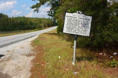
Photographed by Mike Stroud, 2011
2. Sheppard's Crossroads Marker seen looking north along US 25
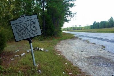
Photographed by Mike Stroud, 2011
3. Sheppard's Crossroads Marker looking southward
Credits. This page was last revised on December 13, 2019. It was originally submitted on October 14, 2008, by Brian Scott of Anderson, South Carolina. This page has been viewed 4,929 times since then and 251 times this year. Photos: 1. submitted on October 14, 2008, by Brian Scott of Anderson, South Carolina. 2, 3. submitted on October 2, 2011, by Mike Stroud of Bluffton, South Carolina.
