The Plains in Fauquier County, Virginia — The American South (Mid-Atlantic)
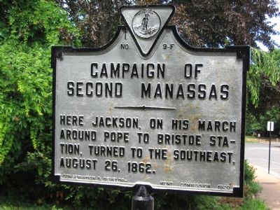
Campaign of Second Manassas
Erected 1928 by Conservation & Development Commission. (Marker Number F-9.)
Topics and series. This historical marker is listed in this topic list: War, US Civil. In addition, it is included in the Virginia Department of Historic Resources (DHR) series list. A significant historical year for this entry is 1862.
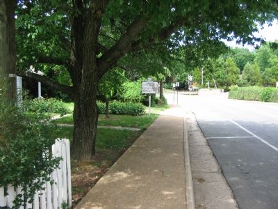
Location. 38° 51.795′ N, 77° 46.31′ W. Marker is in The Plains, Virginia, in Fauquier County. Marker is on Loudoun Avenue (County Route 626) north of John Marshall Highway (Virginia Route 55), on the left when traveling north. Touch for map. Marker is in this post office area: The Plains VA 20198, United States of America. Touch for directions.
Other nearby markers. At least 8 other markers are within 5 miles of this marker, measured as the crow flies. The Plains (approx. 0.2 miles away); Number 18 School (approx. 3.2 miles away); Heflin's Store (approx. 3.4 miles away); Confederate Memorial (approx. 3˝ miles away); a different marker also named Campaign of Second Manassas (approx. 4.3 miles away); Thoroughfare Gap (approx. 4.3 miles away); a different marker also named Thoroughfare Gap (approx. 4.3 miles away); Chapman's Mill (approx. 4.4 miles away).
Regarding Campaign of Second Manassas. Confederate Gen. Thomas “Stonewall” Jackson led his Corps from Salem (present day Marshall), north to Rectorville, then turned towards The Plains. At this location, he turned again and marched his command through Thoroughfare Gap. From there he would march down the railroad lines from Bristoe Station to Manassas Junction. This march placed him behind Union Gen. John Pope’s Army of Virginia, and precipitated the Second Battle of Manassas.
Related markers. Click here for a list of markers that are related to this marker. To better understand the relationship, study each marker in the order shown.
Credits. This page was last revised on June 16, 2016. It was originally submitted on June 23, 2007, by Craig Swain of Leesburg, Virginia. This page has been viewed 1,588 times since then and 22 times this year. Photos: 1, 2. submitted on June 23, 2007, by Craig Swain of Leesburg, Virginia. • J. J. Prats was the editor who published this page.

