Exploring the Coast / Exploration de la côte
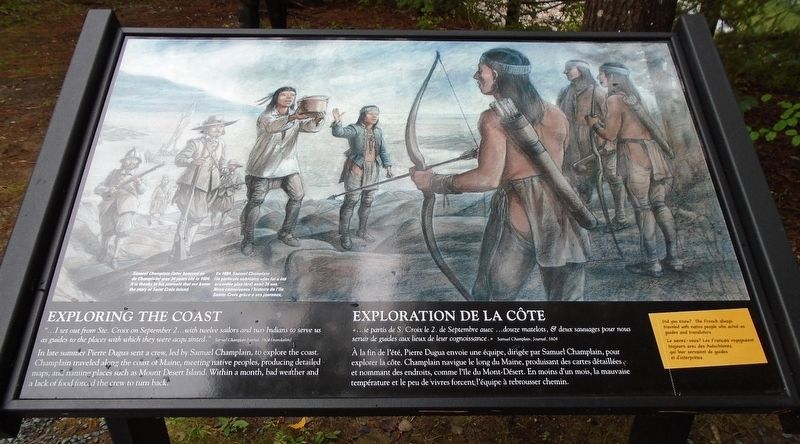
"...I set out from Ste. Croix on September 2...with twelve sailors and two Indians to serve us as guides to the places with which they were acquainted."
Samuel Champlain Journal, 1604 (translation)
In late summer Pierre Dugua sent a crew, led by Samuel Champlain, to explore the coast. Champlain traveled along the coast of Maine, meeting native peoples, producing detailed maps, and naming places such as Mount Desert Island. Within a month, bad weather and a lack of food forced the crew to turn back.
Did you know? The French always traveled with native people who served as guides and translators.
Samuel Champlain (later honored as de Champlain) was 34 years old in 1604. It is thanks to his journals that we know the story of Saint Croix Island.
Samuel Champlain, Journal, 1604
À la fin de l'été,
Pierre Dugua envoie une équipe, dirigée par Samuel Champlain, pour explorer la côte. Champlain navigue le long du Maine, produisant des cartes détaillées et nommant des endroits, comme l'île du Mont-Désert. En moins d'un mois, la mauvaise température et le peu de vivres forcent l'équipe à rebrousser chemin.Le saviez-vous? Les Français voyageaient toujours avec des Autochtones, qui leur servaient de guides et d'interprètes.
En 1604, Samuel Champlain (la particule nobiliaire «de» lui a été accordée plus tard) avait 34 ans. Nous connaissons l'histoire de l'île Sainte-Croix grâce à ses journaux.
Erected by National Park Service.
Topics. This historical marker is listed in these topic lists: Exploration • Native Americans • Settlements & Settlers • Waterways & Vessels. A significant historical date for this entry is September 2, 1604.
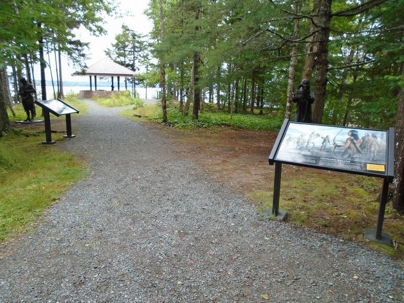
Location. 45° 7.436′ N, 67° 8.771′ W. Marker is near Calais, Maine, in Washington County. Marker is on the grounds of Saint Croix Island International Historic Site, along the interpretive trail. Touch for map. Marker is at or near this postal address: 84 Saint Croix Drive, Calais ME 04619, United States of America. Touch for directions.
Other nearby markers. At least 8 other markers are within walking distance of this marker. Trapped For The Winter / Prisonniers de l'hiver (a few steps from this marker); Building A Community / Tout à bâtir (within
Related markers. Click here for a list of markers that are related to this marker. Saint Croix Island International Historic Site / Île Sainte-Croix Lieu historique international
Also see . . .
1. Saint Croix Island International Historic Site. National Park Service website entry (Submitted on October 20, 2018, by William Fischer, Jr. of Scranton, Pennsylvania.)
2. Saint Croix Island International Historic Site Audio Files for Interpretive Trail
3. Champlain and the Settlement of Acadia 1604-1607. University of Maine website entry (Submitted on October 20, 2018, by William Fischer, Jr. of Scranton, Pennsylvania.)
4. Teaching Champlain and the Settlement of Acadia 1604-1607. University of Maine website entry (Submitted on October 20, 2018, by William Fischer, Jr. of Scranton, Pennsylvania.)
Credits. This page was last revised on April 26, 2024. It was originally submitted on October 20, 2018, by William Fischer, Jr. of Scranton, Pennsylvania. This page has been viewed 154 times since then and 10 times this year. Photos: 1, 2, 3, 4. submitted on October 20, 2018, by William Fischer, Jr. of Scranton, Pennsylvania.


