Centro Histórico in Ciudad de México, Mexico — The Valley of Mexico (The Central Highlands)
Calle Guatemuz
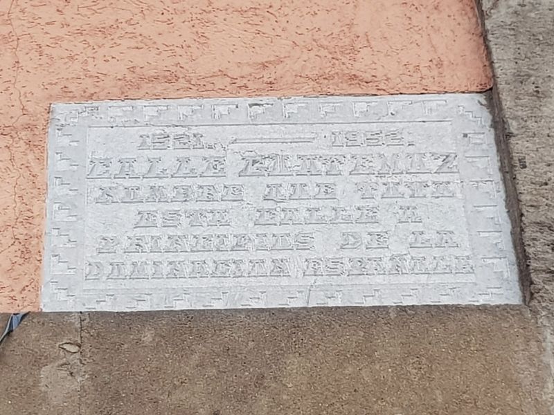
1521. – 1952.
Calle Guatemuz
Nombre que tuvo este calle a principios de la dominación española
1521. – 1952.
Guatemuz Street
This street was known by this name at the beginning of Spanish domination.
Erected 1952.
Topics. This memorial is listed in these topic lists: Roads & Vehicles • Wars, Non-US. A significant historical year for this entry is 1521.
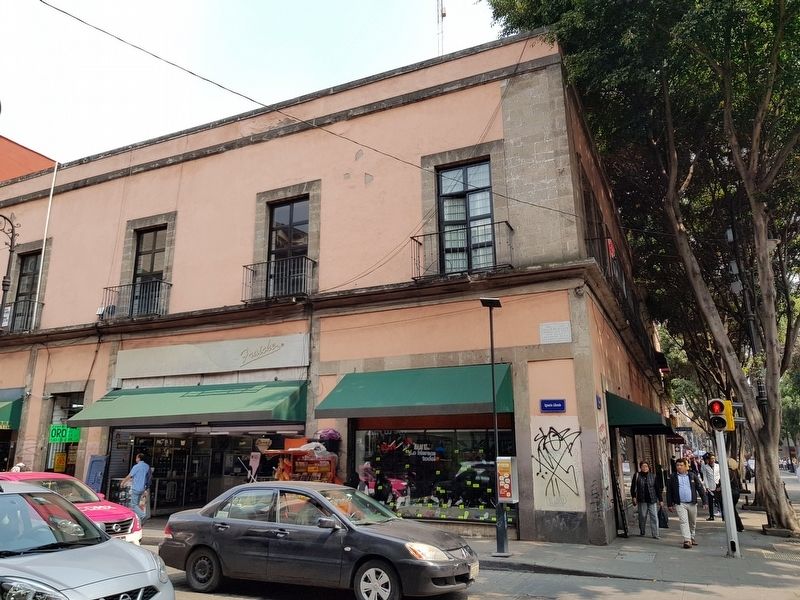
Location. 19° 26.145′ N, 99° 8.278′ W. Marker is in Ciudad de México. It is in Centro Histórico. Memorial is at the intersection of Allende and Calle de Tacuba, on the left when traveling south on Allende. Touch for map. Marker is in this post office area: Ciudad de México 06000, Mexico. Touch for directions.
Other nearby markers. At least 8 other markers are within walking distance of this marker. Café de Tacuba (within shouting distance of this marker); Juan de Cervantes Casaus (within shouting distance of this marker); Teatro Iturbide (about 90 meters away, measured in a direct line); Antonio López de Santa Anna (about 90 meters away); Museum of the Heroic Military College (about 90 meters away); Hospital del Divino Salvador (about 90 meters away); Offices of the Diario del Hogar (about 90 meters away); Filomeno Mata (about 90 meters away). Touch for a list and map of all markers in Ciudad de México.
Regarding Calle Guatemuz. "Guatemuz" was how the Spanish conquistadors attempted to pronounce the name of Cuauhtémoc, the last tlatoani, or king, of the Mexicas. After the fall of Tenochtitlan, he was captured and tortured, presumably so that he would tell the Spanish the location of gold and other valuables. Cortés eventually killed Cuauhtémoc by hanging on the way to Honduras in 1525.
Credits. This page was last revised on April 17, 2020. It was originally submitted on October 21, 2018, by J. Makali Bruton of Accra, Ghana. This page has been viewed 145 times since then and 20 times this year. Photos: 1, 2. submitted on October 21, 2018, by J. Makali Bruton of Accra, Ghana.

