Cleveland in Greenville County, South Carolina — The American South (South Atlantic)
Point of View
The View from the Mountain Bridge Wilderness Area
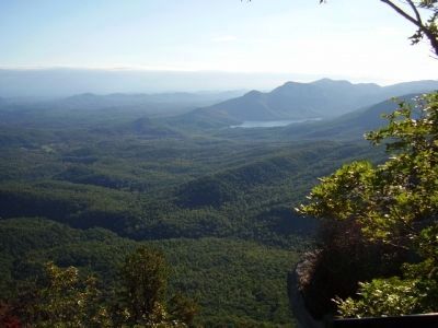
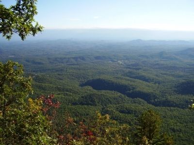
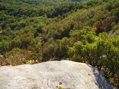
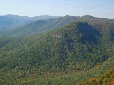
Located in northwestern South Carolina. The Blue Ridge Escarpment ends with an abrupt drop of some 2,000 feet to the foothills below, where the state's Piedmont region begins. The escarpment affords spectacular waterfalls and provides a protected environment for rare and endangered plant and animal species.
Campbell Mountain
2589 feet
Paris Mountain State Park
This isolated mountain stands at 2020 feet above sea level.
Glassy Mountain
1702 feet
Stool Mountain
2600 feet
Table Rock Mountain
This prominent granite outcropping at 3124 feet is a stark contract to the heavily wood forests below. Table Rock State Park is located to the southeast side of the mountain.
Pinnacle Mountain
At a height of 3425 feet, the highest point entirely in South Carolina.
Piedmont
Gently rolling hills at the foot of the mountains. Piedmont is French for foot of the mountains.
Dismal Forest
A dense, mature hardwood forest that stretches for miles beneath Caesars Head State Park.
Table Rock Reservoir
This picturesque lake is a source of water for the city of Greenville.
Raven Cliff Mountain
The raven, this 3000 foot mountain's namesake, has nested on it's cliffs for over a hundred years.
Erected by South Carolina State Park Service.
Topics. This historical marker is listed in this topic list: Environment.
Location. 35° 6.415′ N, 82° 37.926′ W. Marker is in Cleveland, South Carolina, in Greenville County. Marker can be reached from Caesars Head Drive near Geer Highway (Route 276). Marker is in Caesars Head State Park. Touch for map. Marker is at or near this postal address: 8155 Geer Highway, Cleveland SC 29635, United States of America. Touch for directions.
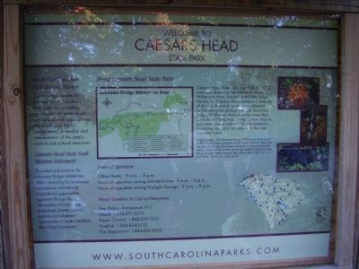
Other nearby markers. At least 10 other markers are within 7 miles of this marker, measured as the crow flies. Tommy Wyche (a few steps from this marker); Welcome to Caesars Head State Park (approx. 0.3 miles away); Raven Cliff Falls (approx. 1˝ miles away); North Carolina / South Carolina (approx. 1.6 miles away in North Carolina); Beliefs Set in Stone (approx. 6.1 miles away); Gap Creek Baptist Church (approx. 6.2 miles away); The Civilian Conservation Corps (approx. 6˝ miles away); a different marker also named Civilian Conservation Corps (approx. 6˝ miles away); A CCC Classic (approx. 6˝ miles away); Parkitecture (approx. 6.6 miles away). Touch for a list and map of all markers in Cleveland.
Regarding Point of View. Photo on marker points out names of mountains in view and physical features of the surrounding area.
Also see . . .
1. Caesars Head State Park. Caesars Head State Park is located in northern Greenville County, SC, only three miles (5 km) from the North Carolina border. (Submitted on June 28, 2009, by Brian Scott of Anderson, South Carolina.)
2. Pinnacle Mountain (South Carolina). Pinnacle Mountain is the highest mountain totally within the state of South Carolina (though it is not as high as nearby Sassafras Mountain). (Submitted on June 28, 2009, by Brian Scott of Anderson, South Carolina.)
3. Glassy Mountain (South Carolina). Glassy Mountain is a mountain close to Pickens, South Carolina, USA, in Northwestern South Carolina, with a summit elevation of 1647 feet (502 m) above mean sea level. (Submitted on June 28, 2009, by Brian Scott of Anderson, South Carolina.)
Credits. This page was last revised on November 15, 2020. It was originally submitted on October 15, 2008, by Stanley and Terrie Howard of Greer, South Carolina. This page has been viewed 1,512 times since then and 16 times this year. Photos: 1. submitted on October 15, 2008, by Stanley and Terrie Howard of Greer, South Carolina. 2. submitted on June 28, 2009, by Brian Scott of Anderson, South Carolina. 3. submitted on October 17, 2010, by Brian Scott of Anderson, South Carolina. 4, 5, 6. submitted on October 15, 2008, by Stanley and Terrie Howard of Greer, South Carolina. 7, 8. submitted on June 28, 2009, by Brian Scott of Anderson, South Carolina. 9. submitted on October 15, 2008, by Stanley and Terrie Howard of Greer, South Carolina. 10. submitted on June 28, 2009, by Brian Scott of Anderson, South Carolina. 11. submitted on October 16, 2008, by Stanley and Terrie Howard of Greer, South Carolina. • Bill Pfingsten was the editor who published this page.


