Near Waubay in Day County, South Dakota — The American Midwest (Upper Plains)
Waubay National Wildlife Refuge
Welcome to
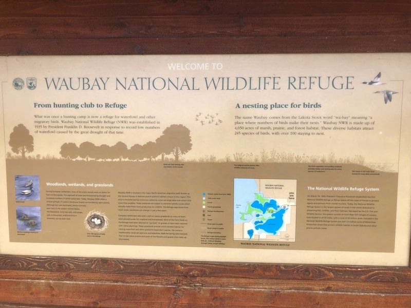
From hunting club to Refuge
What was once a hunting camp is now a refuge for waterfowl and other migratory birds. Waubay National Wildlife Refuge (NWR) was established in 1935 by President Franklin D. Roosevelt in response to record low numbers of waterfowl caused by the great drought of that time.
A nesting place for birds
The name Waubay comes from the Lakota Sioux word "wa-bay " meaning "a place where numbers of birds make their nests." Waubay NWR is made up of 4,650 acres of marsh, prairie, and forest habitat. These diverse habitats attract 245 species of birds, with over 100 staying to nest.
Woodlands, wetlands, and grasslands
During European settlement, most of the area's woods were cut down for fuel and fenceposts. The regrowth of trees was threatened by drought and increased numbers of white-tailed deer. Today, Waubay NWR offers a unique glimpse of eastern deciduous forests surrounded by open prairie. Although bur oak dominates, plants normally seen only in the eastern United States, like basswood, American elm, wild grape, jack-in-the-pulpit, and Dutchman's breeches, can be seen here.
Waubay NWR is located in the major North American migration path known as the Central Flyway. It features prairie pothole habitat unique to this region. This area is characterized by numerous wetlands: some are large lakes and others little more than puddles. These wetlands are subject to extreme wet/dry cycles which actually make them more productive for wildlife. The Refuge map show how much water conditions can change in just a few years.
European settlement also took a toll on native grasslands as many of them were plowed under for cropland and homesteads. Most of the farm fields on the Refuge have been allowed to "go back" to grasses or have been restored with native plantings. These grasslands provide much-needed habitat for nesting waterfowl and other grassland-dependent species, like western meadowlarks, savannah sparrows, and bobolinks. Walk the Spring Lake Overlook Trail to see native prairie and some of the flowers and grasses that make up this habitat.
The National Wildlife Refuge System
On March 14, 1903, President Theodore Roosevelt established the first National Wildlife Refuge at Pelican Island off the coast of Florida to protect egrets and melicans from market hunters. Today, the National Wildlife Refuge System is the largest system of lands in the world dedicated to preserving fish, wildlife, and their habitats. Managed by the U.S. Fisha nd Wildlife Service, this system consists of more than 535 refuges of various sizes located in all 50 states, with a total of 93 million acres. Included in the National Wildlife Refuge System are over 2.5 million acres of Waterfowl Production Areas that protect wildlife habitat in South Dakota and other prairie pothole states.
Picture Captions
Birds can find nesting sites and shelter in the woods.
The tallgrass prairie plants offer wildlife a bounty of seeds.
The thick vegetation surrounding wetlands provides shelter and nesting sites for many species of waterfowl.
The water is rich with food sources for many birds and animals.
Erected by Fish & Wildlife Service, U.S. Department of the Interior.
Topics and series. This historical marker is listed in these topic lists: Charity & Public Work • Environment • Horticulture & Forestry. In addition, it is included in the Former U.S. Presidents: #26 Theodore Roosevelt series list. A significant historical date for this entry is March 14, 1903.
Location. 45° 25.887′ N, 97° 18.485′ W. Marker is near Waubay, South Dakota, in Day County. Marker is on Waubay Refuge Entrance Road. The marker is one half mile from the park entrance off 466th ave. Touch for map. Marker is in this post office area: Waubay SD 57273, United States of America. Touch for directions.
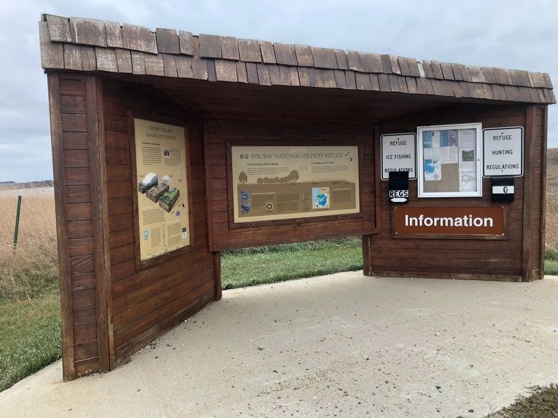
Other nearby markers. At least 8 other markers are within 8 miles of this marker, measured as the crow flies. Waubay Wetland Management District (here, next to this marker); Changes on the Land (approx. 0.4 miles away); a different marker also named Waubay National Wildlife Refuge (approx. one mile away); Potholes and Prairie (approx. 1.1 miles away); Saving Men and Beasts (approx. 1.1 miles away); A Room with a View (approx. 1.1 miles away); Chief Bluedog (approx. 1.2 miles away); Roberts County / Day County South Dakota (approx. 7.9 miles away). Touch for a list and map of all markers in Waubay.
Credits. This page was last revised on August 1, 2020. It was originally submitted on October 23, 2018, by Ruth VanSteenwyk of Aberdeen, South Dakota. This page has been viewed 118 times since then and 13 times this year. Photos: 1, 2, 3. submitted on October 23, 2018, by Ruth VanSteenwyk of Aberdeen, South Dakota. • Andrew Ruppenstein was the editor who published this page.


