East Bloomfield in Ontario County, New York — The American Northeast (Mid-Atlantic)
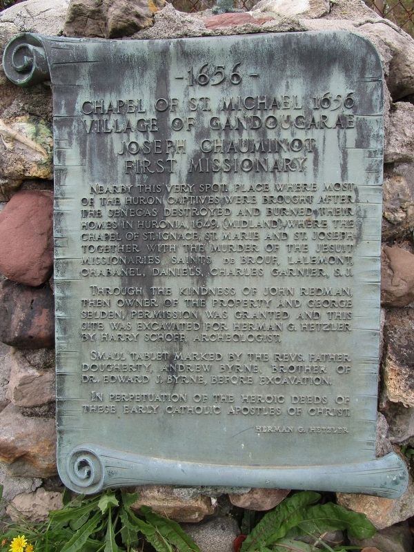
1656 Chapel of St. Michael 1656
Village of Gandougarae
— Joseph Chauminot First Missionary —
Through the kindness of John Redman, then owner of the property and George Selden, permission was granted and this site was excavated for Herman G. Hetzler by Harry Schoff, archeologist.
Small tablet marked by the Revs. Father Dougherty, Andrew Byrne, Brother of Dr. Edward J. Byrne, before excavation.
In perpetuation of the heroic deeds of these early Catholic apostles of Christ.
Erected by Herman G. Hetzler.
Topics. This historical marker is listed in these topic lists: Churches & Religion • Native Americans. A significant historical year for this entry is 1649.
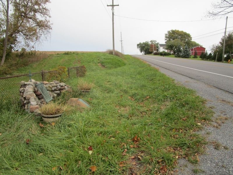
Location. 42° 54.768′ N, 77° 22.528′ W. Marker is in East Bloomfield, New York, in Ontario County. Marker is on North Bloomfield Road (County Route 30) 0.1 miles east of Wheeler Station Road, on the left when traveling east. Marker is east of the Shaeffer Creek bridge. Touch for map. Marker is at or near this postal address: 6370 North Bloomfield Road, Bloomfield NY 14469, United States of America. Touch for directions.
Other nearby markers. At least 8 other markers are within 4 miles of this marker, measured as the crow flies. Gandougarae (here, next to this marker); Town of Bloomfield (approx. 0.2 miles away); a different marker also named Gandougarae (approx. 2.1 miles away); First Town Hall (approx. 3.1 miles away); East Bloomfield to the Memory of her Sons (approx. 3.2 miles away); Former Academy (approx. 3.2 miles away); A Memorial (approx. 3.2 miles away); East Bloomfield Academy (approx. 3.2 miles away). Touch for a list and map of all markers in East Bloomfield.
Credits. This page was last revised on October 27, 2018. It was originally submitted on October 27, 2018, by Anton Schwarzmueller of Wilson, New York. This page has been viewed 299 times since then and 25 times this year. Photos: 1, 2. submitted on October 27, 2018, by Anton Schwarzmueller of Wilson, New York.

