
Victor in Ontario County, New York — The American Northeast (Mid-Atlantic)
Gahayanduk
Photographed by Anton Schwarzmueller, October 26, 2018
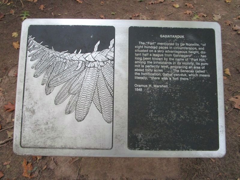
1. Gahayanduk Marker
There are three markers in this series that are in the wooded perimeter of the cleared hilltop. This is the farthest.
The "Fort" mentioned by De Nonville, "of eight hundred paces in circumference, and situated on a very advantageous height, distant half a league from Gannagaro"...has long been known by the name of "Fort Hill," among the inhabitants in its vicinity. Its summit is perfectly level, embracing an area of about forty acres....The Senecas called the fortification, Gah-yan-duk, which means literally, "there was a fort there."
Oramus H. Marshall
1848
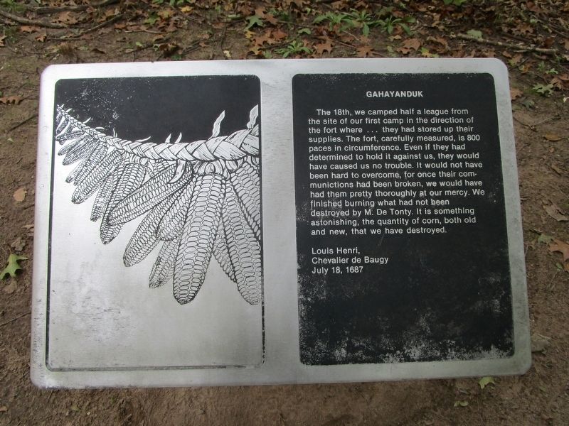
The 18th, we camped half a league from the site of our first camp in the direction of the fort where...they had stored up their supplies. The fort, carefully measured, is 800 paces in circumference. Even if they had determined to hold it against us, they would have caused us no trouble. It would not have been hard to overcome, for once their communications had been broken, we would have had them pretty thoroughly at our mercy. We finished burning what had not been destroyed by M. De Tonty. It is something astonishing, the quantity of corn, both old and new, that we have destroyed.
Louis Henri,
Chevalier de Baugy
July 18, 1687
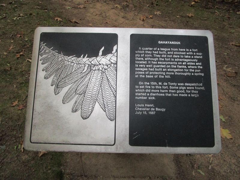
A quarter of
this page online
On the 15th, M. de Tonty was despatched to set fire to this fort. Some pigs were found, which did more harm than good, for they started a diaahoea that has made a large number sick.
Louis Henri,
Chevalier de Baugy
July 15, 1687
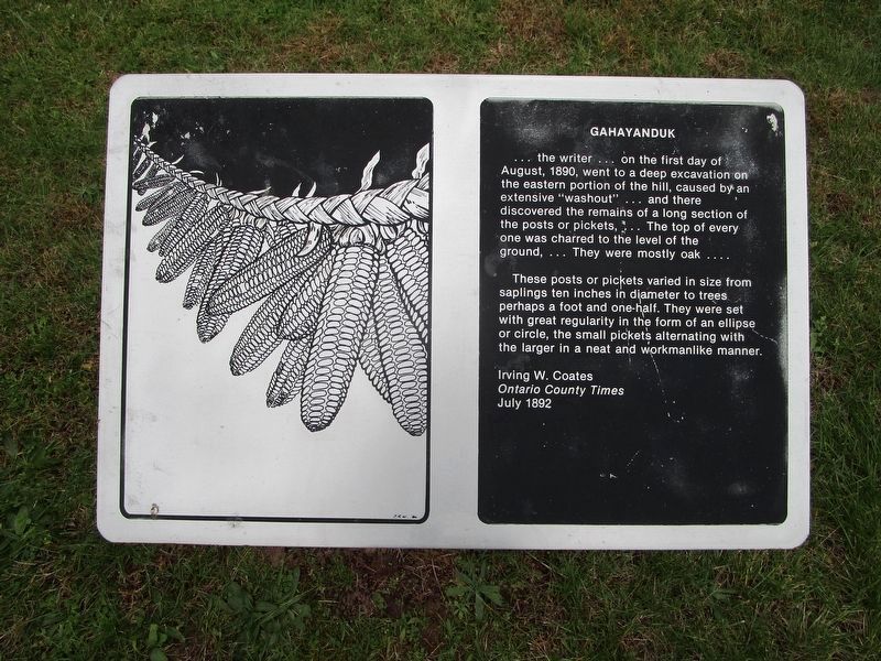
...the writer...on the first day of August, 1890, went to a deep excavation on the eastern portion of the hill, caused by an extensive "washout"...and there discovered the remains of a long section of posts or pickets,...The top of every one was charred to the level of the ground,...They were mostly oak....
These posts or pickets varied in size from saplings ten inches in diameter to trees perhaps a foot and one-half. They were set with great regularity in the form of an ellipse or circle, the small pickets alternating with the larger
Photographed by Anton Schwarzmueller, October 26, 2018
2. Gahayanduk Marker
Irving W. Coates
Ontario County Times
July 1892
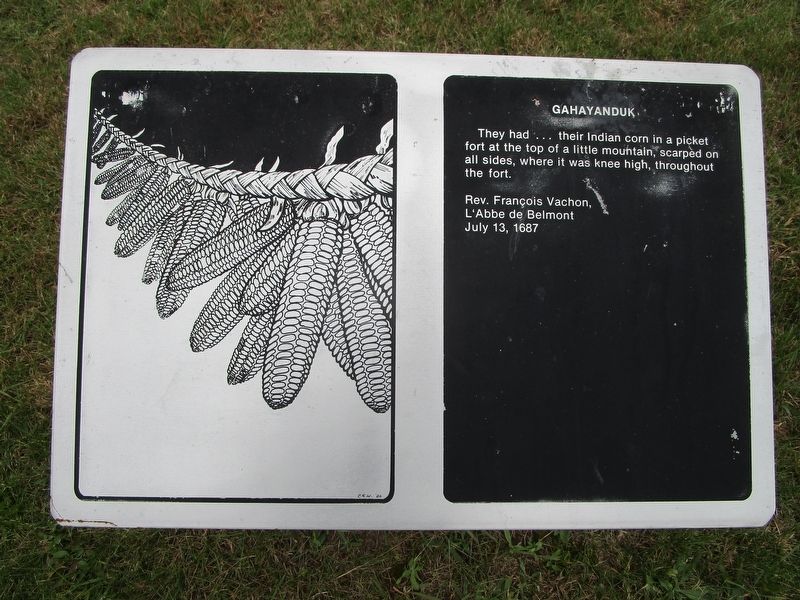
They had...their Indian corn in a picket fort at the top of a little mountain, scarped on all sides, where it was kness high, throughout the fort.
Rev. Francois Vachon,
L'Abbe de Belmont
July 13, 1687
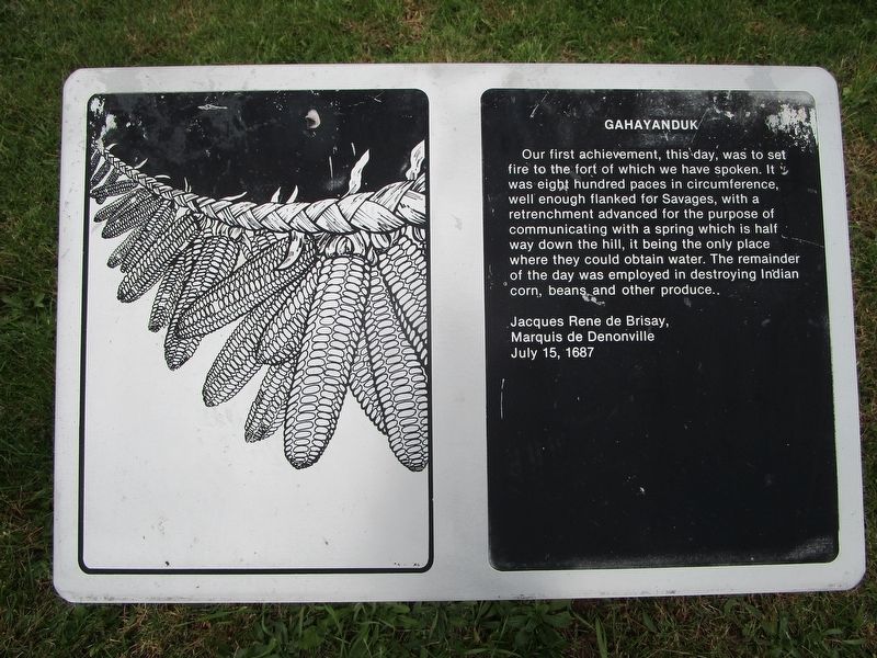
Our first achievement, this day, was to set fire to the fort of which we have spoken. It was eight hundred paces in circumference, well enough flanked for Savages, with a retrenchment advanced for the purpose of communicating with a spring which is half way down the hill, it being the only place where they could obtin water. The remainder of the day was employed in destroying Indian corn, beans, and other produce.
Jacques Rene de Brisay
Marquis de Denonville
July 15, 1687
Topics. This historical marker is listed in these topic lists: Forts and Castles • Indigenous Peoples and Communities. A significant historical year for this entry is 1848.
Location. 42° 57.853′ N, 77° 26.019′ W. Marker is in Victor, New York, in Ontario County. It can be reached from the intersection of Boughton Hill Road (County Route 41) and Murray Lane.
Photographed by Anton Schwarzmueller, October 26, 2018
3. Gahayanduk Marker

Regionally, this marker is in Upstate New York, specifically in Western New York, in the Finger Lakes, and in the Rochester Metropolitan Area. It is also in the American Northeast and in the Mid-Atlantic. Globally, it is in North America, the Western Hemisphere, the Western World, and the Anglosphere. Historically, it finds itself in what was once the Haudenosaunee (Iroquois) Confederacy, New Netherland, and one of the original Thirteen Colonies.
Other nearby markers. At least 8 other markers are within walking distance of this marker: The War on Corn (within shouting distance of this marker); Gannondata (about 400 feet away, measured in a direct line); Nundawahonoga (about 400 feet away); Onondowahgah (about 500 feet away); Totiakton (about 500 feet away); Gannongarae (about 500 feet away); Gannagaro
Photographed by Anton Schwarzmueller, 16
4. Gahayanduk Marker
The other three markers in this series are along the mowed path that cuts across the hilltop. From the three in the wood, this is the first on the grassy path across the hilltop.
Also see . . . Ganondagan State Historic Site. New York State Parks, Recreation and Historic Preservation website entry (Submitted on July 15, 2023, by Larry Gertner of New York, New York.)
Photographed by Anton Schwarzmueller, October 26, 2018
5. Gahayanduk Marker
Photographed by Anton Schwarzmueller, October 26, 2018
6. Gahayanduk Marker
![Farthest Gahayanduk Marker [1] image. Click for full size.](Photos4/451/Photo451719.jpg?1029201835400PM "Farthest Gahayanduk Marker [1]. Click for full size.")
Photographed by Anton Schwarzmueller, October 26, 2018
7. Farthest Gahayanduk Marker [1]
In the distance.
![Gahayanduk Markers [3,2] image. Click for full size.](Photos4/451/Photo451720.jpg?1029201835400PM "Gahayanduk Markers [3,2]. Click for full size.")
Photographed by Anton Schwarzmueller, October 26, 2018
8. Gahayanduk Markers [3,2]
Note the cleared hilltop in the background.
![Gahayanduk Markers [4] Across Hilltop image. Click for full size.](Photos4/451/Photo451721.jpg?1029201835600PM "Gahayanduk Markers [4] Across Hilltop. Click for full size.")
Photographed by Anton Schwarzmueller, October 26, 2018
9. Gahayanduk Markers [4] Across Hilltop
Coming from the three markers in the wood, straight ahead and across the hilltop are the next three markers. The perimeter is mowed left and right. There are no markers to the right. I set the GPS on this page to this marker.
![Gahayanduk Markers [5,6] image. Click for full size.](Photos4/451/Photo451724.jpg?10302018101300AM "Gahayanduk Markers [5,6]. Click for full size.")
Photographed by Anton Schwarzmueller, October 26, 2018
10. Gahayanduk Markers [5,6]
After these markers, there is a series of three "The War on Corn" markers on this path. The service road that ascends the hill is at the end.
Credits. This page was last revised on July 15, 2023. It was originally submitted on October 29, 2018, by Anton Schwarzmueller of Wilson, New York. This page has been viewed 315 times since then and 15 times this year. Photos: 1, 2, 3, 4, 5, 6, 7, 8, 9, 10. submitted on October 29, 2018, by Anton Schwarzmueller of Wilson, New York.
