Grand Ledge in Eaton County, Michigan — The American Midwest (Great Lakes)
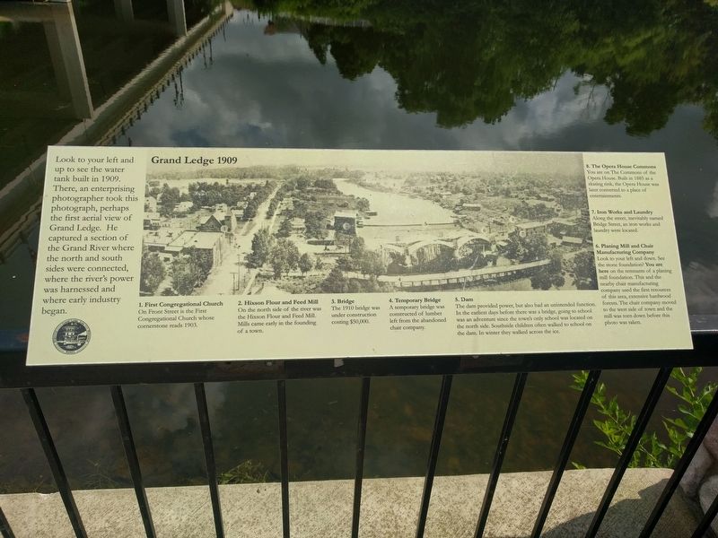
Grand Ledge 1909
Photographed by Joel Seewald, August 7, 2018
1. Grand Ledge 1909 Marker
Look to your left and up to see the water tank built in 1909. There, an enterprising photographer took this photograph, perhaps the first aerial view of Grand Ledge. He captured a section of the Grand River where the north and south sides were connected, where the river's power was harnessed and where early industry began.
Erected by Grand Ledge Area Historical Society.
Topics. This historical marker is listed in these topic lists: Industry & Commerce • Waterways & Vessels. A significant historical year for this entry is 1909.
Location. 42° 45.257′ N, 84° 44.644′ W. Marker is in Grand Ledge, Michigan, in Eaton County. It can be reached from East River Street east of South Bridge Street, on the right when traveling north. Marker is along the Riverwalk in The Commons of the Opera House. Touch for map. Marker is at or near this postal address: 121 South Bridge Street, Grand Ledge MI 48837, United States of America. Touch for directions.

Regionally, this marker is in Mid-Michigan and in Greater Lansing. It is also in the American Midwest. Globally, it is in North America, the Western Hemisphere, the Western
this page online
Other nearby markers. At least 8 other markers are within walking distance of this marker: Blake's Opera House (within shouting distance of this marker); Shane Jewelry Company (about 400 feet away, measured in a direct line); Preston's Grocery - Preston's Bar (about 500 feet away); Historic Island Rollercoaster (about 600 feet away); Second Island (about 700 feet away); "Growing Progress" (approx. 0.2 miles away); Governor Frank D. Fitzgerald Home (approx. 0.2 miles away); Grand Ledge Chair Company (approx. 0.6 miles away). Touch for a list and map of all markers in Grand Ledge.
Photographed by Joel Seewald, August 7, 2018
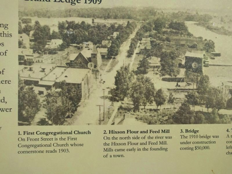
2. Left Half of Image
1. First Congregational Church
On Front Street is the First Congregational Church whose cornerstone reads 1903.
2. Hixson Flour and Feed Mill
On the north side of the river was the Hixson Flour and Feed Mill. Mills came early in the founding of a town.
3. Bridge
The 1910 bridge was under construction costing $50,000.
On Front Street is the First Congregational Church whose cornerstone reads 1903.
2. Hixson Flour and Feed Mill
On the north side of the river was the Hixson Flour and Feed Mill. Mills came early in the founding of a town.
3. Bridge
The 1910 bridge was under construction costing $50,000.
Photographed by Joel Seewald, August 7, 2018
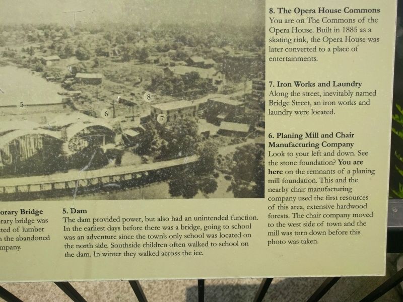
3. Right Half of Image
4. Temporary Bridge
A temporary bridge was constructed of lumber left from the abandoned chair company.
5. Dam
The dam provided power, but also had an unintended function. In the earliest days before there was a bridge, going to school was an adventure since the town's only school was located on the north side. Southside children often walked to school on the dam. In winter they walked across the ice.
6. Planing Mill and Chair Manufacturing Company
Look to your left and down. See the stone foundation? You are here on the remnants of a planing mill foundation. This and the nearby chair manufacturing company used the first resources of this area, extensive hardwood forests. The chair company moved to the west side of town and the mill was torn down before this photo was taken.
7. Iron Works and Laundry
Along the street, inevitably named Bridge Street, an iron works and laundry were located.
8. The Opera House Commons
You are on The Commons of the Opera House. Built in 1885 as a skating rink, the Opera House was later converted to a place of entertainments.
A temporary bridge was constructed of lumber left from the abandoned chair company.
5. Dam
The dam provided power, but also had an unintended function. In the earliest days before there was a bridge, going to school was an adventure since the town's only school was located on the north side. Southside children often walked to school on the dam. In winter they walked across the ice.
6. Planing Mill and Chair Manufacturing Company
Look to your left and down. See the stone foundation? You are here on the remnants of a planing mill foundation. This and the nearby chair manufacturing company used the first resources of this area, extensive hardwood forests. The chair company moved to the west side of town and the mill was torn down before this photo was taken.
7. Iron Works and Laundry
Along the street, inevitably named Bridge Street, an iron works and laundry were located.
8. The Opera House Commons
You are on The Commons of the Opera House. Built in 1885 as a skating rink, the Opera House was later converted to a place of entertainments.
Photographed by Joel Seewald, August 7, 2018
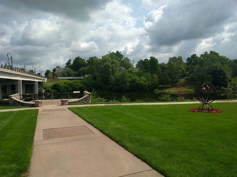
4. Grand Ledge 1909 Marker
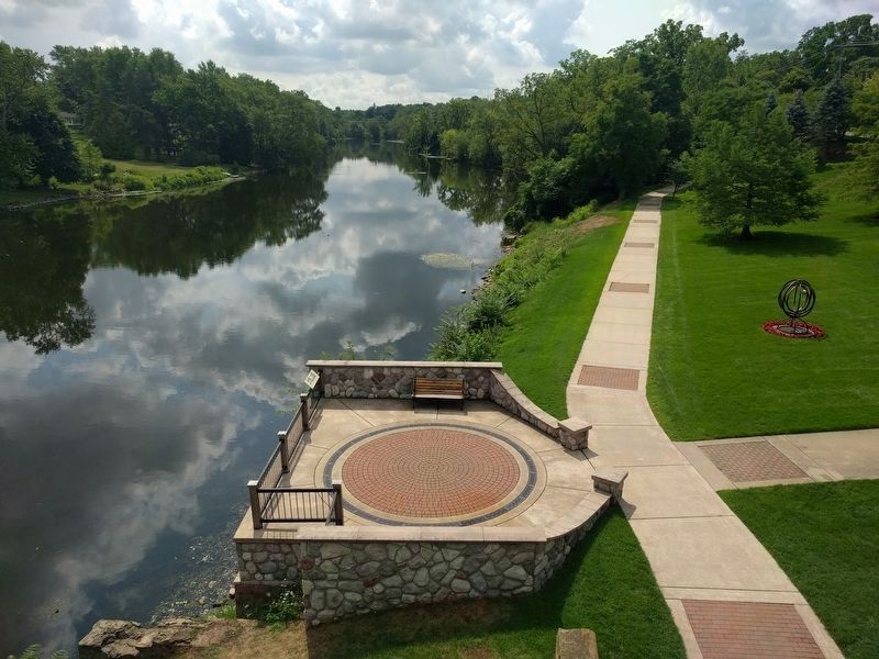
View from the southwest.
Photographed by Joel Seewald, August 7, 2018
5. Grand Ledge 1909 Marker
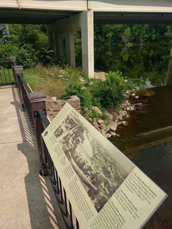
View from the northwest — from the bridge.
Photographed by Joel Seewald, August 7, 2018
6. Grand Ledge 1909 Marker
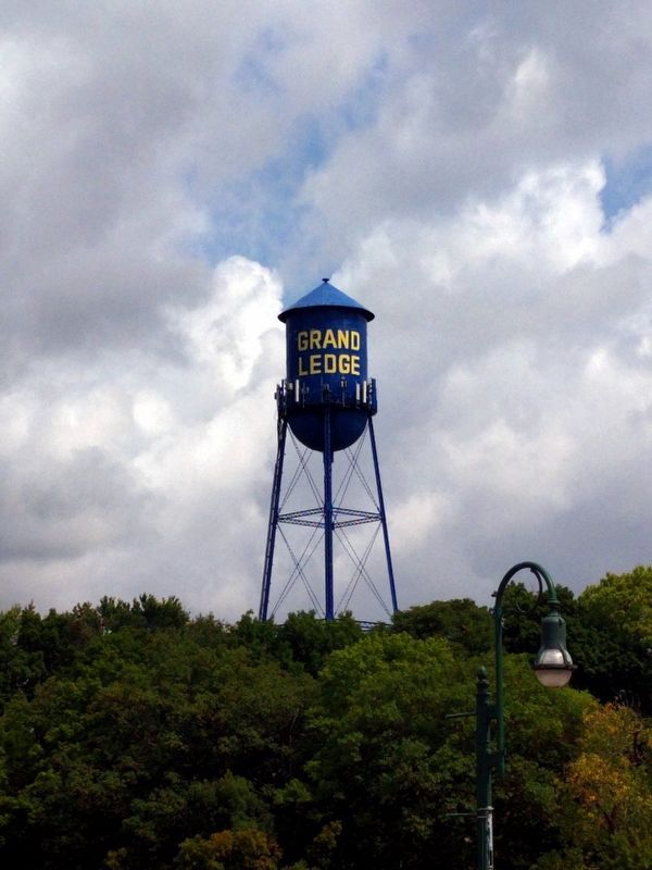
Image includes the stone foundation remnants of a planing mill foundation mentioned on the marker.
Photographed by Joel Seewald, August 7, 2018
7. Water Tower
The water tower is about 0.14 miles due north of the marker.
Credits. This page was last revised on December 7, 2020. It was originally submitted on October 30, 2018, by Joel Seewald of Madison Heights, Michigan. This page has been viewed 700 times since then and 47 times this year. Photos: 1, 2, 3, 4, 5, 6, 7. submitted on October 30, 2018, by Joel Seewald of Madison Heights, Michigan.
