
La croix et le coq du clocher
Haltes à travers le temps
⎯⎯⎯
The Steeple Cross and Rooster Vane
Steps in History
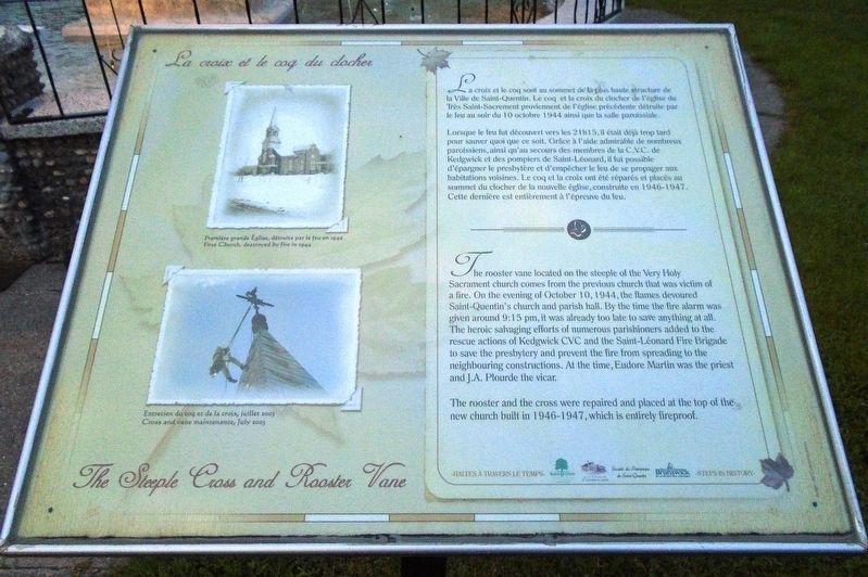

La croix et le coq sont au sommet de la plus haute structure de la Ville de Saint-Quentin. Le coq et la croix du clocher de l'église du Très Saint-Sacrement proviennent de l'église précédente détruite par le feu au soir du 10 octobre 1944 ainsi que la salle paroissiale.
Lorsque le fue fut découvert vers les 21h15, il était déjà trop tard pour sauver quoi que ce soit. Grâce à l'aide admirable de nombreux paroissiens, ainsi qu'au secours des membres de la C.V.C. de Kedgwick et des pompiers de Saint-Léonard, il fut possible d'épargner le presbytère et d'empêcher le feu de se propager aux habitations voisines. Le coq et la croix ont été réparés et placés au sommet du clocher de la nouvelle église, construite en 1946-1947. Cette dernière est entièrement à l'épreuve du feu.
[Légendes photo, de haut en bas, lisez]
• Première grande Église, détruite par le feu en 1944
• Entretien du coq et de la croix, juillet 2003
this page online
The rooster and the cross were repaired and placed at the top of the new church built in 1946-1947, which is entirely fireproof.
[Photo captions, from top to bottom, read]
• First Church, destroyed by fire in 1944
• Cross and vane maintenance, July 2003
Erected by Société du Patrimoine de Saint-Quentin, Ville de Saint-Quentin, and Others.
Topics. This historical marker is listed in these topic lists: Disasters • Man-Made Features • Religion & Religious Structures. A significant historical year for this entry is 1944.
Location. 47° 30.652′ N, 67° 23.519′ W.
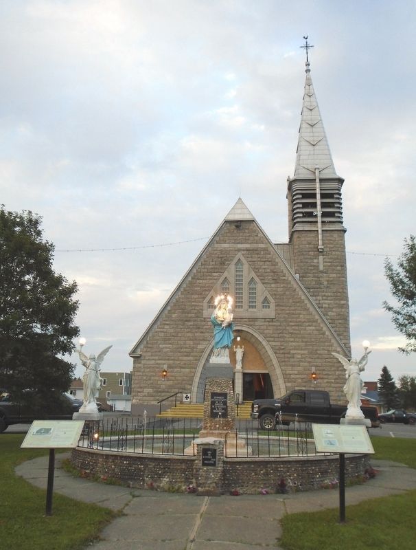

Regionally, this marker is in New Brunswick’s Upper Saint John River Valley. It is also in the Maritimes and in Atlantic Canada. Globally, it is in the North Atlantic Region, North America, the Western Hemisphere, the Western World, and the Anglosphere. Historically, it finds itself in what was once a British colony, the Viceroyalty of New France, and Acadia.
Other nearby markers. At least 5 other markers are within 16 kilometers of this marker, measured as the crow flies: Le monument aux fondateurs / The Founders Monument (here, next to this marker); Saint-Quentin Hommage militaire / Military Tribute (within shouting distance of this marker); Veterans Memorial (within shouting distance of this marker); M114 155mm Howitzer (approx. 15.2 kilometers away); a different marker also named Veterans Memorial (approx. 15.3 kilometers away).
Also see . . .
1. Paroisse Très Saint-Sacrement de Saint-Quentin. (Submitted on October 30, 2018, by William Fischer, Jr. of Reynoldsburg, Ohio.)
2. Paroisse Très Saint-Sacrement de Saint-Quentin on Facebook. (Submitted on October 30, 2018, by William Fischer, Jr. of Reynoldsburg, Ohio.)
Credits. This page was last revised on October 30, 2018. It was originally submitted on October 30, 2018, by William Fischer, Jr. of Reynoldsburg, Ohio. This page has been viewed 271 times since then and 17 times this year. Photos: 1, 2. submitted on October 30, 2018, by William Fischer, Jr. of Reynoldsburg, Ohio.
