
Falls Church, Virginia — The American South (Mid-Atlantic)
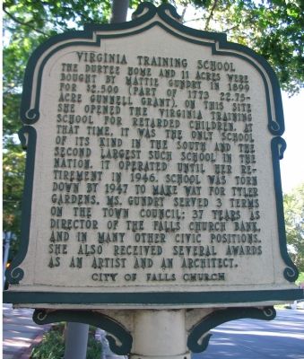
Virginia Training School
Photographed by Craig Swain, September 12, 2007
1. Front Side of Marker
Erected by City of Falls Church.
Topics and series. This historical marker is listed in these topic lists: Education • Women. In addition, it is included in the Virginia, City of Falls Church series list. A significant historical year for this entry is 1899.
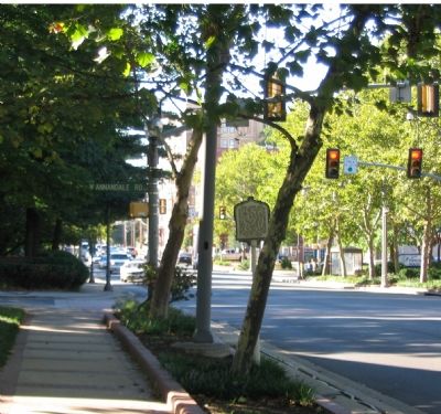
Location. 38° 53.075′ N, 77° 10.493′ W. Marker is in Falls Church, Virginia. It is at the intersection of West Broad Street (State Highway 7) and West Annandale Road, on the right when traveling east on West Broad Street. Touch for map. Marker is in
this page online

Regionally, this marker is in the Washington Metropolitan Area and in Northern Virginia. It is also in the American South, specifically in the Upper South, and in the Mid-Atlantic. Globally, it is in North America, the Western Hemisphere, the Western World, and the Anglosphere. Historically, it finds itself in what was once the territory of the Mississippian Culture, one of the original Thirteen Colonies, one of the Confederate States of America, and the Antebellum South.
Other nearby markers. At least 8 other markers are within walking distance of this marker: Cherry Hill (about 500 feet away); Falls Church Home Front (about 600 feet away); Big Chimneys (about 600 feet away); The Story of Big Chimneys (about 700 feet away); George Mason (about 800 feet away); Veterans Memorial (approx. 0.2 miles away); Living in Fear (approx. 0.2 miles away); Iraq War Memorial (approx. 0.2 miles away). Touch for a list and map of all markers in Falls Church.
Other markers no longer nearby. Hangman's Tree (was about 300 feet away, measured
Photographed by Craig Swain, September 12, 2007
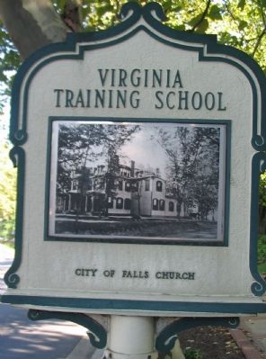
2. Back Side of Marker
More about this marker. On the back side, the marker displays a photograph of the school.
Photographed by Craig Swain, September 12, 2007
3. Marker at the Intersection of Broad and Annandale Streets
Credits. This page was last revised on November 6, 2018. It was originally submitted on October 9, 2007, by Craig Swain of Leesburg, Virginia. This page has been viewed 2,043 times since then and 36 times this year. Last updated on November 4, 2018, by Devry Becker Jones of Washington, District of Columbia. Photos: 1, 2, 3. submitted on October 9, 2007, by Craig Swain of Leesburg, Virginia. • Bill Pfingsten was the editor who published this page.
