Plaka in Kentrikos Tomeas Athinon, Attica, Greece — Ελλάδα (Southeastern Europe, Balkan Peninsula)
The Ancient Street of the Tripods - The Lysikrates Choregic Monument
Photographed by Barry Swackhamer, July 20, 2018
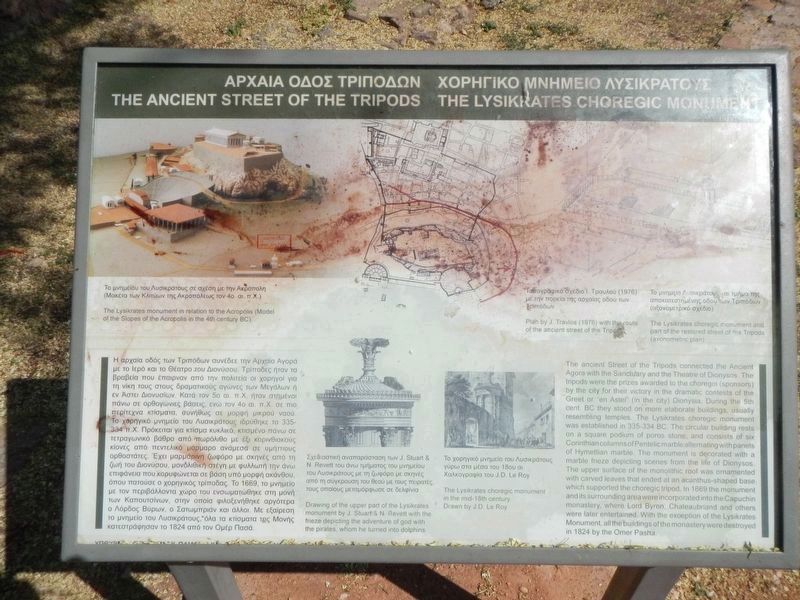
1. The Ancient Street of the Tripods - The Lysikrates Choregic Monument marker
Captions: (upper left) The Lysikrates monument in relation to the Acropolis (Model of the Slopes of the Acropolis in the 4th century BC); (upper center) Plan by J. Travlos (1974) with the route of the ancient street of the Tripods; (upper right) The Lysikrates choregic monument and part of the restored street of the Tripods (axonometric plan); (bottom center, l and r) Drawing of the upper part of the Lysikrates monument by J. Stuart & N. Revett with frieze depicting the adventure of god with the pirates, whom he turned into dolphins; The Lysikrarte choregic monument in the mid-18th century. Drawing by J.D. Le Roy.
(Text in Greek on the left side. To read it enlarge the marker image)
English:
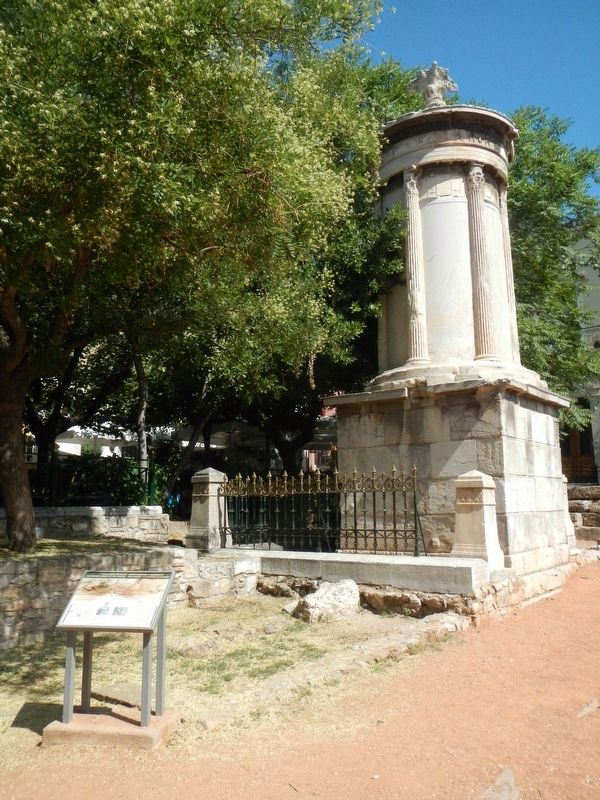
The ancient Street of the Tripods connected the Ancient Agora with the Sanctuary and the Theatre of Dionysos. The tripods were the prizes awarded to the choregoi (sponsors) by the city for their victory in the dramatic contests of the Greet or "en Astei" (in the city) Dionysia. During the 5th cent. BC they stood on more elaborate buildings, usually resembling temples. The Lysicrates choregic monument was established in 335-334 BC. The circular building rests on a square podium of portos stone, and consist of six Corinthian columns of Pentelic marble alternating with panels of Hymettian marble. The monument is decorated with a marble frieze depicting scenes from the life of Dionysos. The upper surface of the monolithic roof was ornamented with carved leaves that ended
this page online
Topics. This historical marker and monument is listed in these topic lists: Landmarks • Man-Made Features.
Location. 37° 58.254′ N, 23° 43.8′ E. Marker is in Plaka, Attica, in Kentrikos Tomeas Athinon. It is on Vyronos close to Lisikratous, on the right when traveling south. Touch for map. Marker is at or near this postal address: Vyronos 6, Plaka, Attica 105 58, Greece. Touch for directions.

Regionally, it is in Europe, the European Union, the Balkans, the Schengen Area, a coastal Mediterranean country, and the Western World. Historically, it finds itself in what was once the Byzantine Empire, the Ottoman Empire, and specifically the Roman Empire.
Other nearby markers. At least 8 other markers are within walking distance of this marker: Μνημείο Λυσικράτη
Photographed by Barry Swackhamer, July 20, 2018
2. The Ancient Street of the Tripods - The Lysikrates Choregic Monument and marker
Credits. This page was last revised on March 21, 2022. It was originally submitted on November 10, 2018, by Barry Swackhamer of Brentwood, California. This page has been viewed 1,262 times since then and 102 times this year. Photos: 1, 2. submitted on November 10, 2018, by Barry Swackhamer of Brentwood, California.
