Tynemouth in Tyne and Wear, England, United Kingdom — Northwestern Europe (the British Isles)
Site of Tynemouth Lighthouse
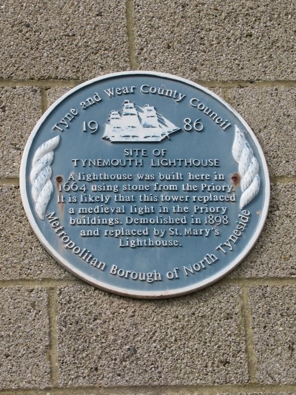
Photographed by Michael Herrick, August 19, 2018
1. Site of Tynemouth Lighthouse Marker
1986
Site of Tynemouth Lighthouse
Topics and series. This historical marker is listed in this topic list: Waterways & Vessels. In addition, it is included in the Lighthouses series list. A significant historical year for this entry is 1986.
Location. 55° 1.076′ N, 1° 25.014′ W. Marker is in Tynemouth, England, in Tyne and Wear. It can be reached from the intersection of Front Street and Pier Road, on the right when traveling east. Located at Tynemouth Priory and Castle. Touch for map. Marker is in this post office area: Tynemouth, England NE30 4BZ, United Kingdom. Touch for directions.

Regionally, this marker is in North East England. Globally, it is on the Atlantic Ocean, in the North Atlantic Region, in Europe, in Atlantic Europe, on one of the British Isles, in the Western World, and in the Anglosphere. Historically, it finds itself
this page online
Other nearby markers. At least 8 other markers are within walking distance of this marker: 1859 Gun (within shouting distance of this marker); The Shrine Area (within shouting distance of this marker); 6 Inch Gun (within shouting distance of this marker); The Cloister (within shouting distance of this marker); Lost Buildings (within shouting distance of this marker); The Priory Church (about 90 meters away, measured in a direct line); Stone Detectives (about 90 meters away); The Gatehouse (about 120 meters away). Touch for a list and map of all markers in Tynemouth.
Also see . . .
1. English Heritage - Tynemouth Priory and Castle. (Submitted on November 11, 2018, by Michael Herrick of Southbury, Connecticut.)
2. Tynemouth Priory and Castle on Wikipedia. (Submitted on November 11, 2018, by Michael Herrick of Southbury, Connecticut.)
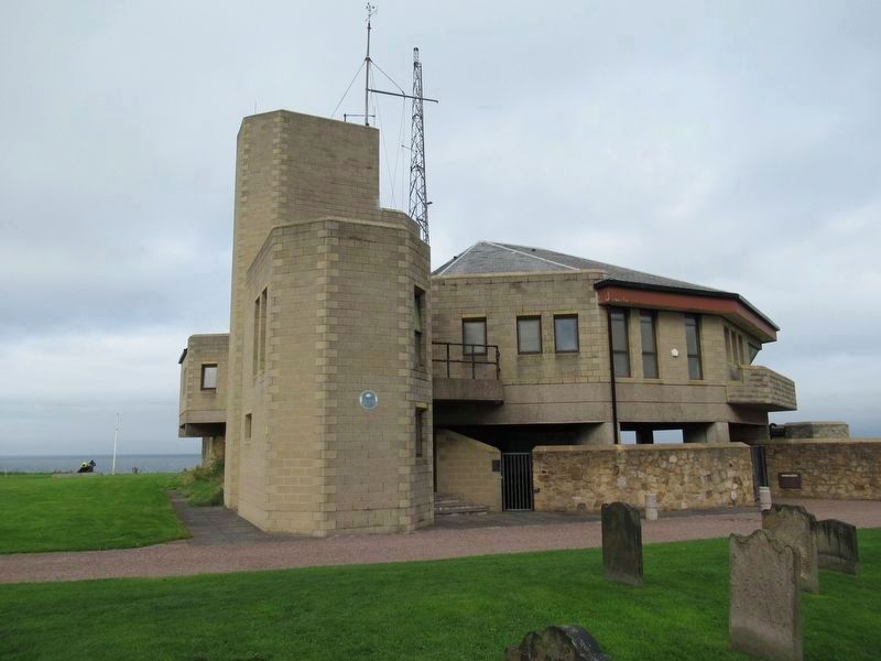
Photographed by Michael Herrick, August 19, 2018
2. Site of Tynemouth Lighthouse Marker
This building was a coastguard station, built in 1980, closed in 2001.
Credits. This page was last revised on January 27, 2022. It was originally submitted on November 11, 2018, by Michael Herrick of Southbury, Connecticut. This page has been viewed 464 times since then and 22 times this year. Photos: 1, 2. submitted on November 11, 2018, by Michael Herrick of Southbury, Connecticut.
