
Put-in-Bay in Ottawa County, Ohio — The American Midwest (Great Lakes)
Amareta Mosher Anchor
Photographed by Cosmos Mariner, August 23, 2013
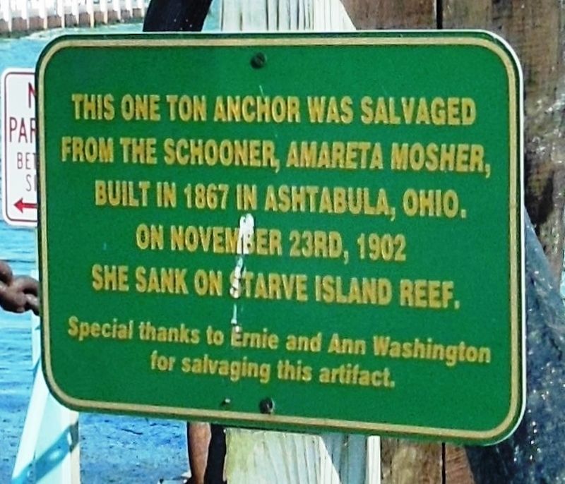
1. Amareta Mosher Anchor Marker
from the schooner Amareta Mosher,
built in 1867 in Ashtabula, Ohio.
On November 23rd, 1902
she sank on Starve Island Reef.
Special thanks to Ernie and Ann Washington
for salvaging this artifact.
Topics. This historical marker is listed in these topic lists: Disasters • Waterways & Vessels. A significant historical date for this entry is November 23, 1902.
Location. 41° 39.248′ N, 82° 48.953′ W. Marker is in Put-in-Bay, Ohio, in Ottawa County. It is at the intersection of Bayview Avenue (Ohio Route 357) and East Bayview Drive, on the left when traveling east on Bayview Avenue. Marker and subject anchor are located beside the Put-in-Bay boat ramp and dock. Touch for map. Marker is at or near this postal address: 207 Hartford Avenue, Put in Bay OH 43456, United States of America. Touch for directions.

Regionally, this marker is on the Lake Erie Shore and in the Toledo Metropolitan Area. It is also in the American Midwest and in the Corn Belt. Globally, it is in North America, on the Great Lakes, in the Western Hemisphere, in the Western World, and in the Anglosphere. Historically,
this page online
Other nearby markers. At least 8 other markers are within walking distance of this marker: First Ship-To-Shore Radio Broadcast (here, next to this marker); “The Light of Elizabeth’s Office” (here, next to this marker); This Life Boat (here, next to this marker); Joseph De Rivera St. Jurgo, 1813-1889 (about 400 feet away, measured in a direct line); Perry’s Longboat (about 600 feet away); Monumental Heights (about 600 feet away); Oelschlager's Dry Goods Store (about 800 feet away); Joseph (Jose) DeRivera St. Jurgo (approx. 0.2 miles away). Touch for a list and map of all markers in Put-in-Bay.
Also see . . . The Wreck Today. The Mosher lies badly broken and scattered on rock bottom. The stern is at a depth of about 15 feet with the bow remains sloping down to about 22 feet. Our attempts to locate this one have been thwarted because of poor (zero) visibility and the uneven rocky bottom. Old time divers have visited the area so we know that this
Photographed by Cosmos Mariner, August 23, 2013
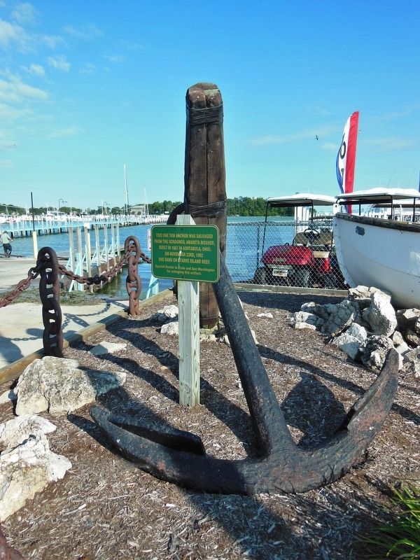
2. Amareta Mosher Anchor Marker (tall view)
Additional keywords. Amareta Mosher Anchor
Credits. This page was last revised on November 14, 2018. It was originally submitted on November 12, 2018, by Cosmos Mariner of Cape Canaveral, Florida. This page has been viewed 460 times since then and 17 times this year. Photos: 1, 2. submitted on November 12, 2018, by Cosmos Mariner of Cape Canaveral, Florida. • Bill Pfingsten was the editor who published this page.
