Cumberland Township near Gettysburg in Adams County, Pennsylvania — The American Northeast (Mid-Atlantic)
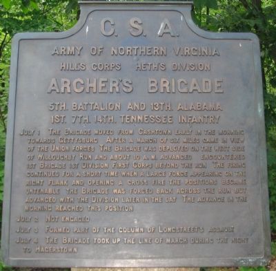
Archer's Brigade
Heth's Division - Hill's Corps
— Army of Northern Virginia —
Army of Northern Virginia
Hill's Corps Heth's Division
Archer's Brigade
5th. Battalion and 13th. Alabama
1st. 7th. 14th. Tennessee Infantry
July 1 The Brigade moved from Cashtown early in the morning toward Gettysburg. After a march of six miles came in view of Willoughby Run and about 10 a.m. advanced. Encountered 1st Brigade 1st Division First Corps beyond the run. The firing continued for a short time when a large force appearing on the right flank and opening a cross fire the positions became untenable the Brigade was forced back across the run but advanced with the Division later in the day. The advance in the morning reached this position.
July 2 Not engaged.
July 3 Formed part of the column of Longstreet's assault.
July 4 The Brigade took up the line of march during the night to Hagerstown.
Erected 1910 by Gettysburg National Military Park Commission.
Topics. This historical marker is listed in this topic list: War, US Civil. A significant historical month for this entry is July 1895.
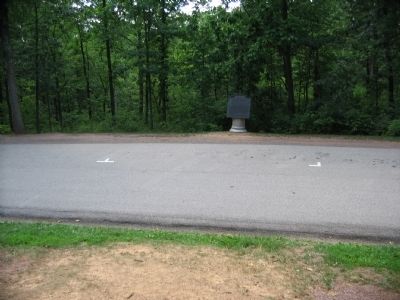
Location. 39° 50.093′ N, 77° 15.279′ W. Marker is near Gettysburg, Pennsylvania, in Adams County. It is in Cumberland Township. Marker is on Meredith Avenue, on the right when traveling south. Located in the Herbst Farm Woods (also called McPherson's or Reynolds' Woods) in Gettysburg National Military Park. Touch for map. Marker is in this post office area: Gettysburg PA 17325, United States of America. Touch for directions.
Other nearby markers. At least 8 other markers are within walking distance of this marker. Twenty-Sixth North Carolina Regiment (a few steps from this marker); 24th Michigan Infantry Regiment (a few steps from this marker); First Brigade (within shouting distance of this marker); 19th Indiana Infantry Regiment (about 300 feet away, measured in a direct line); 2nd Wisconsin Volunteer Infantry (about 300 feet away); 7th Wisconsin Infantry Regiment (about 400 feet away); 14th (Brooklyn) Infantry N.Y.S.M. (about 600 feet away); John Burns (about 700 feet away). Touch for a list and map of all markers in Gettysburg.
Also see . . . Report of Archer's Brigade at Gettysburg. Wikisource entry:
Col. S. G. Shepard of the Seventh Tennessee Infantry wrote the official report of the Brigade:
We had encountered the enemy but a short time, when the made his appearance suddenly upon our right flank with a heavy force, and opened upon us a cross-fire. Our position was at once rendered untenable, and the right of our line was forced back. He made also a demonstration upon our left, and our lines commenced falling back, but owing to the obstructions in our rear..., some 75 of the brigade were unable to make their escape, General Archer among the rest. I saw General Archer a short time before he surrendered, and he appeared to be very much exhausted with fatigue. (Submitted on October 18, 2008, by Craig Swain of Leesburg, Virginia.)
Photographed By Craig Swain, August 16, 2008
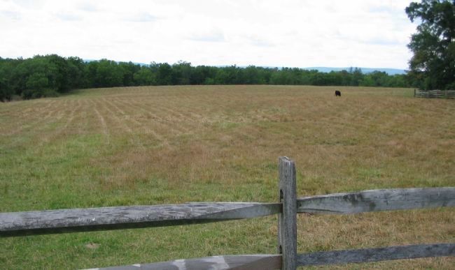
3. Archer's Brigade Moves Forward
In the opening phases of the battle, Archer's Brigade deployed off the Chambersburg Pike to confront the cavalry of Buford's Federal Division. This view looks west from Stone Avenue across the open fields south of the Chambersburg Pike. Initially, the 7th Tennessee Infantry advanced across the ground here. Archer's Brigade was forced back beyond Willoughby Run by the arrival of Cutler's and Meredith's (Iron) Brigades. The run passes through the distant tree line.
Photographed By Craig Swain, November 1, 2008
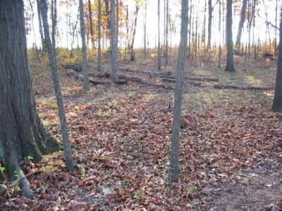
4. McPherson Woods
Also known as Herbst Woods at the time of the battle, the woods became a heavily contested location during the morning of July 1. In this view, looking east from inside the woods, one can see the gradual slope down hill toward Willoughby Run. The 14th Tennessee ran into the 2nd Wisconsin of the Federal Iron Brigade in these woods. It is likely an overshot from the 14th Tennessee was the bullet that killed General Reynolds as he urged the Iron Brigade forward.
Photographed By Craig Swain, November 1, 2008
5. General Archer Captured
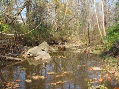
Looking upstream (north) along Willoughby Run. General Archer was captured by Federals from the 2nd Wisconsin as the Brigade fell back out of the woods and over the run. Caught on three sides by the rapid advance of the Federals, along with 75 other Confederates, Archer was captured about 30 yards west of this location.
Credits. This page was last revised on February 7, 2023. It was originally submitted on October 18, 2008, by Craig Swain of Leesburg, Virginia. This page has been viewed 1,986 times since then and 92 times this year. Photos: 1, 2, 3. submitted on October 18, 2008, by Craig Swain of Leesburg, Virginia. 4, 5. submitted on January 11, 2009, by Craig Swain of Leesburg, Virginia.
