Fort Oglethorpe in Catoosa County, Georgia — The American South (South Atlantic)
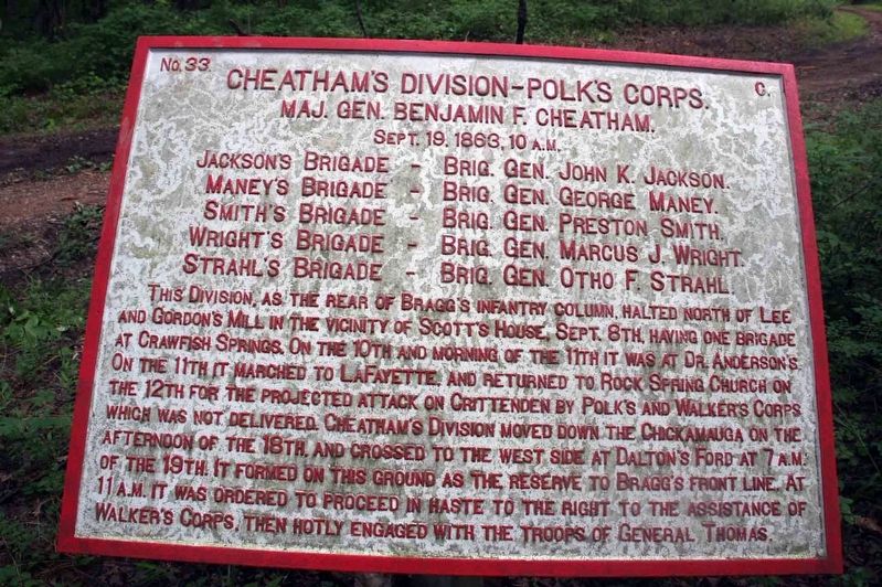
Cheatham’s Division – Polk’s Corps
Photographed by Byron Hooks, June 24, 2011
1. Cheatham’s Division – Polk’s Corps Marker
Maj. Gen. Benjamin F. Cheatham.
Sept. 19th, 1863, 10 A.M.
Jackson’s Brigade, - Brig. Gen. John K. Jackson.
Maney’s Brigade, - Brig. Gen. George Maney.
Smith’s Brigade, - Brig. Gen. Preston Smith.
Wright’s Brigade, - Brig. Gen. Marcus J. Wright.
Strahl’s Brigade, - Brig. Gen. Otho F. Strahl.
Erected 1890
this page online
Topics. This historical marker is listed in these topic lists: Parks & Recreational Areas • War, US Civil. A significant historical date for this entry is September 19, 1863.
Location. 34° 53.881′ N, 85° 14.803′ W. Marker is in Fort Oglethorpe, Georgia, in Catoosa County. It can be reached from Viniard Road half a mile east of LaFayette Road when traveling east. Parking is available in a gravel lot on the south side of Viniard Road (N 34 54.091 W 85 15.105). From the parking area on Viniard Road follow the un-paved park road (no vehicular traffic allowed) that starts at the parking area, south to the marker. A secondary path will fork off the right (east) before you reach this marker. Stay on the main trail, the secondary path will lead to a group of 5 other markers. Touch for map. Marker is in this post office area: Fort Oglethorpe GA 30742, United States of America. Touch for directions.

Regionally, this marker is in the Mountains. It is also in the American South and specifically in the Deep South. Globally, it is in North America, the Western Hemisphere, the Western World, and the Anglosphere.
Photographed by Byron Hooks, June 24, 2011
2. Cheatham’s Division – Polk’s Corps Marker
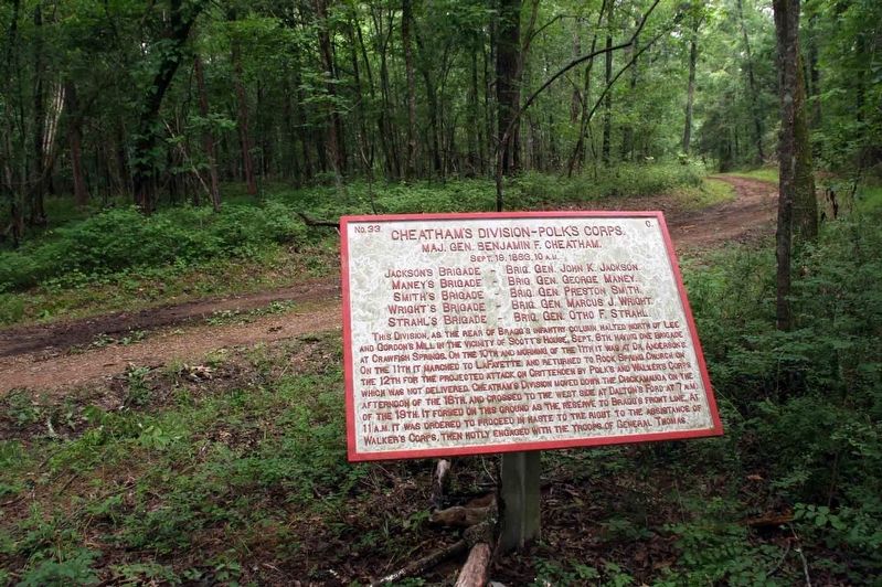
Note road / path in the background.
Other nearby markers. At least 8 other markers are within walking distance of this marker: 18th Indiana Battery (approx. ¼ mile away); Preston's Division (approx. ¼ mile away); a different marker also named Preston’s Division (approx. ¼ mile away); Kelly’s Brigade (approx. ¼ mile away); Gracie’s Brigade (approx. ¼ mile away); Jeffress’ Virginia Battery (approx. ¼ mile away); 65th Georgia Infantry (approx. ¼ mile away); Stewart's Division (approx. 0.3 miles away). Touch for a list and map of all markers in Fort Oglethorpe.
More about this marker. Approximately 700 metal position and descriptive markers with raised lettering were installed on the Chickamauga Battlefield by the War Department in 1890. This plaque is red indicating it is for a Confederate unit.
In locating this marker I used the "Chickamauga Battlefield" map, that I purchased at the Chickamauga and Chattanooga National Military Park, Visitor Center, to determine both the marker number for this marker and the marker's location in relation to the rest of the park's monuments, markers, and tablets. According to the map it provides the, "numerical listing of all monuments, markers, and tablets on the Chickamauga Battlefield (using the Chick-Chatt NMP Monument Numbering System).”
Also see . . .
1. Death Knell of the Confederacy. Link to the Chickamauga and Chattanooga National Military Park web site. (Submitted on November 23, 2018, by Byron Hooks of Sandy Springs, Georgia.)
2. Battle of Chickamauga. Overview of the Battle of Chickamauga provided by the American Battlefield Trust. (Submitted on November 23, 2018, by Byron Hooks of Sandy Springs, Georgia.)
Credits. This page was last revised on October 18, 2020. It was originally submitted on November 23, 2018, by Byron Hooks of Sandy Springs, Georgia. This page has been viewed 388 times since then and 38 times this year. Last updated on December 3, 2018, by T. Patton of Jefferson, Georgia. Photos: 1, 2. submitted on November 23, 2018, by Byron Hooks of Sandy Springs, Georgia. • Bernard Fisher was the editor who published this page.
