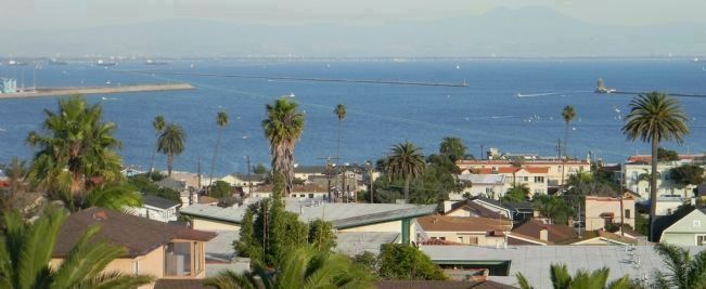
San Pedro in Los Angeles in Los Angeles County, California — The American West (Pacific Coastal)
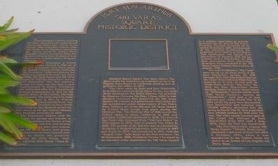
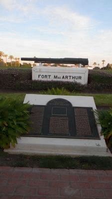
Fort MacArthur / 500 Varas Square Historic District
Port of Los Angeles
Juan Rodriquez Cabrillo, exploring for Spain, discovered Alta California and named San Pedro Bay, “Bahia de los Fumos” (Bay of Smokes), October 1542. The smoke on the Bay shore came from the native Suang-Na Indian Fires. Sebastian Vizcaino named San Pedro Bay in honor of Saint Peter of Alexandria (a 4th Century Christian Martyr of Egypt), November 1632.
Juan Jose Dominguez a retired Spanish soldier, received in 1784 one of the first land grants from Pedro Fages, the Spanish Governor of Alta California. The Dominguez 75,000 acre Rancho San Pedro encompassed the small San Pedro landing, 100 Varas Square and 500 Varas Square of “Old San Pedro Port” here at Fort MacArthur. The Vara measure, though not fixed, was less than a yard (approximately 33 inches). Commerce was authorized after the declaration of Mexican independence in 1822 for the English house of McCulloch, Hartnell and Company. The adobe depot for hides and tallow built in 1823 by William Hartnell of McCulloch and Hartnell was the first known structure on these bluffs overlooking the bay. Hartnell deeded the Hide House to the San Gabriel Mission after financial adversity in 1820.
The Franciscan Fathers used the warehouse for storage and transfer to the missions and Pueblo of Los Angeles until they sold it to Abel Stearns in 1834. At the same time Abel Stearns sold the 100 Varas Square land grant, which he had received from General Jose Figueroa to obtain the property surrounding the Hide House. Abel Stearns called the Hide House “Casa de San Pedro.”
Richard Henry Dana’s Two Years Before The Mast recalls his experience as a seaman on the brig Pilgrim from Boston to California, landing here at primitive San Pedro in 1835.
The claim made by Juan and Jose Sepulveda to the 32,000-acre Rancho de los Palos Verdes, on half of the Dominguez-San Pedro Ranch, was granted by Mexican Governor Pio Pico, 3 June, 1846. In this decision Governor Pico preserved the 500 Varas Square (41.2 acres) as a government reservation for the unrestricted public embarcadero of San Pedro Port. Military use of the 100 and 500 Varas Square by United States troops took place during the Mexican War. The Mexican War of 1846 moved the United States to annex California in 1848 and proclaim California statehood in 1850. The Port of San Pedro was relocated from “Old San Pedro” to Wilmington in 1858, then to present San Pedro in 1888. The growth of the Harbor was accelerated by dredging. A Federal breakwater, authorized in 1897 and begun in 1899, was completed in 1912, with the “Angels Gate” light house at the Port entrance. On 14 September, 1888, President Grover Cleveland in an
executive order established the 500 Varas Square as a military reservation to provide protection for the port of San Pedro. President Theodore Roosevelt set in motion 14 January, 1909, development of the seacoast fortification for the protection of the Harbor at San Pedro. This fortification was named Fort MacArthur 10 January, 1914, for Lt. General Arthur MacArthur, Jr. The first permanent Fort MacArthur structures were completed at the 500 Varas Square Military Reservation, 19 August, 1918.
The coast fortification “Big Guns” were set up on all three levels of the Fort MacArthur terrain. By 1918 through 1945, Fort MacArthur had on the Upper Reservation at Point Fermin batteries of 12 inch, 14 inch and, at White Point, 16 inch, “Big Guns.” By 1926 the Fort MacArthur lower landing, known as Lower Reservation or “Bottomside,” and the middle level (500 Varas Square), known as “Middleside” each had a 14 inch railroad gun. After World War II in 1945 all the big guns were dismantled. Fort MacArthur had inducted over 750,000 military personnel into the Army in World War II, then separated over 150,000 soldiers by 1946 after the war. The Nike missile became part of the Coast Air Defense at Fort MacArthur from 1954 until 1 July, 1974, when the Fort was deactivated.
The Fort MacArthur original 500 Varas Square “Middle
Reservation” remained a sub-post of Fort Ord until 1 October, 1982, when it was transferred to the United States Air Force as an Annex of Los Angeles Air Force Base.
Erected by U.S. Air Force.
Topics and series. This historical marker is listed in these topic lists: Landmarks • Military • Settlements & Settlers • Waterways & Vessels. In addition, it is included in the Former U.S. Presidents: #22 and #24 Grover Cleveland, and the Former U.S. Presidents: #26 Theodore Roosevelt series lists. A significant historical date for this entry is January 14, 1909.
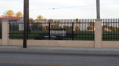
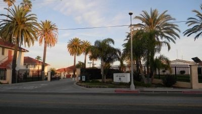
Location. 33° 43.268′ N, 118° 17.266′ W. Marker is in Los Angeles, California, in Los Angeles County. It is in San Pedro. Marker is on South Pacific Avenue south of Meyler Road, on the right when traveling north. Marker is visible from the sidewalk on Pacific Avenue, through the fence, south of Meyler Road and the main entrance to the L.A. Air Force Base reservation. Touch for map. Marker is in this post office area: San Pedro CA 90731, United States of America. Touch for directions.
Other nearby markers. At least 8 other markers are within 2 miles of this marker, measured as the crow flies. Casa de San Pedro (approx. 0.2 miles away); Muller House (approx. 0.7 miles away); Korean Friendship Bell (approx. 0.7 miles away); Stephen M. White (approx. ¾ mile away); Battery Osgood-Farley Historic Site (approx. 0.8 miles away); Cabrillo Beach Bath House (approx. 0.8 miles away); Timms' Point and Landing (approx. 0.9 miles away); San Pedro Landmarks (approx. 1.1 miles away). Touch for a list and map of all markers in Los Angeles.
Credits. This page was last revised on February 7, 2023. It was originally submitted on December 15, 2011, by Richard E. Miller of Oxon Hill, Maryland. This page has been viewed 1,689 times since then and 45 times this year. Last updated on December 6, 2018, by Craig Baker of Sylmar, California. Photos: 1, 2, 3, 4, 5. submitted on December 15, 2011, by Richard E. Miller of Oxon Hill, Maryland. • Andrew Ruppenstein was the editor who published this page.
