Near Northwood in Worth County, Iowa — The American Midwest (Upper Plains)
Jefferson Highway Completion
Photographed by Cosmos Mariner, August 22, 2016
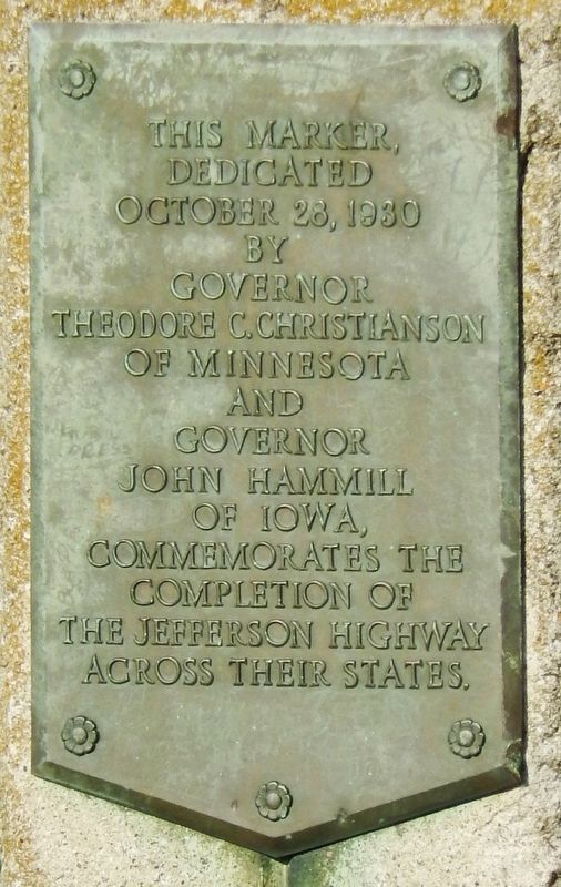
1. Jefferson Highway Completion Marker
dedicated
October 28, 1930
by
Governor
Theodore C. Christianson
of Minnesota
and
Governor
John Hammill
of Iowa,
commemorates the
completion of
the Jefferson Highway
across their states.
Erected 1930.
Topics and series. This historical marker is listed in this topic list: Roads & Vehicles. In addition, it is included in the Jefferson Highway series list. A significant historical date for this entry is October 28, 1930.
Location. 43° 29.973′ N, 93° 14.821′ W. Marker is near Northwood, Iowa, in Worth County. It is at the intersection of Orchid Avenue (U.S. 65) and Freeborn Minnesota County Road 106, on the right when traveling north on Orchid Avenue. This marker is on the east side of Orchid Avenue (U.S. Highway 65), literally at the Iowa/Minnesota state line. Touch for map. Marker is in this post office area: Northwood IA 50459, United States of America. Touch for directions.

Regionally, this marker is in North Iowa. It is also in the American Midwest and in the Corn Belt. Globally, it is in North America, the Western Hemisphere, the Western World, and the Anglosphere. Historically, it finds itself in what was once the territory of the Mississippian Culture and also the Louisiana Purchase.
Other nearby markers. At least 8 other markers are within 4 miles of this marker, measured as the crow flies: South Shell Rock Lutheran (approx. 3.8 miles away); Peoples Gas & Electric Building (approx. 4.1 miles away); Emery Building (approx. 4.1 miles away); Amundson-Grosland Building (approx. 4.1 miles away); Index Building (approx. 4.1 miles away); Worth County Courthouse Cannon (approx. 4.1 miles away); IOOF - Erickson Building (approx. 4.1 miles away); Anchor Building (approx. 4.1 miles away). Touch for a list and map of all markers in Northwood.
Also see . . .
1. Old Jefferson Highway - Iowa State Line to Albert Lea.
this page online
2. Jefferson Highway. The Jefferson Highway was an automobile highway stretching through the central United States from New Orleans, Louisiana, to Winnipeg, Manitoba, Canada. The Jefferson Highway was replaced with the new numbered US Highway system in the late 1920s. It was built in the 1910s as part of the National Auto Trail system. Named for President Thomas Jefferson, inspired by the east–west Lincoln Highway, it was nicknamed the "Palm to Pine Highway", for the varying types of trees found at either end. (Submitted on December 8, 2018, by Cosmos Mariner of Cape Canaveral, Florida.)
Photographed by Cosmos Mariner, August 22, 2016
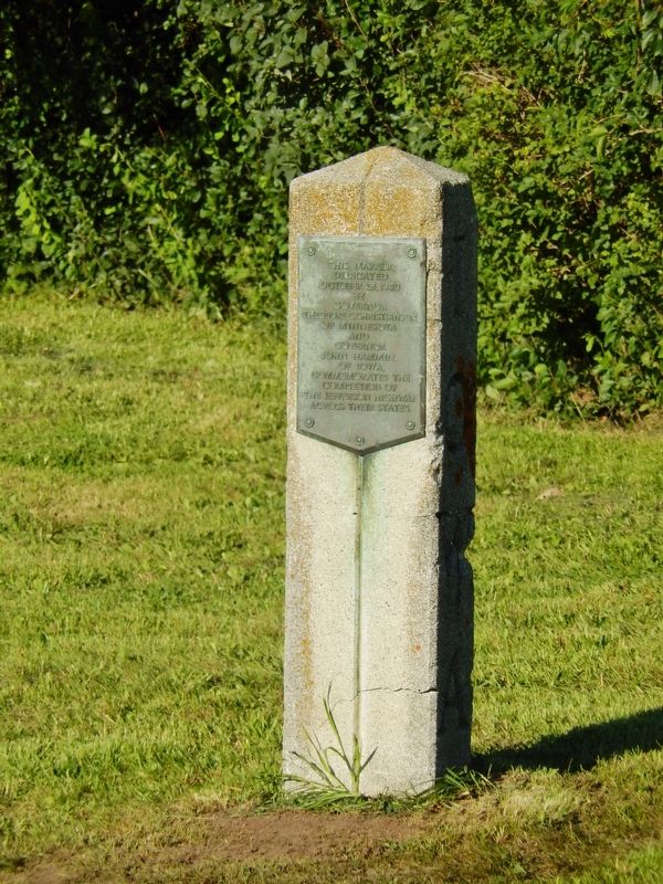
2. Jefferson Highway Completion Marker (tall view; west side)
Photographed by Cosmos Mariner, August 22, 2016
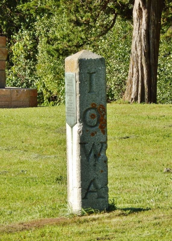
3. Jefferson Highway Completion Marker (tall view; south "Iowa" side)
Photographed by Cosmos Mariner, August 22, 2016
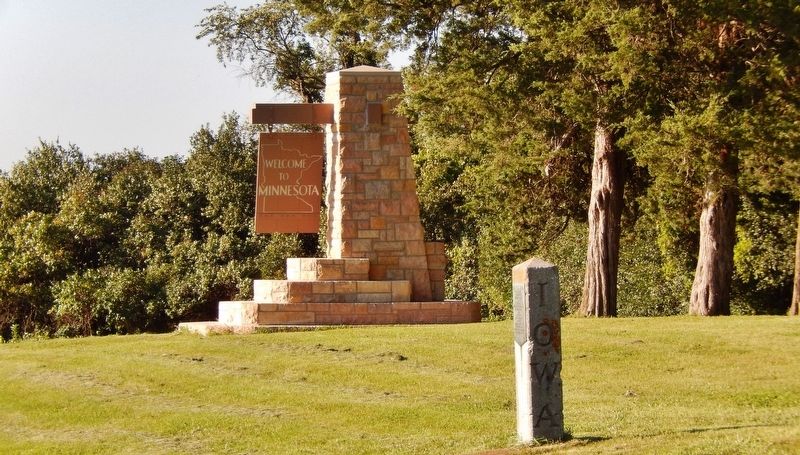
4. Jefferson Highway Completion Marker (wide view; Minnesota "Welcome" sign in background)
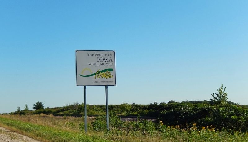
Photographed by Cosmos Mariner, August 22, 2016
5. Welcome to Iowa Sign (located near marker on southbound side of US Highway 65)
Credits. This page was last revised on December 10, 2018. It was originally submitted on December 8, 2018, by Cosmos Mariner of Cape Canaveral, Florida. This page has been viewed 539 times since then and 36 times this year. Photos: 1, 2, 3, 4, 5. submitted on December 8, 2018, by Cosmos Mariner of Cape Canaveral, Florida. • Bill Pfingsten was the editor who published this page.
