St. Augustine in St. Johns County, Florida — The American South (South Atlantic)
Fort Matanzas National Monument
Photographed by Cosmos Mariner, January 14, 2010
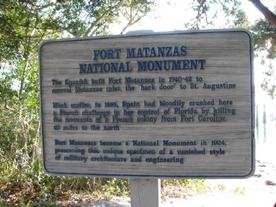
1. Fort Matanzas National Monument Marker
Much earlier, in 1565, Spain had bloodily crushed here a French challenge to her control of Florida by killing the remnants of a French colony from Fort Caroline, 40 miles to the north.
Fort Matanzas became a National Monument in 1924, preserving this unique specimen of a vanished style of military architecture and engineering.
Topics. This historical marker and monument is listed in these topic lists: Colonial Era • Forts and Castles • Landmarks • Settlements & Settlers. A significant historical year for this entry is 1565.
Location. 29° 42.888′ N, 81° 14.091′ W. Marker is in St. Augustine, Florida, in St. Johns County. It can be reached from A1A Scenic and Historic Coastal Byway (State Road A1A) 4 miles south of State Road 206, on the right when traveling south. Marker is located on the Fort Matanzas National Monument grounds, on the west side of the Visitor's Center, overlooking the Matanzas River. Touch for map. Marker is at or near this postal address: 8635 A1A South, Saint Augustine FL 32080, United
this page online

Regionally, this marker and monument is in First Coast and in Greater Jacksonville. It is also in the American South and on the Eastern Seaboard. Globally, it is in the North Atlantic Region, North America, a Gulf of Mexico state, the Western Hemisphere, the Western World, and the Anglosphere. Historically, it finds itself in what was once New Spain, the territory of the Mississippian Culture, one of the Confederate States of America, and the Antebellum South.
Other nearby markers. At least 8 other markers are within 4 miles of this marker, measured as the crow flies: Closing the Door / Protegiendo el acceso (a few steps from this marker); Crumbling Coquina / Piedra frágil (a few steps from this marker); Massacre by Menendez (about 600 feet away, measured in a direct line); Old World Showdown / Reyes y fe (about 600 feet away); Southeast Intracoastal Waterway Park (approx. 0.3 miles away); Guarding Matanzas Inlet (approx. 0.3 miles away); Massacre of the French (approx. 0.4 miles away); Early Settlers on This Land (approx. 3.2 miles away). Touch for a list and map of all markers
Photographed by Cosmos Mariner, January 14, 2010
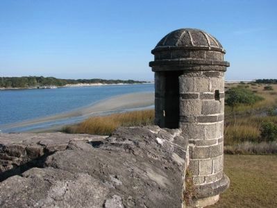
2. Fort Matanzas Sentry Box
More about this marker. Marker is a large painted wooden panel mounted on a waist-high post.
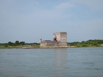
Regarding Fort Matanzas National Monument. Fort Matanzas (Spanish, 1740) guards Matanzas Inlet, southern mouth of Matanzas River, rear entrance to St. Augustine's primary defense, Castillo de San Marcos.
Related markers. Click here for a list of markers that are related to this marker. Fort Matanzas National Monument
Also see . . .
1. Fort Matanzas National Monument - St. Augustine, Florida. History (Submitted on February 23, 2018, by Kenneth Ramagost of Louisiana, USA.)
2. Historic Fort Matanzas National Monument in 4k UHD Video. (Submitted on February 23, 2018, by Kenneth Ramagost of Louisiana, USA.)
Photographed by Cosmos Mariner, January 14, 2010
3. Fort Matanzas National Monument
The park commemorates the killing of nearly 250 French Huguenots by the Spanish, an act that gave the river and inlet the name Matanzas (Spanish for "slaughters"). One hundred seventy-five years later, the fort was constructed to help protect St. Augustine from a new threat - the British.
Photographed by Cosmos Mariner, January 14, 2010
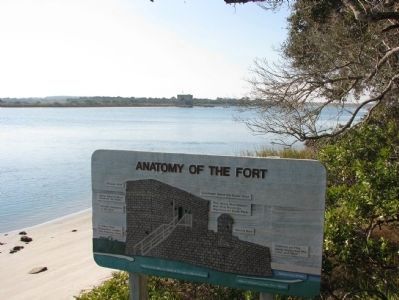
4. Fort Matanzas Architecture
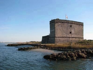
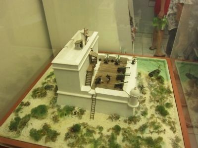
The Fort is constructed of coquina, a common shellstone building material in the area. It is 50 feet (15 m) long on each side with a 30-foot (9.1 m) tower.
Photographed by Cosmos Mariner, January 14, 2010
5. Fort Matanzas Shore View
The marshy terrain was stabilized by a foundation of pine pilings. The standard staff for the Fort was one officer in charge, four infantrymen, and two gunners, though more troops could be stationed if necessary.
Photographed by Cosmos Mariner, January 14, 2010
6. Fort Matanzas Soldier
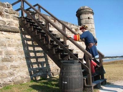
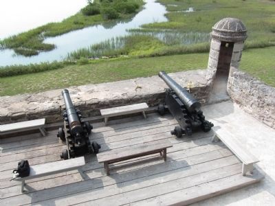
All soldiers at Fort Matanzas served on rotation from their regular duty in St. Augustine. Five cannons were placed at the Fort - four six pounders and one 18 pounder. All guns could reach the inlet, which at the time was less than a half mile away.
Photographed by Cosmos Mariner, January 14, 2010
7. Fort Matanzas Sergeant's Desk
Photographed by Cosmos Mariner, January 14, 2010
8. Fort Matanzas Window View
Photographed by Craig Swain, August 1, 2011
9. Model of Fort Matanzas
Photographed by Craig Swain, August 1, 2011
10. Fort Matanzas
Photographed by Craig Swain, August 1, 2011
11. Cannons and Sentry Box
Credits. This page was last revised on January 2, 2019. It was originally submitted on February 8, 2010, by Cosmos Mariner of Cape Canaveral, Florida. This page has been viewed 2,863 times since then and 70 times this year. Last updated on December 19, 2018, by Cosmos Mariner of Cape Canaveral, Florida. Photos: 1, 2, 3, 4, 5, 6, 7, 8. submitted on February 8, 2010, by Cosmos Mariner of Cape Canaveral, Florida. 9, 10, 11. submitted on August 15, 2011, by Craig Swain of Leesburg, Virginia. • Bernard Fisher was the editor who published this page.
