National Harbor in Fort Washington in Prince George's County, Maryland — The American Northeast (Mid-Atlantic)
The Tobacco Economy
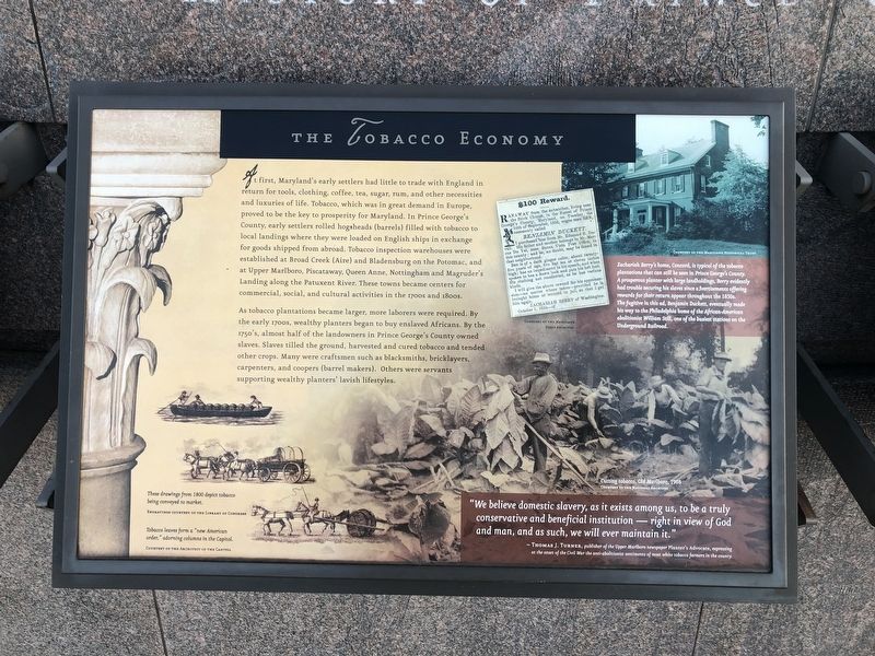
At first, Maryland's early settlers had little to trade with England in return for tools, clothing, coffee, tea, sugar, rum, and other necessities and luxuries of life. Tobacco, which was in great demand in Europe, proved to be the key to prosperity for Maryland. In Prince George's County, early settlers rolled hogsheads (barrels) filled with tobacco to local landings where they were loaded on English ships in exchange for goods shipped from abroad. Tobacco inspection warehouses were established at Broad Creek (Aire) and Bladensburg on the Potomac, and at Upper Marlboro, Piscataway, Queen Anne, Nottingham and Magruder's Landing along the Patuxent River. These towns became centers for commercial, social, and cultural activities in the 1700s and 1800s.
As tobacco plantations became larger, more laborers were required. By the early 1700s, wealthy planters began to buy enslaved Africans. By the 1750's, almost half of the landowners in Prince George's County owned slaves. Slaves tilled the ground, harvested and cured tobacco and tended other crops. Many were craftsman such as blacksmiths, bricklayers, carpenters, and coopers (barrel makers). Others were servants supporting wealthy planters' lavish lifestyles.
[Captions:]
Zachariah Berry's home, Concord, is typical of the tobacco plantations that can still be seen in Prince George's County A prosperous planter with large landholdings, Berry evidently had trouble securing his slaves since advertisements offering rewards for their return appear throughout the 1850s. The fugitive in this ad, Benjamin Duckett, eventually made his way to the Philadelphia home of the African-American abolitionist William Still, one of the busiest stations on the Underground Railroad.
"We believe domestic slavery, as it exists among us, to be a truly conservative and beneficial institution — right in view of God and man, and as such, we will ever maintain it."
Thomas J. Turner, publisher of the Upper Marlboro newspaper Planter's Advocate, expressing at the onset of the Civil War the anti-abolition sentiments of most white tobacco farmers in the country.
These drawings from 1800 depict tobacco being conveyed to market.
Tobacco leaves form "new American order," adorning columns in the Capitol.
Topics. This historical marker is listed in these topic lists: Abolition & Underground RR • African Americans • Agriculture • Industry & Commerce. A significant historical year for this entry is 1908.
Location. 38° 47.561′ N, 77° 1.456′ W. Marker is in Fort Washington, Maryland
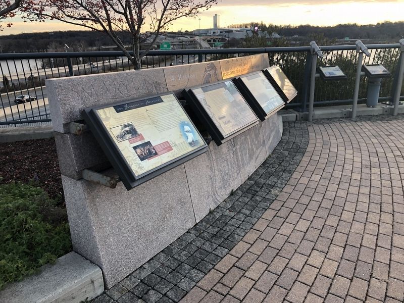
Other nearby markers. At least 8 other markers are within walking distance of this marker. The Founding of Maryland (here, next to this marker); Neighbor to the Nation's Capital (here, next to this marker); The Growth of the Black Middle Class (here, next to this marker); College Park (here, next to this marker); Hyattsville (here, next to this marker); Andrews Air Force Base (here, next to this marker); Laurel (here, next to this marker); Bladensburg (here, next to this marker). Touch for a list and map of all markers in Fort Washington.
Credits. This page was last revised on March 14, 2024. It was originally submitted on December 23, 2018, by Devry Becker Jones of Washington, District of Columbia. This page has been viewed 191 times since then and 11 times this year. Last updated on July 25, 2022, by Carl Gordon Moore Jr. of North East, Maryland. Photos: 1, 2. submitted on December 23, 2018, by Devry Becker Jones of Washington, District of Columbia.

