Marker Logo HMdb.org THE HISTORICAL
MARKER DATABASE
“Bite-Size Bits of Local, National, and Global History”
Near Spotsylvania Courthouse in Spotsylvania County, Virginia — The American South (Mid-Atlantic)
 

Junction of Earthworks


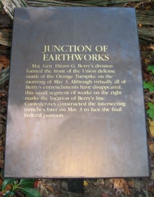
Junction of Earthworks Marker image. Click for full size.
Photographed By Craig Swain, October 18, 2008
1. Junction of Earthworks Marker
Inscription. Maj. Gen. Hiram G. Berry's division formed the front of the Union defense north of the Orange Turnpike on the morning of May 3. Although virtually all of Berry's entrenchments have disappeared, this small segment of works on the right marks the location of Berry's line. Confederates constructed the intersecting trenches later on May 3 to face the final Federal position.
 
Topics. This historical marker is listed in this topic list: War, US Civil. A significant historical date for this entry is May 3, 1944.
 
Location. 38° 18.722′ N, 77° 38.677′ W. Marker is near Spotsylvania Courthouse, Virginia, in Spotsylvania County. Marker can be reached from Plank Road / Germania Highway (State Highway 3), on the right when traveling west. Located at trail stop three on the Chancellorsville History Trail, at the Chancellorsville Battlefield. Touch for map. Marker is in this post office area: Spotsylvania VA 22553, United States of America. Touch for directions.
 
Other nearby markers. At least 8 other markers are within walking distance of this marker. Confederate Breakthrough (within shouting distance of this marker); The Union Army Escapes (about 400 feet away, measured in a direct line); Flanking of Hays' Brigade (about 600 feet away); Collis Zouaves (approx. 0.2 miles away); Chancellorsville Campaign (approx. ¼ mile away); Chancellorsville (approx. ¼ mile away);
Paid Advertisement
Click on the ad for more information.
Please report objectionable advertising to the Editor.
Click or scan to see
this page online
A Fatal Reconnaissance (approx. ¼ mile away); Fredericksburg and Spotsylvania National Military Park (approx. ¼ mile away). Touch for a list and map of all markers in Spotsylvania Courthouse.
 
Also see . . .  Battle of Chancellorsville. National Park Service site. (Submitted on October 21, 2008, by Craig Swain of Leesburg, Virginia.) 
 
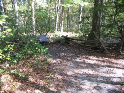
Chancellorsville History Trail - Stop Three image. Click for full size.
Photographed By Craig Swain, October 18, 2008
2. Chancellorsville History Trail - Stop Three
The fence protects a small section of earthworks.
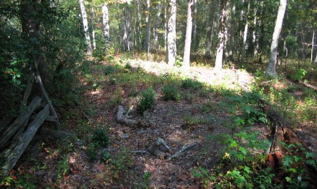
Confederate Earthworks image. Click for full size.
Photographed By Craig Swain, October 18, 2008
3. Confederate Earthworks
Remnants of earthworks lace through the woods in this section of the battlefield.
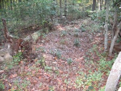
Section of Berry's Earthworks image. Click for full size.
Photographed By Craig Swain, October 18, 2008
4. Section of Berry's Earthworks
Extending to the south of the marker location is a section of Federal trenches occupied on May 2-3, 1863.
 
 
Credits. This page was last revised on July 9, 2021. It was originally submitted on October 21, 2008, by Craig Swain of Leesburg, Virginia. This page has been viewed 860 times since then and 8 times this year. Photos:   1, 2, 3, 4. submitted on October 21, 2008, by Craig Swain of Leesburg, Virginia.
Share this page.  
Share on Tumblr
m=12785

CeraNet Cloud Computing sponsors the Historical Marker Database.
This website earns income from purchases you make after using our links to Amazon.com. We appreciate your support.
Paid Advertisement
Apr. 24, 2024