Perryville in Cecil County, Maryland — The American Northeast (Mid-Atlantic)
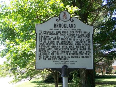
Brookland
Land Grant by Lord Baltimore, 1732
Photographed by William Pfingsten, July 12, 2007
1. Brookland Land Grant by Lord Baltimore 1732 Marker
Erected by Perryville Bicentennial Committee and Maryland Historical Society.
Topics and series. This historical marker is listed in these topic lists: Colonial Era • Government & Politics • Patriots & Patriotism • War, US Revolutionary. In addition, it is included in the Maryland Historical Trust series list. A significant historical year for this entry is 1735.
Location. 39° 34.996′ N, 76° 4.339′ W. Marker is in Perryville, Maryland, in Cecil County. It is at the intersection of St. Mark’s Church Road and Beacon Point Drive, on the right when traveling west on St. Mark’s Church Road. Touch for map. Marker is in this post office area: Perryville MD 21903, United States of America. Touch for directions.

Regionally,
this page online
Other nearby markers. At least 8 other markers are within 2 miles of this marker, measured as the crow flies: Susquehanna Manor (approx. 1.4 miles away); F. Donaldson Brown Estate (approx. 1½ miles away); Railroad History (approx. 1.7 miles away); Perryville (approx. 1.7 miles away); Perryville Railroad Ferry & Station (approx. 1.8 miles away); a different marker also named Perryville (approx. 1.8 miles away); Revered Son (approx. 1.8 miles away); Old Post Road (approx. 1.8 miles away). Touch for a list and map of all markers in Perryville.
Another marker is no longer nearby. Perryville (was approx. 1.8 miles away but has been replaced with another
Photographed by William Pfingsten, July 12, 2007
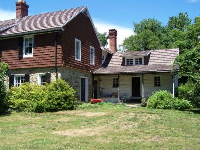
2. Brookland
This is the original log portion of the dwelling.
Additional commentary.
1. Brookland
This home is owned by my former father-in-law, Lester Roane. My memories of this home, are from the years around 1983-1987. I remember the spiral staircase, coming down to the living room on one side and the other to the kitchen area. I was always told that the slave chains are still attached to the cellar walls, however I never went down there. Its architectural beauty inside is a work of art, which combined with the history is a time and place in my life, which I will always remember.
Editor's Note: Thank you for your interest in the Historical Marker database, and for sharing a bit of history about Brookland. If you were to find some historical photographs of the house in your family records, we'd be glad to host them here.
— Submitted August 18, 2010, by Steven Beaver of Floyd, Virginia.
Photographed by William Pfingsten, July 12, 2007
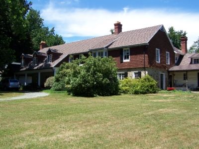
3. Brookland
House is still occupied as a private residence.
Photographed by William Pfingsten, July 13, 2007
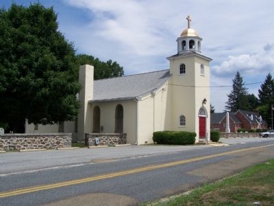
4. St. Mark's Episcopal Church and Cemetery
Photographed by William Pfingsten, July 13, 2007
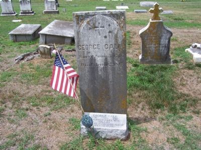
5. Gravestone of George Gale (1756–1815)
Credits. This page was last revised on June 6, 2022. It was originally submitted on July 12, 2007, by Bill Pfingsten of Bel Air, Maryland. This page has been viewed 2,486 times since then and 59 times this year. Last updated on December 29, 2018, by Carl Gordon Moore Jr. of North East, Maryland. Photos: 1, 2, 3. submitted on July 12, 2007, by Bill Pfingsten of Bel Air, Maryland. 4, 5. submitted on July 13, 2007, by Bill Pfingsten of Bel Air, Maryland. • Andrew Ruppenstein was the editor who published this page.
