
Gerrardstown in Berkeley County, West Virginia — The American South (Appalachia)
Gerard House
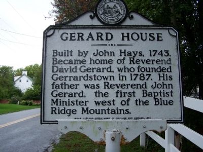
Photographed by Beverly Pfingsten, September 28, 2008
1. Gerard House Marker
Erected 1978 by West Virginia Department of Culture and History.
Topics and series. This historical marker is listed in these topic lists: Colonial Era • Religion & Religious Structures • Settlements & Settlers. In addition, it is included in the West Virginia Archives and History series list. A significant historical year for this entry is 1743.
Location. 39° 22.178′ N, 78° 5.822′ W. Marker is in Gerrardstown, West Virginia, in Berkeley County. It is on Dominion Road 0.1 miles south of Gerrardstown Road, on the left when traveling south. Touch for map. Marker is in this post office area: Gerrardstown WV 25420, United States of America. Touch for directions.

Regionally, this marker is in the Eastern Panhandle. It is also in the American South, specifically in the Upper South, in Appalachia, and specifically in Northern Appalachia. Globally, it is in North America, the Western Hemisphere, the Western World,
this page online
Other nearby markers. At least 8 other markers are within 3 miles of this marker, measured as the crow flies: Mill Creek Baptist Church (about 300 feet away, measured in a direct line); Malin-Wilson-Gray House (about 500 feet away); Gerrardstown Veterans Memorial (about 600 feet away); Gerrardstown (about 700 feet away); Mills Gap (approx. 1½ miles away); Morgan Cabin (approx. 2.7 miles away); Cool Spring Presbyterian Church (approx. 2.7 miles away); Zacquill Morgan House (approx. 2.7 miles away). Touch for a list and map of all markers in Gerrardstown.
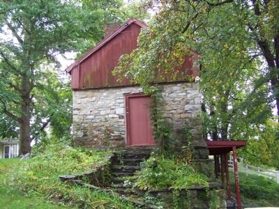
Photographed by Beverly Pfingsten, September 28, 2008
2. Gerard House
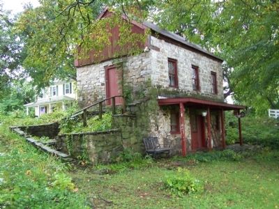
Photographed by Beverly Pfingsten, September 28, 2008
3. Gerard House
Credits. This page was last revised on June 16, 2016. It was originally submitted on October 21, 2008, by Bill Pfingsten of Bel Air, Maryland. This page has been viewed 3,336 times since then and 43 times this year. Photos: 1, 2, 3. submitted on October 21, 2008, by Bill Pfingsten of Bel Air, Maryland.
