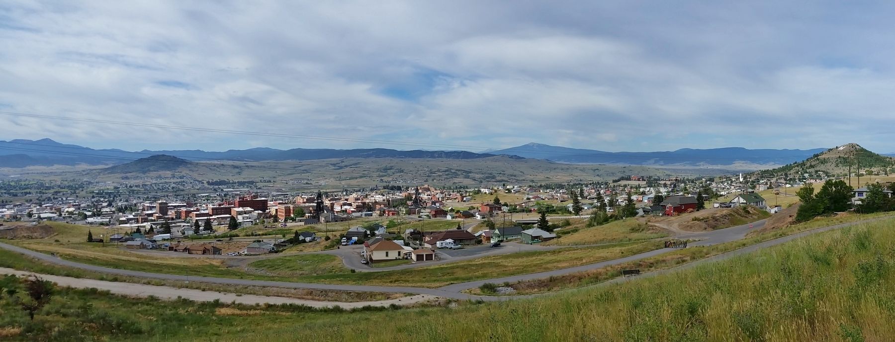
Butte in Silver Bow County, Montana — The American West (Mountains)
Welcome! To the Top of the World
Montana’s Copperway
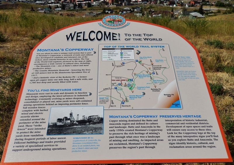
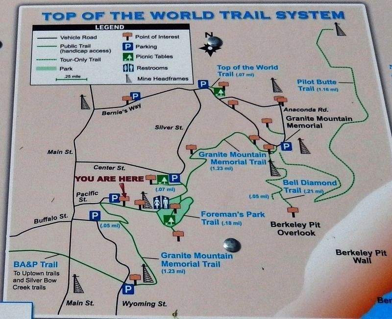
You are about to enter a unique trail system that is part of Montana's Copperway, a network of trails and cultural sites developed to celebrate and interpret one of the richest, most colorful histories in our nation. The Top of the World trail segment, pictured in the map at right, encompasses a wide variety of cultural sites, including:
• The Mountain Con — one of Butte's oldest and most productive mines.
• The Granite Mountain Memorial — honoring the lives of 168 miners lost in the disastrous Speculator Fire of 1917.
• And a fantastic view of the Berkeley Pit — a former open pit copper mine one mile long, half a mile wide, and 1,780 feet deep and mostly filled with water.
You’ll Find Mineyards Here
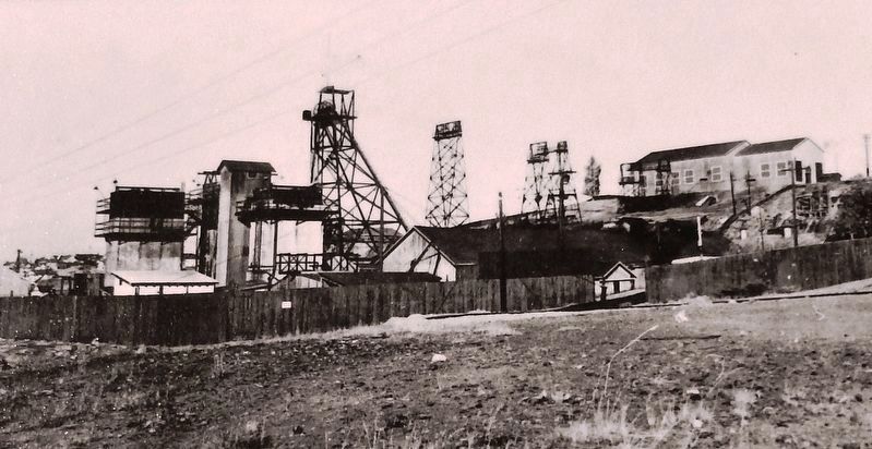
Mineyards were vast in scale and dynamic in function and design, employing the latest advances in industrial technology. Constantly evolving as mines deepened, consolidated or played out, mine yards were self-contained mining operations behind an imposing perimeter fence. Tall wooden fences complete with barbed wired and electric security alarms extended around the perimeter of the mine yard. These “strike fences” were intended to protect the mine yards from vandalism during frequent periods of labor unrest. Different buildings and trades provided a variety of specialized services to support underground mining operations.
Montana’s Copperway Preserves Heritage
Copper mining dominated the Butte and Anaconda region and defined its culture and landscape. Butte and Anaconda in the early 1990s created Montana's Copperway to preserve the rich heritage of mining's past through what once was a landscape of mining and smelting. As impacted areas are reclaimed, Montana's Copperway preserves the region's past through interpretation of historic industrial, commercial and residential districts. Development of open spaces and trails will ensure easy access to these sites. Look for, the Copperway logo at the top of the many interpretive signs you'll and as you explore Butte and Anaconda. The signs identify historic, cultural, and reclamation areas around the region.
Topics. This historical marker is listed in these topic lists: Industry & Commerce • Notable Places • Parks & Recreational Areas.
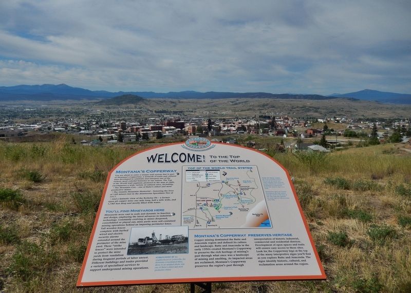
Location. 46° 1.377′ N, 112° 31.976′ W. Marker is in Butte, Montana, in Silver Bow County. Marker can be reached from Little Minah Street, 0.2 miles east of North Main Street, on the right when traveling east. Marker is located on the south side of the Mountain Consolidated Mine parking lot, overlooking city of Butte. Touch for map. Marker is in this post office area: Butte MT 59701, United States of America. Touch for directions.
Other nearby markers. At least 8 other markers are within walking distance of this marker. The Con Headframe (within shouting distance of this marker); The Steward (approx. 0.3 miles away); 611 North Main Street (approx. 0.4 miles away); Corby Residence (approx. 0.4 miles away); St. Mary's Church (approx. 0.4 miles away); From The Ashes (approx. 0.4 miles away); The Original (Mine) (approx. half a mile away); Anaconda Road (approx. half a mile away). Touch for a list and map of all markers in Butte.
More about this marker. Marker is a large composite plaque, mounted horizontally on a waist-high post.
Related markers. Click here for a list of markers that are related to this marker. Butte-Anaconda National Historic Landmark District
Also see . . . Butte, Montana. Established in 1864 as a mining camp in the northern Rocky Mountains on the Continental Divide, Butte experienced rapid development in the late-nineteenth century, and was Montana's first major industrial city. In its heyday between the late-nineteenth and early-twentieth centuries, it was one of the largest copper boomtowns in the American West. Over the course of its history, Butte's mining and smelting operations generated an excess of $48 billion worth of ore, but also resulted
in numerous environmental implications for the city: The upper Clark Fork River, with headwaters at Butte, is the largest Superfund site in the United States, and the city is also home to the Berkeley Pit. In the 21st century, efforts at interpreting and preserving Butte's heritage are addressing both the town's historical significance and the continuing importance of mining to its economy and culture. (Submitted on January 1, 2019, by Cosmos Mariner of Cape Canaveral, Florida.)
Credits. This page was last revised on October 15, 2020. It was originally submitted on January 1, 2019, by Cosmos Mariner of Cape Canaveral, Florida. This page has been viewed 440 times since then and 36 times this year. Photos: 1, 2, 3, 4, 5. submitted on January 1, 2019, by Cosmos Mariner of Cape Canaveral, Florida. • Andrew Ruppenstein was the editor who published this page.
