Dillon in Beaverhead County, Montana — The American West (Mountains)
Mapping the Way
Instruments for ascertaining, by celestial observations, the geography of the country through which you will pass, have been already provided. —President Thomas Jefferson
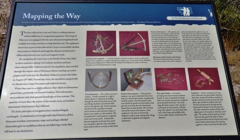
The data collected by Lewis and Clark is a striking indicator of their skillful use of navigational equipment. The Corps of Discovery was equipped with the most advanced navigational tools available, but rarely used them to help find their way. The equipment shown here is part of what allowed the Corps to successfully calculate their positions of latitude and longitude, distance traveled and to differentiate between true north and magnetic north.
For navigating the waterways to the Pacific Ocean they relied on three resources: talking with Indians, intuition and keen observational skills. Unfortunately for the expedition, they traveled through the current state of Montana without meeting any native people until Lewis met the Shoshone Indians in present day Idaho on August 13th 1805. Several days later, the expedition camped with the Shoshone at Camp Fortunate and traded for horses.
When they came to a river confluence they relied on information gained from previously encountered Indians. This information was combined with their general knowledge of river systems. The quantity of water flow, the nature of the terrain, luck, and instinct determined which current they followed.
The basic principles of navigation have remained largely unchanged. A combination of recognizable land features, advice from past travelers, instruments, maps and perhaps celestial observation give us confidence that we are following a route that will lead to our destination.
Erected by Montana State Parks.
Topics and series. This historical marker is listed in these topic lists: Exploration • Native Americans. In addition, it is included in the Former U.S. Presidents: #03 Thomas Jefferson, and the Lewis & Clark Expedition series lists. A significant historical year for this entry is 1805.
Location. 45° 14.117′ N, 112° 37.982′ W. Marker is in Dillon, Montana, in Beaverhead County. Marker is on Clarks Lookout Road west of State Highway 91, on the right when traveling south. Marker is located in Clark's Lookout State Park, at the trailhead on the west side of the parking lot. Touch for map. Marker is at or near this postal address: 25 Clarks Lookout Road, Dillon MT 59725, United States of America. Touch for directions.
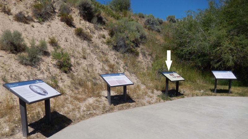
Other nearby markers. At least 8 other markers are within 2 miles of this marker, measured as the crow flies. Distant Features (here, next to this marker); Reliable Landmarks (here, next to this marker); William Clark (here, next to this marker); Clark Pocket Compass Monument
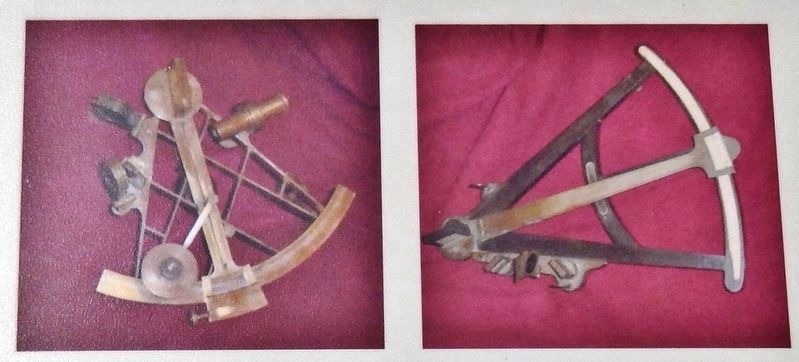
2. Marker detail: Sextant & Octant
Latitude and Longitude —
Latitude indicates a location in degrees north or south of the equator (0°). Longitude is a measure of location in degrees east or west of the Prime Meridian at Greenwich, England (0°). When both the latitude and longitude of a place are known, that place can be located precisely on a map.
Sextant (and octant) —
The captains used these precision instruments to determine the angle between two celestial objects such as the moon and the sun or a star. They also used them to measure the angle between the sun and its reflection from a tray of water or mirror because there is no true horizon on land from which to measure its altitude. The measure of the sun's altitude at noon, used in conjunction with tables from their Nautical Almanac, was the simplest and most reliable way of determining latitude.
Mechanics of the Sextant and Octant
The heart of both instruments was their two-mirror system. One mirror (horizon glass) was opposite the eyepiece; it was silvered only on the side nearest the body of the instrument, the other half was clear glass. The other mirror (index glass) was on the instrument's moveable (index) arm. With his eye to the eyepiece, the captain sighted an object such as a star through the clear part of the horizon glass. Next he moved the index arm until the image from another object - say the edge of the moon - was reflected from the index mirror to the mirror part of the horizon glass that was in direct contact with the other object being sighted through the clear glass. The angle between the two objects was read from the instrument's graduated arc and recorded.
More about this marker. Marker is a large, framed composite plaque, mounted horizontally on waist-high metal posts.
Related markers. Click here for a list of markers that are related to this marker. Clark's Lookout State Park
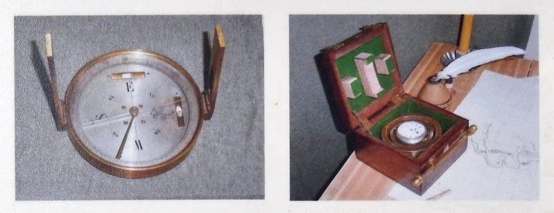
3. Marker detail: Circumferentor & Pocket Chronometer
Circumferentor —
Also called a surveyor's compass. Usually mounted on a staff, a distant feature is sighted in by looking through the slotted metal piece on one side and lining the feature up with the thin wire on the opposite side. Used to measure the direction the expedition traveled and to measure what direction a place or feature was relative to their position. The circumferentor's needle points to magnetic north, not to true north. A distinction between magnetic north and true north was essential so that the rivers and their route could be shown correctly on their final maps.
Pocket Chronometer —
This precision timepiece was used to determine the correct time of a celestial observation, usually made with the sextant. The chronometer's time was checked by special sun observations that gave the true time that the chronometer should show at that locality. The corrected time of the sextant observations, when compared to the time at Greenwich, England, could be used, among other things, to determine longitude and magnetic declination.
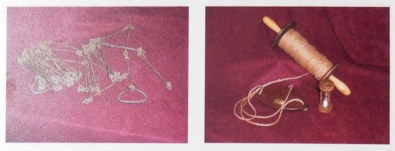
4. Marker detail: Two-pole Chain & Log Line
Two-pole Chain —
A common surveying tool used to measure distance in poles or rods. A standard surveying chain was 66 feet long and was composed of one hundred links each 7.92 inches long; 80 chains equals a mile. A pole is an old unit of measurement, 16-1/2 feet long. The captains’ two-pole chain thus was 33 feet long and had fifty links; it was useful only for measuring short distances.
Log Line —
Sailors commonly used a log line to determine the speed of their ship and from that, calculate the distance traveled A log line consisted of a piece of wood, the “log” and a rope, knotted at uniform intervals. The line was fastened to the ship and the log heaved overboard As the line paid out, one sailor counted the number of knots that slipped past in 30 seconds as timed by a sand glass. The number of knots paid out in that time was the speed of the ship in “knots.” Lewis and Clark carried a log line but rarely used it because they always were moving against or with a current of variable speed.
Credits. This page was last revised on January 3, 2019. It was originally submitted on January 3, 2019, by Cosmos Mariner of Cape Canaveral, Florida. This page has been viewed 248 times since then and 14 times this year. Photos: 1, 2, 3, 4, 5, 6. submitted on January 3, 2019, by Cosmos Mariner of Cape Canaveral, Florida. • Andrew Ruppenstein was the editor who published this page.
