St. Augustine in St. Johns County, Florida — The American South (South Atlantic)
Wall of Defense / Una ciudad amurallada
Castillo de San Marcos National Monument
English:
Wall of Defense
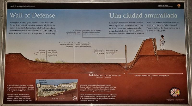
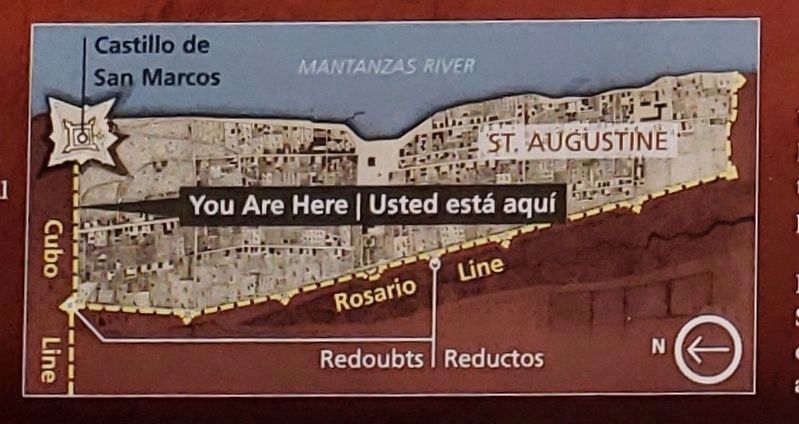
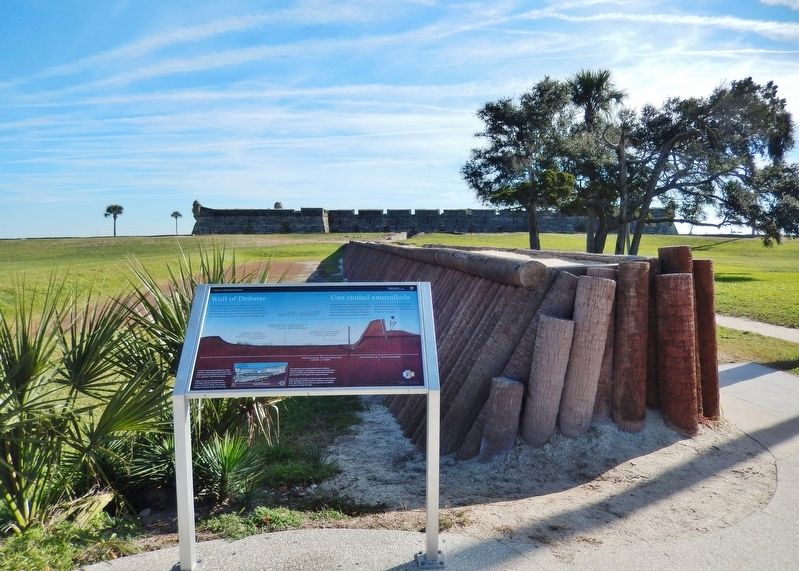
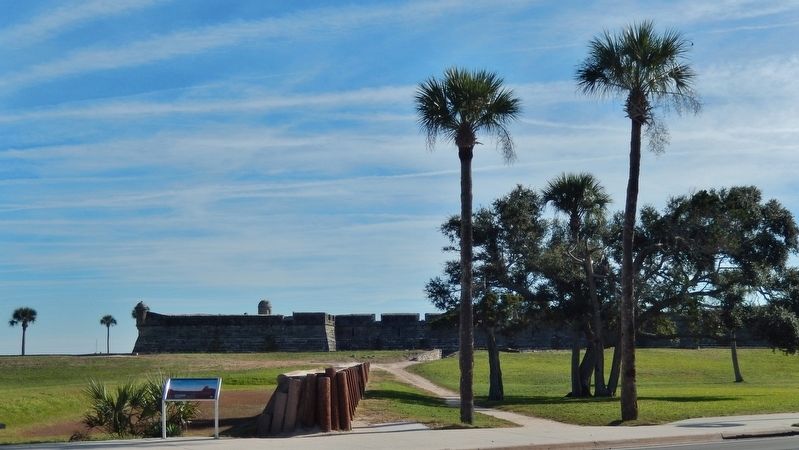
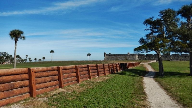
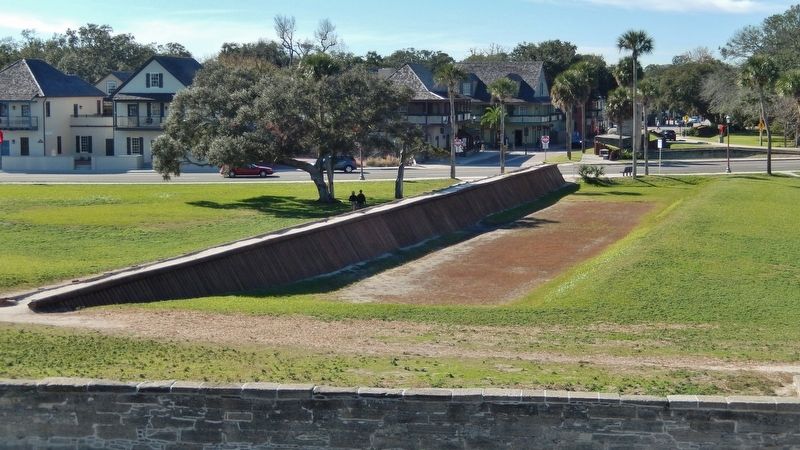
The log wall at your right is a replica of the Cubo Line. The earth-and-palm-log embankment extended from the Castillo to the San Sebastian River a half-mile behind you. Two defensive walls enclosed the city: the Cubo and Rosario lines. The Cubo Line marks St. Augustine's northern edge.
• The 5-foot-deep moat was dangerous to cross.
• Defenders cleared brush and trees to deny cover to invaders.
• A 9-foot-high embankment his soldiers from the invader’s view.
• A palisade wall of pine stakes stood in the moat.
A series of enclosed gun platforms, called redoubts, connected by palm log and earth walls formed the fortified town walls critical to St. Augustine's land-based defense.
Today, you can see the rebuilt Santo Domingo/Tolomato Redoubt near the corner of Cordova Street, one of three defensive positions along the Cubo Line.
Spanish:
<
El muro de troncos que tiene a su derecho es una réplica de la línea del Cubo. El muro de tierra y troncos de palma se extendía desde el castillo hasta el río San Sebastián ubicado a menos de un kilómetro detrás de usted. Dos murallas defensivas rodeaban la ciudad: la línea del Cubo y línea del Rosario. La línea del Cubo marca el borde al norte de San Agustín.
• Era peligroso cruzar el foso de un metro y medio de profundidad.
• Los defensores removieron arbustos y arboles para negar cobertura a invasores.
• Un muro de casi tres metros de altura ocultaba a los soldados de la vista de los invasores.
• En el foso se elevaba una empalizada de estacas de pino.
Una cadena de encerradas plataformas de cañones, llamadas reductos, conectaban los largos muros de tierra y troncos de palma, que formaban las murallas fortificadas para defender a San Agustín de ataques terrestres.
Hoy en día, usted puede ver una reconstrucción del reducto Santo Domingo, también llamado Tolomato, en la esquina de la calle Córdova, una de las tres posiciones de defensa a lo largo de la línea del Cubo.<
Erected 2018 by National Park Service, U.S. Department of the Interior.
Topics. This historical marker is listed in these topic lists: Architecture • Colonial Era • Forts and Castles • Hispanic Americans.
Location. 29° 53.876′ N, 81° 18.789′ W. Marker is in St. Augustine, Florida, in St. Johns County. Marker is at the intersection of South Castillo Drive (State Highway A1A) and Orange Street, on the right when traveling north on South Castillo Drive. Touch for map. Marker is in this post office area: Saint Augustine FL 32084, United States of America. Touch for directions.
Other nearby markers. At least 8 other markers are within walking distance of this marker. The Town Wall (here, next to this marker); The City Gate (within shouting distance of this marker); This Gate Opened in 1739 (within shouting distance of this marker); Safe Haven / Refugio seguro (within shouting distance of this marker); Invincible? / ¿Invencible? (within shouting distance of this marker); General Biassou House (within shouting distance of this marker); The Salcedo House (within shouting distance of this marker); Huguenot Cemetery (within shouting distance of this marker). Touch for a list and map of all markers in St. Augustine.
Related markers. Click here for a list of markers that are related to this marker. St. Augustine City Wall & Gate
Also see . . . Castillo de San Marcos National Monument. National Park Service (Submitted on December 13, 2018.)
Credits. This page was last revised on August 20, 2020. It was originally submitted on December 10, 2018, by Cosmos Mariner of Cape Canaveral, Florida. This page has been viewed 340 times since then and 44 times this year. Last updated on January 3, 2019, by Byron Hooks of Sandy Springs, Georgia. Photos: 1, 2. submitted on December 11, 2018, by Cosmos Mariner of Cape Canaveral, Florida. 3. submitted on December 12, 2018, by Cosmos Mariner of Cape Canaveral, Florida. 4, 5, 6. submitted on December 11, 2018, by Cosmos Mariner of Cape Canaveral, Florida. • Andrew Ruppenstein was the editor who published this page.
