Hydroelectric Power Plant
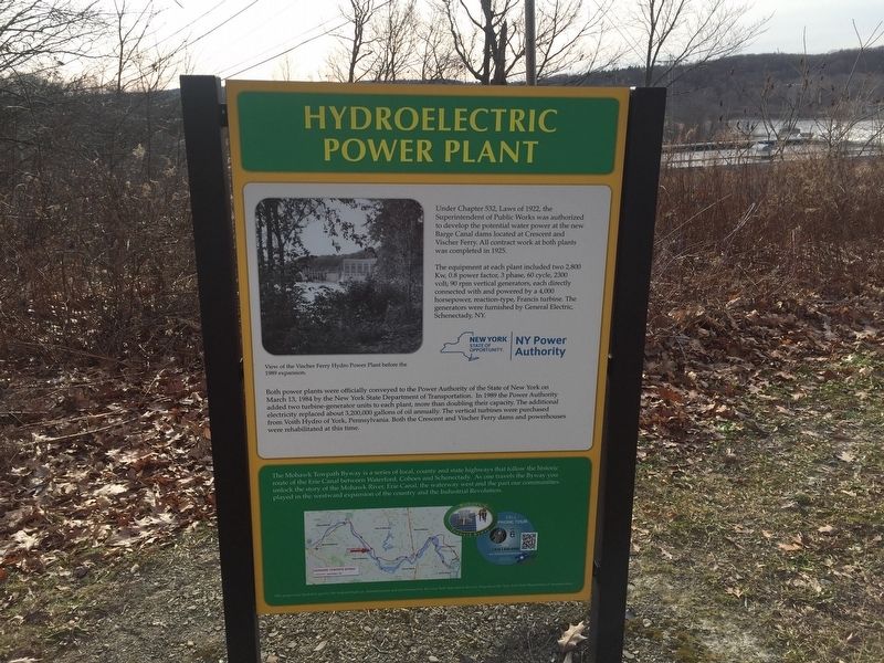
The equipment at each plant included two 2,800 kW, 0.8 power factor, 3 phase, 60 cycle, 2,300 volt 90 rpm vertical generators, each directly connected with and powered by a 4,000 horsepower, reaction-type, Francis turbine. The generators were furnished by General Electric, Schenectady, NY.
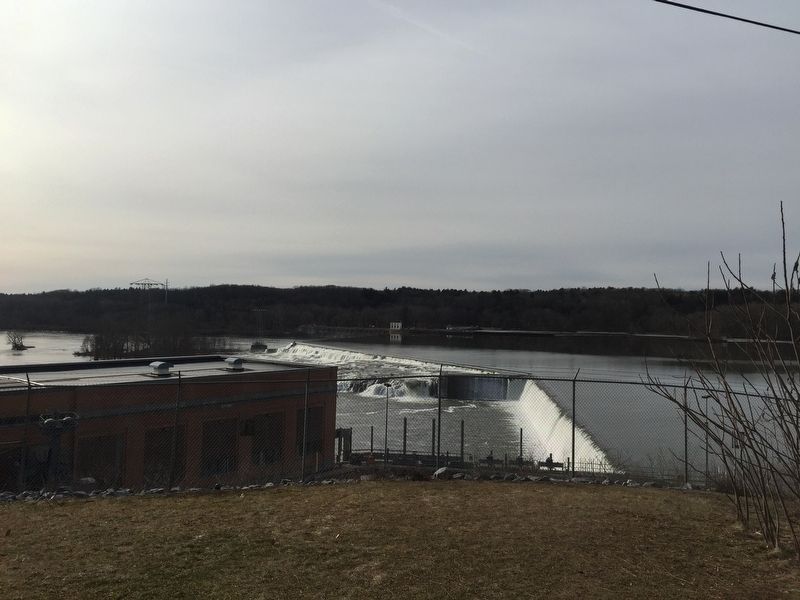
Both power plants were officially conveyed to the Power Authority of the State of New York on March 13, 1984 by the New York Department of Transportation. In 1989 the Power Authority added two turbine-generator units to each plant, more than doubling their capacity. The additional electricity replaced about 3,200,000 gallons of oil annually. The vertical turbines were purchased from Vroth Hydro of York, Pennsylvania. Both the Crescent and Vischer Ferry dams and powerhouses were rehabilitated at this time.
Inset at bottom: The Mohawk Towpath Byway is a series of local, county, and state highways that follow the historic route of the Erie Canal between Waterford, Cohoes, and Schenectady. As one travels the Byway, you can unlock the story of the Mohawk River, Erie Canal, the waterway west,
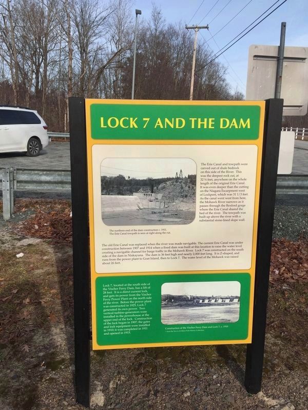
and the part our communities played in the western expansion of the country and the Industrial Revolution.Lock 7 and the Dam The Erie Canal and the towpath were carved out of shale bedrock on this side of the River. This was the deepest rock cut, at 32 ½ feet, anywhere on the whole length of the original Erie Canal. It was even deeper than the cutting on the Niagara Escarpment wet of Lockport, which was 31 1/3 feet. As the canal went west from here, the Mohawk River narrows as it passes through the Rexford gorge where the Erie Canal shared the bed of the river. The towpath was built up above the river with a substantial stone-lined slope wall.
The old Erie Canal was replaced when the river was made navigable. The current Erie Canal was under construction between 1907 and 1914 when a fixed dam was built at this location to raise the water level creating a navigable channel for the barge traffic in the Mohawk River. Lock 7 was constructed on the south side of the dam in Niskayuna. The dam is 36 feet high and nearly 2,000 feet long. It is Z-shaped, and runs from the power plant to Goat Island, then to Lock 7. The water level of the Mohawk was raised about 26 feet. Bottom Inset: Lock 7, located at the south side of the Vischer Ferry Dam has a lift of 28 feet. It is a direct current lock and gets it power from the Vischer Ferry Power Plant on the north side
of the river. Before the power plant was constructed in 1925, Lock 7 generated its own power. Two vertical turbine-generators were installed in the powerhouse at the upper end of the lock. Construction of the lock began in 1907; the gates and lock equipment were installed in 1910; it was completed in 1911, and opened in 1913.Erected by New York Power Authority.
Topics. This historical marker is listed in these topic lists: Industry & Commerce • Waterways & Vessels. A significant historical date for this entry is March 13, 1984.
Location. 42° 48.482′ N, 73° 50.545′ W. Marker is in Vischer Ferry, New York, in Saratoga County. Marker can be reached from the intersection of Riverview Road and Sugar Hill Road. The entrance to the dam is located at the intersection of Riverview and Sugar Hill Roads. The marker itself is at the parking lot about 1/2 mile south on the entrance road. The road ends at the parking lot. Touch for map. Marker is in this post office area: Rexford NY 12148, United States of America. Touch for directions.
Other nearby markers. At least 8 other markers are within 2 miles of this marker, measured as the crow flies. Shepherd House (approx. half a mile away); Best House (approx. 0.9 miles away); Vischer Ferry Historic District (approx. 0.9 miles away); Vischer Ferry (approx. 0.9 miles away); John Brown Hiking Trails and Mohawk River State Park (approx. 1.1 miles away); The Vischer Family (approx. 1.1 miles away); Ferry (approx. 1.1 miles away); Hamlet of Vischer Ferry (approx. 1.1 miles away). Touch for a list and map of all markers in Vischer Ferry.
Also see . . . Vischer Ferry Dam. (Submitted on January 7, 2019, by Steve Stoessel of Niskayuna, New York.)
Credits. This page was last revised on January 8, 2019. It was originally submitted on January 7, 2019, by Steve Stoessel of Niskayuna, New York. This page has been viewed 377 times since then and 51 times this year. Photos: 1, 2, 3, 4. submitted on January 7, 2019, by Steve Stoessel of Niskayuna, New York. • Andrew Ruppenstein was the editor who published this page.


