
Neihart in Cascade County, Montana — The American West (Mountains)
The Mining Legacy
Photographed by Cosmos Mariner, August 10, 2015
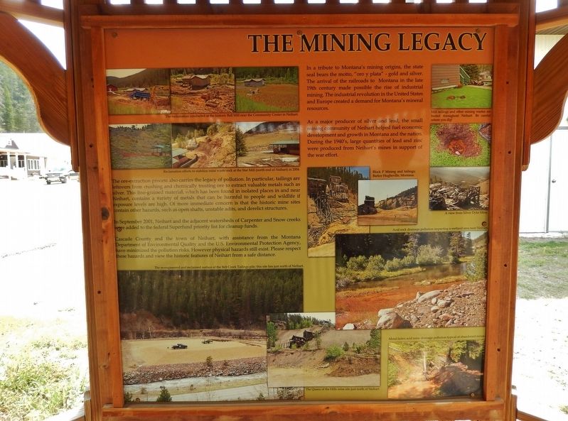
1. The Mining Legacy Marker
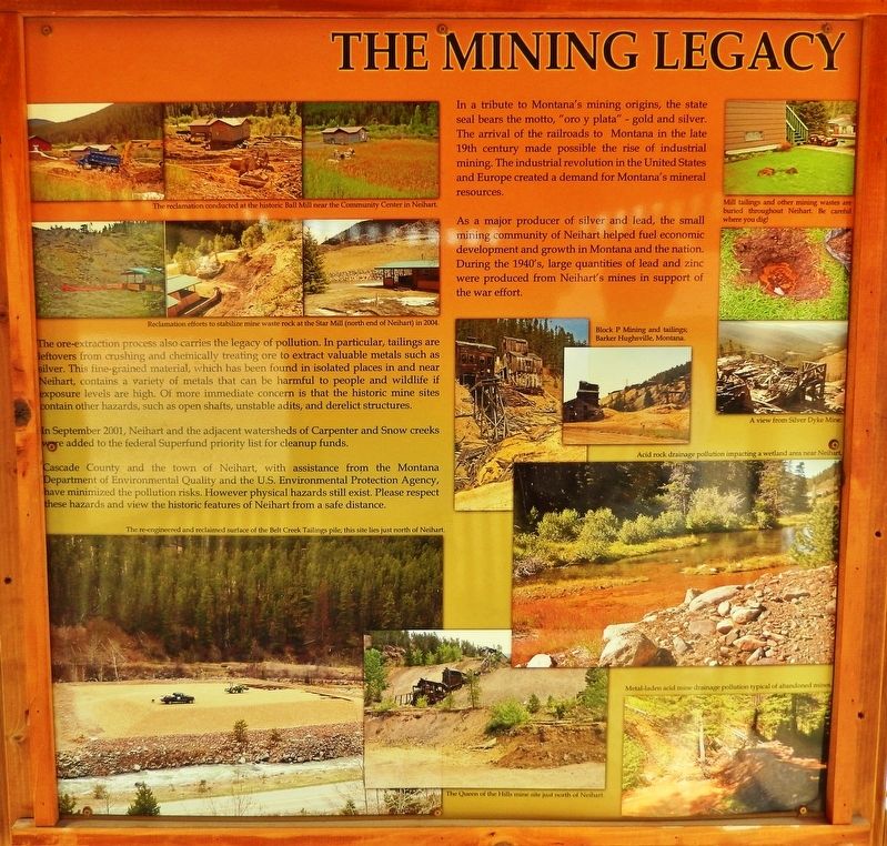
In September 2001, Neihart and the adjacent watersheds of Carpenter and Snow creeks were added to the federal Superfund priority list for cleanup funds.
Casade County and the town of Neihart, with assistance from the Montana department of Environmental Quality and the U.S. Environmental Protection Agency, have minimized the pollution risks. However physical hazards still exist. Please respect these hazards and view the historic features of Neihart from a safe distance.
In a tribute to Montana’s mining origins, the state seal bears the motto, “oro y plata” - gold and silver. The arrival of the
this page online
As a major producer of silver and lead, the small mining community of Neihart helped fuel economic development and growth in Montana and the nation. During the 1940’s, large quantities of lead and zinc were produced from Neihart's mines in support of the war effort.
picture captions:
• The re-engineered and reclaimed surface of the Belt Creek Tailings pile; this site lies just north of Neihart.
• Mill tailings and other mining wastes are buried throughout Neihart. Be careful where you dig!
• Block P Mining and tailings; Barker Hughsville, Montana
• A view from Silver Dyke Mine
Topics. This historical marker is listed in these topic lists: Environment • Industry & Commerce • Natural Resources • War, World II.
Location. 46° 55.988′ N, 110° 44.138′ W. Marker is in Neihart, Montana, in Cascade County. It is at the intersection of Main Street (U.S. 89) and East Granite
2. Marker detail: Reclamation
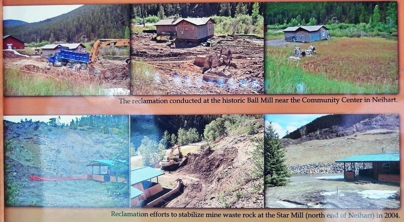
Top: The reclamation conducted at the historic Ball Mill near the Community Center in Neihart.
Bottom: Reclamation efforts to stabilize mine waste rock at the Star Mill (north end of Neihart) in 2004.
Bottom: Reclamation efforts to stabilize mine waste rock at the Star Mill (north end of Neihart) in 2004.

Regionally, this marker is in andspecifically entral Montana in Russell Country. It is also in the American Mountain West and in the Lewis & Clark Corridor. Globally, it is in North America, the Rocky Mountains, the Western Hemisphere, the Western World, and the Anglosphere. Historically, it finds itself in what was once Rupert’s Land and also the Louisiana Purchase.
Other nearby markers. At least 2 other markers are within 11 miles of this marker, measured as the crow flies: Neihart Mining District's Heyday (here, next to this marker); The Ace in the Hole (approx. 11.1 miles away).
More about this marker. Marker is a large, framed interpretive panel, mounted at eye-level in a wooden kiosk.
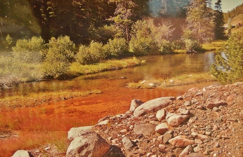
3. Marker detail: Acid rock drainage pollution impacting a wetland area near Neihart
4. Marker detail: Queen of the Hills mine ruins (left)
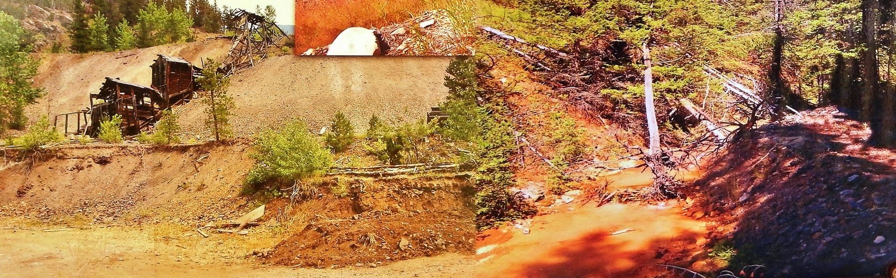
Left: The Queen of the Hills mine just north of Neihart.
Right: Metal-laden acid mine pollution typical of abandoned mines.
Right: Metal-laden acid mine pollution typical of abandoned mines.
Photographed by Cosmos Mariner, August 10, 2015
5. The Mining Legacy Marker (wide view; Main Street in background on left)
Photographed by Cosmos Mariner, August 10, 2015
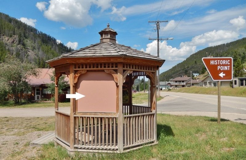
6. Neihart Mining District Interpretive Kiosk (marker located on south side of kiosk)
Backside of marker visible from this direction.
Credits. This page was last revised on January 9, 2019. It was originally submitted on January 7, 2019, by Cosmos Mariner of Cape Canaveral, Florida. This page has been viewed 393 times since then and 38 times this year. Photos: 1, 2, 3, 4, 5, 6. submitted on January 7, 2019, by Cosmos Mariner of Cape Canaveral, Florida. • Andrew Ruppenstein was the editor who published this page.
