Near Butte in Silver Bow County, Montana — The American West (Mountains)
Thompson Park
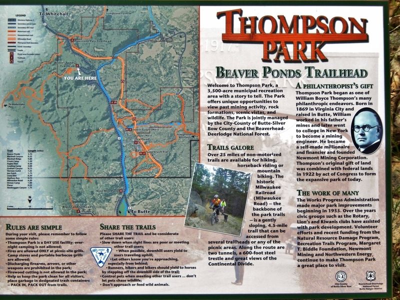
Beaver Ponds Trailhead
Photographed by Cosmos Mariner, July 17, 2016
1. Thompson Park Marker
Trails Galore
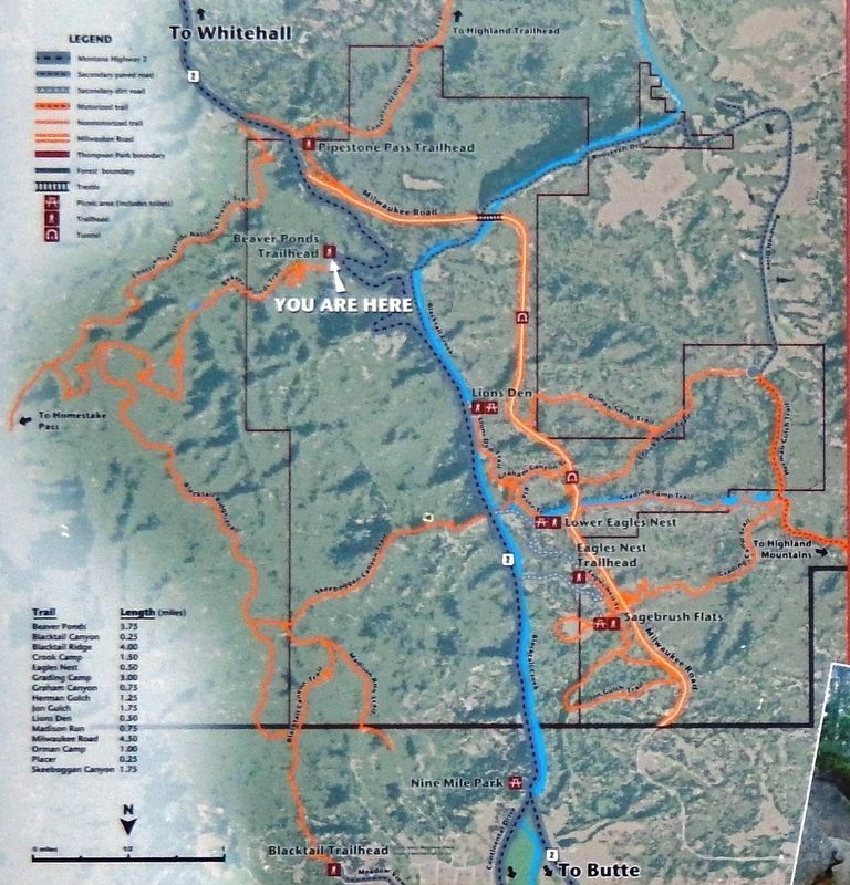
Over 25 miles of non-motorized trails are available for hiking, horseback riding or mountain biking. The historic Milwaukee Railroad (Milwaukee Road) — the backbone of the park trails — is a gently sloping, 4.5-mile trail that can be accessed from several trailheads or any of the picnic areas. Along the route are two tunnels, a 600-foot steel trestle and great views of the Continental Divide.
A Philanthropist’s Gift
Thompson Park began as one of William Boyce Thompson’s many philanthropic endeavors. Born in 1869 in Virginia City and raised in Butte, William worked in his father's mines and later went to college in New York to become a mining engineer. He became a self-made millionaire and financier and founded Newmont Mining Corporation. Thompson's original gift of land was combined with
this page online
The Work of Many
The Works Progress Administration made major park improvements beginning in 1935. Over the years civic groups such as the Rotary, Lion's and Kiwanis clubs have assisted with park development. Volunteer efforts and recent funding from the Natural Resource Damage Program, Recreation Trails Program, Margaret T. Biddle Foundation, Newmont Mining and Northwestern Energy, continue to make Thompson Park a great place to visit.
Erected by City-County of Butte-Silver Bow County and the Beaverhead-Deerlodge National Forest.
Topics and series. This historical marker is listed in these topic lists: Charity & Public Work • Parks & Recreational Areas • Railroads & Streetcars. In addition, it is included in the Chicago, Milwaukee, St. Paul and Pacific Railroad, and the Works Progress Administration (WPA) projects series lists. A significant historical year for this entry is 1922.
Location. 45° 51.93′ N, 112° 26.685′ W. Marker is near Butte, Montana, in Silver Bow County. It is on Highway 2 9.8 miles south of U.S. 90, on the left when traveling
Photographed by Cosmos Mariner, July 17, 2016
2. Marker detail: Trail map

Regionally, this marker is in andspecifically outhwest Montana, in Gold West Country, in Mining Country. It is also in the American Mountain West and in the Lewis & Clark Corridor. Globally, it is in North America, the Rocky Mountains, the Western Hemisphere, the Western World, and the Anglosphere. Historically, it finds itself in what was once Rupert’s Land and also the Louisiana Purchase.
Other nearby markers. At least 8 other markers are within 10 miles of this marker, measured as the crow flies: The Great Divide Trophy (approx. 6.6 miles away); Our Lady of the Rockies Statue (approx. 8.8 miles away); Meaderville (approx. 8.8 miles away); The Boulder Batholith and the Richest Hill on Earth (approx. 8.8 miles away); Butte (approx. 8.8 miles away); Robert Emmet Literary Association (approx. 9.4 miles away); Socialist Hall (approx. 9½ miles away); 9-11-01 All Gave Some, Some Gave All (approx. 9½ miles away). Touch for a list and map
Photographed by Cosmos Mariner, July 17, 2016
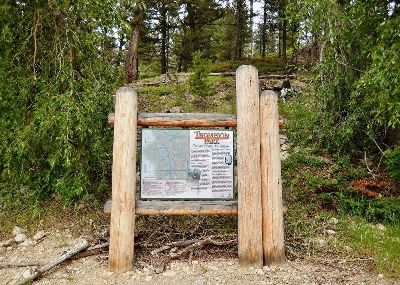
3. Thompson Park Marker (wide view)
Also see . . .
1. Chicago, Milwaukee, St. Paul and Pacific Railroad (the "Milwaukee Road") (Wikipedia).
Excerpt: In the 1890s the Milwaukee's directors felt they had to extend the railroad to the Pacific in order to remain competitive with other roads. The two main mountain ranges that had to be crossed (the Rockies and the Cascades) required major civil engineering works and additional locomotive power. Operating conditions in the mountain regions of the Pacific Extension proved difficult. Winter temperatures of −40 °F (−40 °C) in Montana made it challenging for steam locomotives to generate sufficient steam.(Submitted on January 9, 2019, by Cosmos Mariner of Cape Canaveral, Florida.)
2. William Boyce Thompson (Wikipedia).
Excerpt: William Boyce Thompson was an American mining engineer, financier, philanthropist, and founder of Newmont Mining. Thompson was one of the significant early twentieth century mine operators that discovered and exploited vast copper deposits that revolutionized Western American mining and reaped for themselves tremendous fortunes. He donated money for parks and libraries at many of his mining camps. He donated $50,000 for a park in Butte.(Submitted on January 9, 2019, by Cosmos Mariner of Cape Canaveral, Florida.)
Credits. This page was last revised on August 19, 2026. It was originally submitted on January 9, 2019, by Cosmos Mariner of Cape Canaveral, Florida. This page has been viewed 892 times since then and 81 times this year. Photos: 1, 2, 3. submitted on January 9, 2019, by Cosmos Mariner of Cape Canaveral, Florida. • Andrew Ruppenstein was the editor who published this page.
