Near Fredericksburg in Spotsylvania County, Virginia — The American South (Mid-Atlantic)
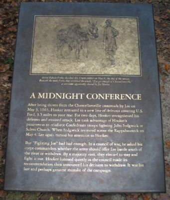
A Midnight Conference
But "Fighting Joe" had had enough. In a council of war, he asked his corps commanders whether the army should offer Lee battle south of the river or withdraw. By a majority vote, they elected to stay and fight it out. Hooker listened quietly as the council made its recommendation then announced his decision to withdraw. It was his last and perhaps greatest mistake of the campaign.
Topics. This historical marker is listed in this topic list: War, US Civil. A significant historical month for this entry is May 1821.
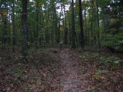
Location. 38° 19.043′ N, 77° 38.755′ W. Marker is near Fredericksburg, Virginia, in Spotsylvania County. Marker can be reached from Bullock Road, on the left when traveling east. Located at trail stop ten on the Chancellorsville History Trail, at the Chancellorsville Battlefield. Touch for map. Marker is at or near this postal address: 9100 Elys Ford Rd, Fredericksburg VA 22407, United States of America. Touch for directions.
Other nearby markers. At least 8 other markers are within walking distance of this marker. Stone's Reconnaissance (about 600 feet away, measured in a direct line); The Union Army Escapes (approx. 0.3 miles away); Junction of Earthworks (approx. 0.4 miles away); Chancellorsville (approx. 0.4 miles away); Colquitt’s Attack (approx. 0.4 miles away); Colquitt Turns Tyler’s Flank (approx. 0.4 miles away); Tyler’s Withdrawal To This Line (approx. 0.4 miles away); Confederate Breakthrough (approx. 0.4 miles away). Touch for a list and map of all markers in Fredericksburg.
More about this marker. Above the text is a drawing with the caption, Artist Edwin Forbes sketched this Union soldier on May 6, the day of the retreat. Beneath the mule Forbes has scribbled the words, "I've got enough of Chancellorsville," a sentiment apparently shared by Joe Hooker.
Also see . . . Battle of Chancellorsville. National Park Service page detailing the battle. (Submitted on October 22, 2008, by Craig Swain of Leesburg, Virginia.)
Credits. This page was last revised on February 2, 2023. It was originally submitted on October 22, 2008, by Craig Swain of Leesburg, Virginia. This page has been viewed 1,036 times since then and 13 times this year. Photos: 1, 2, 3. submitted on October 22, 2008, by Craig Swain of Leesburg, Virginia.


