Gaithersburg in Montgomery County, Maryland — The American Northeast (Mid-Atlantic)
Supplying an Agricultural Community
Photographed by Tom Fuchs, November 3, 2007
1. Supplying an Agricultural Community marker
Inscription.
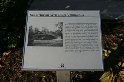
Supplying an Agricultural Community. . Gaithersburg began as an agricultural community. With the coming of the railroad in the late 1800's, markets in Washington, D. C. and Baltimore were opened to area farmers. Wheat, vegetables, fruits, meats, dairy products, and cider could be easily moved to markets in larger cities. The Gaithersburg area flourished and soon became the center of farming activity in Montgomery County. In addition to commercial farming, domestic farming was also common. A family often raised its own chickens, cows, and pigs, and cultivated its own produce. Southern States Co-op opened in the 1930's to serve farmers and the agricultural community at large, selling feed, seed, fertilizer, and farm supplies. The company, based in Richmond, Virginia, offered a much wider variety of products than locally owned businesses. Goods shipped from Richmond to Washington, D. C. were easily transported via railroad to the Gaithersburg store location, which was strategically located near the train station in Olde Towne., (Photo caption): Southern States, circa 1939
Gaithersburg began as an agricultural community. With the coming of the railroad in the late 1800's, markets in Washington, D. C. and Baltimore were opened to area farmers. Wheat, vegetables, fruits, meats, dairy products, and cider could be easily moved to markets in larger cities. The Gaithersburg area flourished and soon became the center of farming activity in Montgomery County. In addition to commercial farming, domestic farming was also common. A family often raised its own chickens, cows, and pigs, and cultivated its own produce. Southern States Co-op opened in the 1930's to serve farmers and the agricultural community at large, selling feed, seed, fertilizer, and farm supplies. The company, based in Richmond, Virginia, offered a much wider variety of products than locally owned businesses. Goods shipped from Richmond to Washington, D. C. were easily transported via railroad to the Gaithersburg store location, which was strategically located near the train station in Olde Towne.
Location. 39° 8.502′ N, 77° 11.564′ W. Marker is in Gaithersburg, Maryland, in Montgomery County. It can be reached from South Summit Avenue just south of East Diamond Avenue, on the right when traveling north. Touch for map. Marker is at or near this postal address: 9 South Summit Avenue, Gaithersburg MD 20877, United States of America. Touch for directions.
Regionally, this marker is in the Washington Metropolitan Area. It is also in the American Mid-Atlantic. Globally, it is in North America, the Western Hemisphere, the Western World, and the Anglosphere. Historically, it finds itself in what was once one of the original Thirteen Colonies and also the Antebellum South.
Credits. This page was last revised on January 12, 2020. It was originally submitted on November 6, 2007, by Tom Fuchs of Greenbelt, Maryland. This page has been viewed 1,328 times since then and 22 times this year. Last updated on January 17, 2019, by Bruce Guthrie of Silver Spring, Maryland. Photo1. submitted on November 6, 2007, by Tom Fuchs of Greenbelt, Maryland. • Bill Pfingsten was the editor who published this page.