Near Wishram in Klickitat County, Washington — The American West (Northwest)
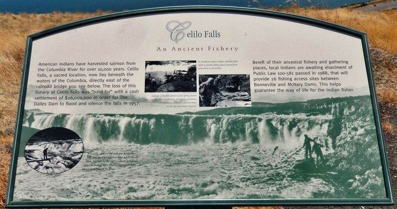
Celilo Falls
An Ancient Fishery
Bereft of their ancestral fishery and gathering places, local Indians are awaiting enactment of Public Law 100-581 passed in 1988, that will provide 26 fishing access sites between Bonneville and McNary Dams. This helps guarantee the way of life for the Indian fisher.
Erected by Washington State Department of Transportation. (Marker Number 21.)
Topics. This historical marker is listed in these topic lists: Native Americans • Natural Resources • Notable Places • Waterways & Vessels.
Location. 45° 39.769′ N, 120° 57.385′ W. Marker is near Wishram, Washington, in Klickitat County. Marker is on Lewis and Clark Highway (State Highway 14) 0.8 miles west of Wishram Road, on the left when traveling west. Marker is located in a large pull-out on the south side of the highway, overlooking the small town of Wishram and the Columbia River. Touch for map. Marker is in this post office area: Wishram WA 98673, United States of America. Touch for directions.
Other nearby markers. At least 8 other markers are within walking distance of this marker. Wyam (here, next to this marker); View of Mount Jefferson (here, next to this marker); Great Falls of the Columbia (a few steps from this marker); Class P-2 Engine No. 2507 (approx. 0.6 miles away); The Lewis and Clark Expedition (approx. 0.9 miles away in Oregon); Greatest Indian Fishery of the Northwest (approx. 0.9 miles away in Oregon); Ancient Indian Fishing Grounds (approx. 0.9 miles away in Oregon); Celilo Falls Fishing Grounds (approx. one mile away in Oregon). Touch for a list and map of all markers in Wishram.
More about this marker. Marker is a large composite plaque, mounted horizontally on a waist-high wooden post.
Related markers. Click here for a list of markers that are related to this marker. Celilo Falls
Also see . . .
1. Celilo Falls. Celilo Falls (also known as Horseshoe Falls) was located on the mid-Columbia River about twelve miles east of The Dalles. It was part of an approximately nine-mile-long indigenous fishery that included sites such as the Upper Dalles, the Lower Dalles, Three Mile Rapids, Five Mile Rapids, and Big Eddy. By 1953, the Army Corps of Engineers began construction of a large dam that would transform the river and allow
traffic to move freely up and down the river.
On March 10, 1957, The Dalles dam reservoir flooded Celilo Falls and a portion of Celilo Village. The site is now called Celilo Lake. (Submitted on January 22, 2019, by Cosmos Mariner of Cape Canaveral, Florida.)
2. History of Celilo Falls. Celilo Village, on the Oregon side of the Columbia River, sits directly across from Fallbridge (now Wishram) - a predominantly white railroad town on the north bank in Washington. These two towns, separated by cultural and natural chasms, were connected only by a high railroad bridge. The only way to get from one town to the other was to walk the tracks above the rocks and river far below. The reservation town of Warm Springs, where the Indian boarding school was located, is a southbound one-hour drive from Celilo today. However, during the early 20th century it was considered quite remote. (Submitted on January 22, 2019, by Cosmos Mariner of Cape Canaveral, Florida.)

Source: Oregon Historical Society
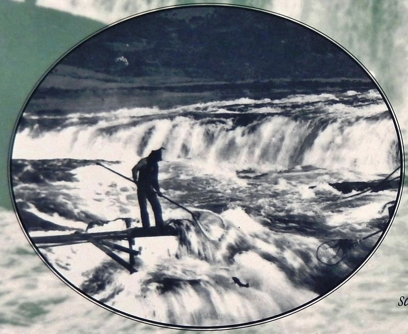
4. Marker detail: Native fisherman
Braced on wet wood, the man grips a wooden pole. At its tip, a net of Indian hemp is tied with elk sinew. Deafened by the roaring tumult, he balances above the frothing water and reaches for a graceful salmon shimmying in the spray.
Credits. This page was last revised on January 27, 2020. It was originally submitted on January 21, 2019, by Cosmos Mariner of Cape Canaveral, Florida. This page has been viewed 327 times since then and 31 times this year. Photos: 1, 2, 3, 4, 5. submitted on January 21, 2019, by Cosmos Mariner of Cape Canaveral, Florida. • Andrew Ruppenstein was the editor who published this page.


![Celilo Falls Marker (<i>wide view; Wishram [right] and Columbia River in background</i>). Click for full size. Celilo Falls Marker (<i>wide view; Wishram [right] and Columbia River in background</i>) image. Click for full size.](Photos4/461/Photo461664.jpg?124201914500PM)