San Gabriel in Los Angeles County, California — The American West (Pacific Coastal)
Chapman’s Mill and Millrace
Then and Now
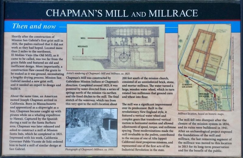
Shortly after the construction of Mission San Gabriel's first grist mill in 1816, the padres realized that it did not work as they had hoped. Located more than 2 miles to the northwest, El Molino Viejo (the Old Mill), as it came to be called, was too far from the grain fields and featured an old and inefficient design. More importantly, a construction flaw caused the grain to be soaked as it was ground, necessitating a lengthy drying process. Mission San Gabriel needed a new grist mill, and it needed an expert to design and build it.
About the same time, an American named Joseph Chapman arrived in California. Born in Massachusetts and apprenticed as a shipwright as a boy, Chapman became caught up with pirates while on a whaling expedition to Hawaii. Captured by the Spanish during a raid in the Santa Barbara area, Chapman was later released and asked to construct a mill at Mission Santa Ines, which he completed in 1821. Impressed with his work, California Governor Pablo Vicente de Solá ordered him to build a mill of similar design at San Gabriel.
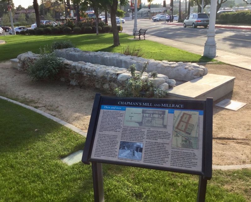
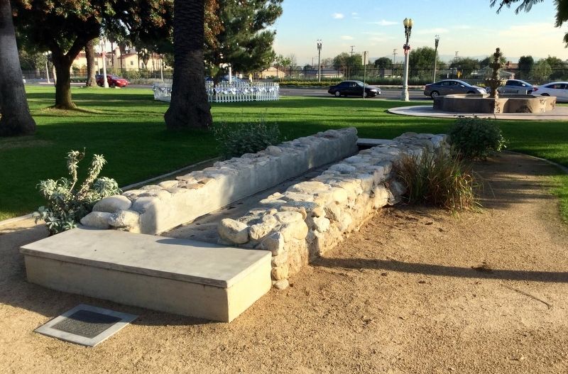
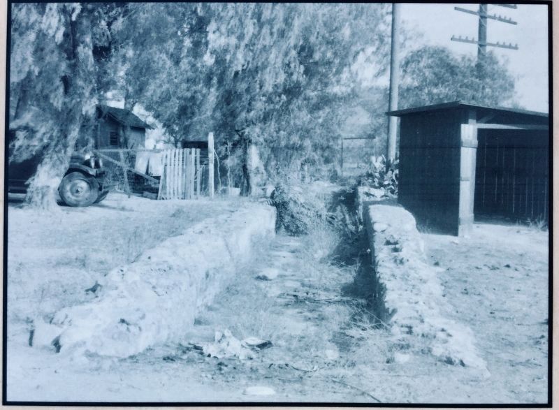
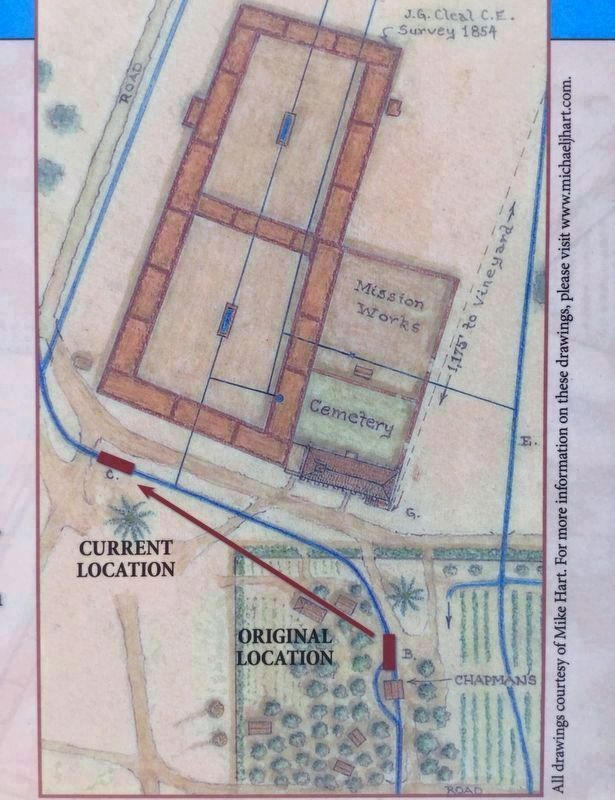
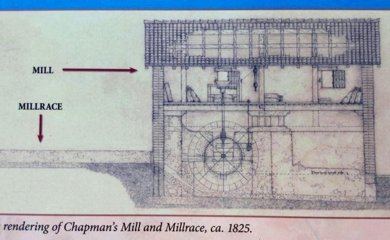
Chapman's Mill was constructed by Gabrieleno Mission Indians at Chapman's direction. Completed around 1825, it was powered by water directed from a series of springs north of the mission via earthen and tile-lined ditches to the mill. The final stretch of the waterway, which ran from this very spot to the mill's location about 200 feet south of the mission church, consisted of an unreinforced brick, stone, and mortar millrace. The water turned a large, wooden water wheel, which in turn rotated two millstones that ground corn and wheat into flour.
The mill was a significant improvement over its predecessor. Built in the revolutionary New England style, it featured a vertical water wheel and complex gears that transferred vertical motion to horizontal motion and allowed adjustments of speed, torque, and millstone spacing. These modernizations made the mill invaluable to the padres, contributed to the success of one of Alta (upper) California's most prosperous missions, and represented one of the first acts of the Industrial Revolution in the state.
The mill fell into disrepair after the closure of the mission system in 1834, and its ruins were bulldozed in 1941. After an archaeological project exposed the foundations of the mill and millrace, the last remaining segment of the millrace was moved to this location in 2013 for its long-term preservation and for the benefit of the public.
Erected 2013.
Topics. This historical marker is listed in these topic lists: Industry & Commerce • Native Americans • Settlements & Settlers.
Location. 34° 5.797′ N, 118° 6.457′ W. Marker is in San Gabriel, California, in Los Angeles County. Marker is at the intersection of Ramona Street and Mission Drive, on the right when traveling north on Ramona Street. Touch for map. Marker is at or near this postal address: 428 S Mission Drive, San Gabriel CA 91776, United States of America. Touch for directions.
Other nearby markers. At least 8 other markers are within walking distance of this marker. Joseph Chapman’s Millrace (within shouting distance of this marker); Mission San Gabriel Archangel / El Camino Real Door (within shouting distance of this marker); Lt. Colonel Juan Bautista de Anza (within shouting distance of this marker); San Gabriel Mission (about 300 feet away, measured in a direct line); Old Spanish Trail (about 300 feet away); 1776 Overland Immigration Expedition (about 300 feet away); a different marker also named San Gabriel Mission (about 300 feet away); Early California (about 400 feet away). Touch for a list and map of all markers in San Gabriel.
Credits. This page was last revised on January 30, 2023. It was originally submitted on January 22, 2019, by Craig Baker of Sylmar, California. This page has been viewed 484 times since then and 76 times this year. Photos: 1, 2, 3, 4, 5, 6. submitted on January 22, 2019, by Craig Baker of Sylmar, California. • Andrew Ruppenstein was the editor who published this page.
